Aliceville North Topo Map Alabama
To zoom in, hover over the map of Aliceville North
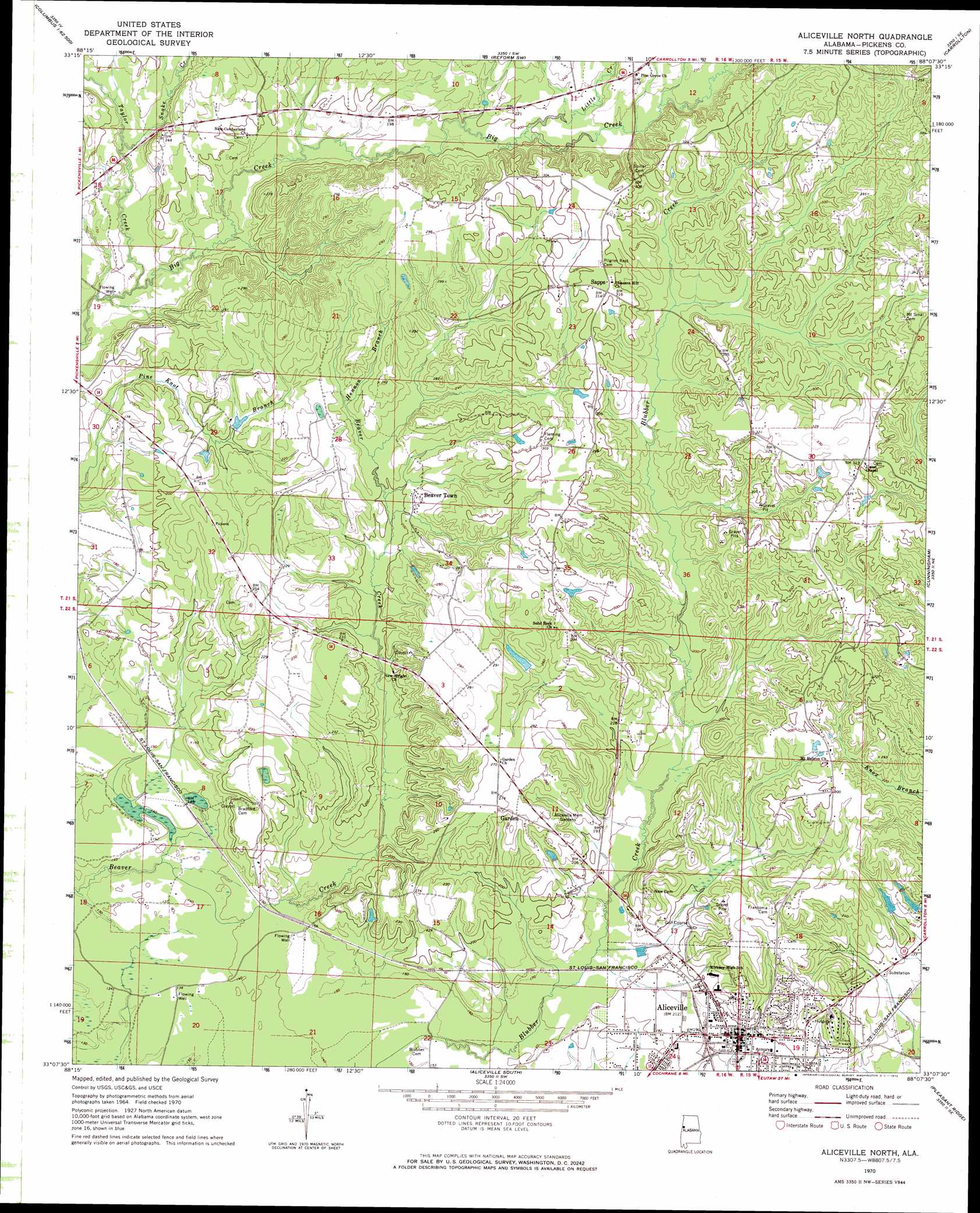
USGS Topo Quad 33088b2 - 1:24,000 scale
| Topo Map Name: | Aliceville North |
| USGS Topo Quad ID: | 33088b2 |
| Print Size: | ca. 21 1/4" wide x 27" high |
| Southeast Coordinates: | 33.125° N latitude / 88.125° W longitude |
| Map Center Coordinates: | 33.1875° N latitude / 88.1875° W longitude |
| U.S. State: | AL |
| Filename: | o33088b2.jpg |
| Download Map JPG Image: | Aliceville North topo map 1:24,000 scale |
| Map Type: | Topographic |
| Topo Series: | 7.5´ |
| Map Scale: | 1:24,000 |
| Source of Map Images: | United States Geological Survey (USGS) |
| Alternate Map Versions: |
Aliceville North AL 1970, updated 1972 Download PDF Buy paper map Aliceville North AL 1970, updated 1991 Download PDF Buy paper map Aliceville North AL 2011 Download PDF Buy paper map Aliceville North AL 2014 Download PDF Buy paper map |
1:24,000 Topo Quads surrounding Aliceville North
Columbus South |
New Hope |
Ethelsville |
Reform |
Palmetto |
Trinity |
Forreston |
Reform Sw |
Carrollton |
Gordo |
Cliftonville |
Pickensville |
Aliceville North |
Cunningham |
Kirk |
Mcleod |
Dancy |
Aliceville South |
Pleasant Ridge |
Mantua |
Paulette |
Panola |
Warsaw |
West Greene |
Union |
> Back to 33088a1 at 1:100,000 scale
> Back to 33088a1 at 1:250,000 scale
> Back to U.S. Topo Maps home
Aliceville North topo map: Gazetteer
Aliceville North: Dams
Sanders Dam elevation 62m 203′Aliceville North: Parks
Westervelt Game Reserve elevation 41m 134′Aliceville North: Populated Places
Aliceville elevation 58m 190′Beaver Town elevation 73m 239′
Garden elevation 87m 285′
McMullen elevation 59m 193′
Sapps elevation 93m 305′
Aliceville North: Post Offices
Aliceville Post Office elevation 58m 190′Aliceville North: Reservoirs
Sanders Lake elevation 62m 203′Aliceville North: Streams
Hennon Branch elevation 74m 242′Little Creek elevation 62m 203′
Snake Creek elevation 55m 180′
Taylor Creek elevation 45m 147′
Yantley Creek elevation 92m 301′
Aliceville North digital topo map on disk
Buy this Aliceville North topo map showing relief, roads, GPS coordinates and other geographical features, as a high-resolution digital map file on DVD: