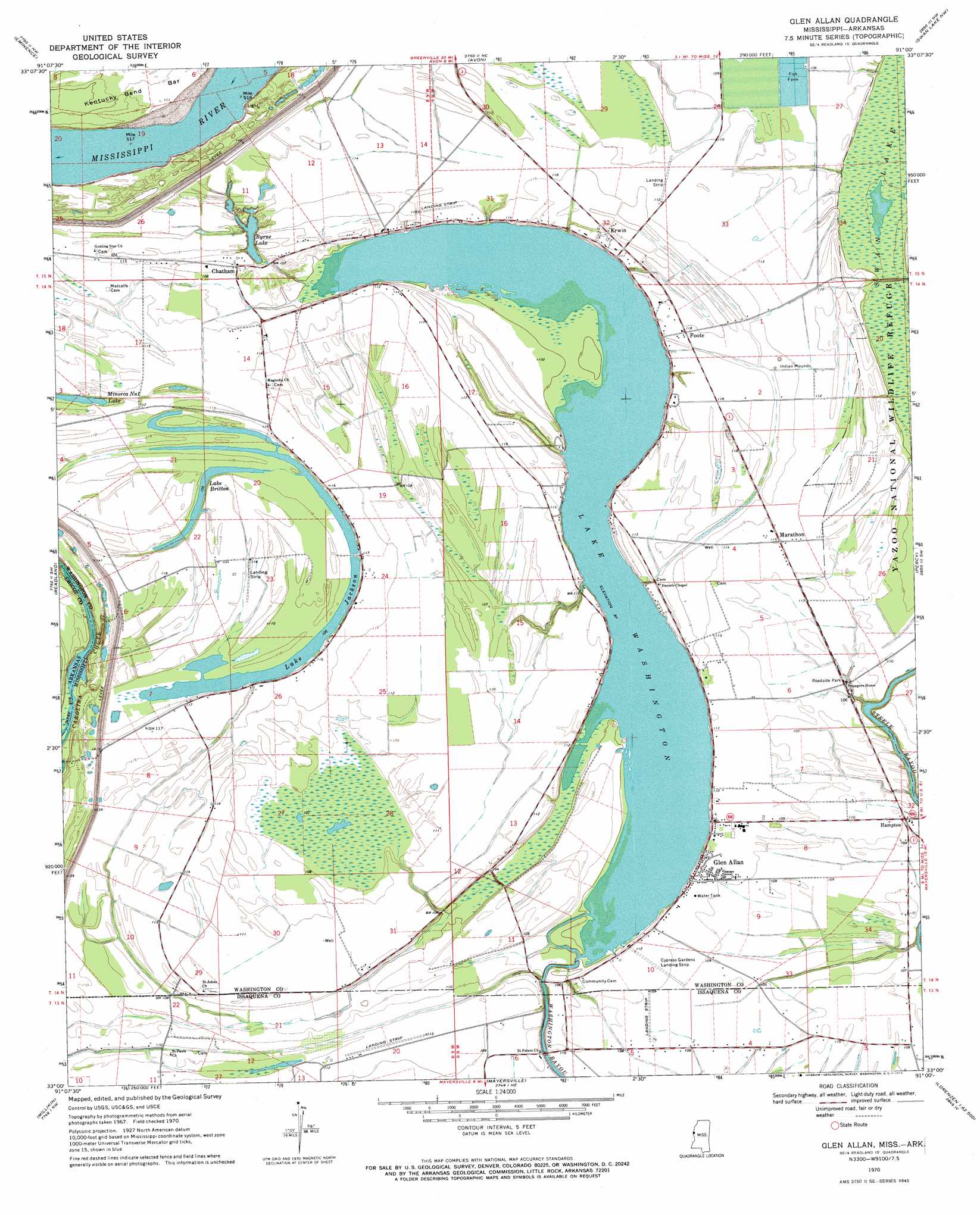
Glen Allan Topo Map Mississippi
To zoom in, hover over the map of Glen Allan
USGS Topo Quad 33091a1 - 1:24,000 scale
| Topo Map Name: | Glen Allan |
| USGS Topo Quad ID: | 33091a1 |
| Print Size: | ca. 21 1/4" wide x 27" high |
| Southeast Coordinates: | 33° N latitude / 91° W longitude |
| Map Center Coordinates: | 33.0625° N latitude / 91.0625° W longitude |
| U.S. States: | MS, AR |
| Filename: | o33091a1.jpg |
| Download Map JPG Image: | Glen Allan topo map 1:24,000 scale |
| Map Type: | Topographic |
| Topo Series: | 7.5´ |
| Map Scale: | 1:24,000 |
| Source of Map Images: | United States Geological Survey (USGS) |
| Alternate Map Versions: |
Glen Allan MS 1970, updated 1972 Download PDF Buy paper map Glen Allan MS 2011 Download PDF Buy paper map Glen Allan MS 2012 Download PDF Buy paper map Glen Allan MS 2015 Download PDF Buy paper map |
1:24,000 Topo Quads surrounding Glen Allan
Lake Village |
Red Leaf |
Wayside |
Arcola |
Tribbett |
Eudora North |
Eminence |
Avon |
Swan Lake Nw |
Hollandale |
Eudora South |
Readland |
Glen Allan |
Percy |
Delta City |
Kilbourne |
Millikin |
Mayersville |
Rolling Fork West |
Rolling Fork East |
Baxter Bayou |
Lake Providence |
Whiting Bayou |
Cary |
Red Rock |
> Back to 33091a1 at 1:100,000 scale
> Back to 33090a1 at 1:250,000 scale
> Back to U.S. Topo Maps home
Glen Allan topo map: Gazetteer
Glen Allan: Airports
Lake Washington Airport elevation 35m 114′Lewis Airport elevation 34m 111′
Glen Allan: Lakes
Byrne Lake elevation 29m 95′Carolina Chute elevation 24m 78′
Lake Britton elevation 33m 108′
Lake Jackson elevation 32m 104′
Lake Washington elevation 29m 95′
Minorca Nut Lake elevation 33m 108′
Glen Allan: Levees
Kentucky Bend Revetment elevation 35m 114′Glen Allan: Populated Places
Alhambra elevation 32m 104′Byrne City elevation 35m 114′
Chatham elevation 35m 114′
Erwin elevation 35m 114′
Foote elevation 34m 111′
Glen Allan elevation 34m 111′
Hampton elevation 33m 108′
Leota elevation 34m 111′
Linsey (historical) elevation 35m 114′
Marathon elevation 35m 114′
Princeton (historical) elevation 34m 111′
Valewood elevation 34m 111′
Glen Allan: Streams
Swan Lake Slough elevation 31m 101′Glen Allan digital topo map on disk
Buy this Glen Allan topo map showing relief, roads, GPS coordinates and other geographical features, as a high-resolution digital map file on DVD: