Hayfield Spring Topo Map California
To zoom in, hover over the map of Hayfield Spring
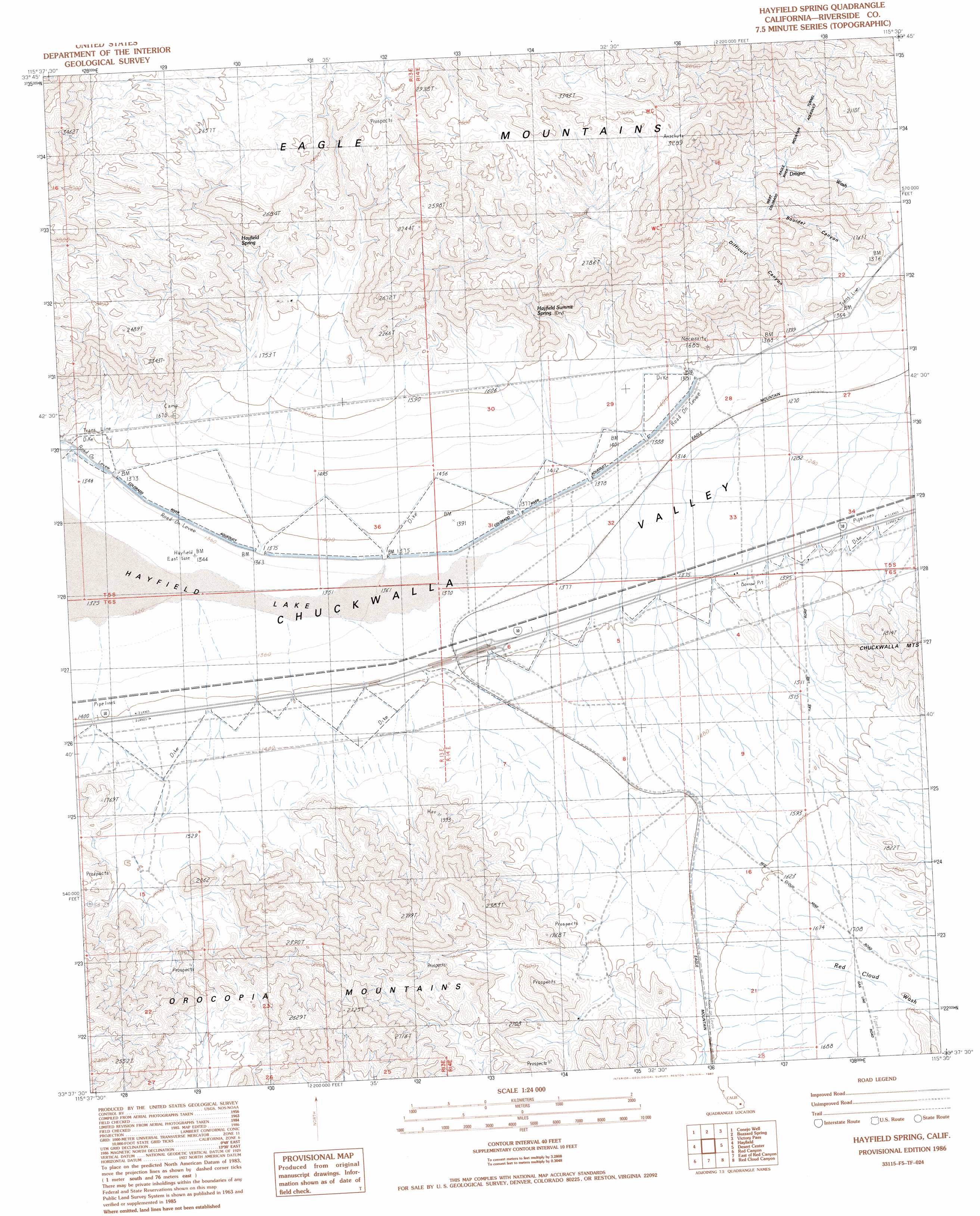
USGS Topo Quad 33115f5 - 1:24,000 scale
| Topo Map Name: | Hayfield Spring |
| USGS Topo Quad ID: | 33115f5 |
| Print Size: | ca. 21 1/4" wide x 27" high |
| Southeast Coordinates: | 33.625° N latitude / 115.5° W longitude |
| Map Center Coordinates: | 33.6875° N latitude / 115.5625° W longitude |
| U.S. State: | CA |
| Filename: | o33115f5.jpg |
| Download Map JPG Image: | Hayfield Spring topo map 1:24,000 scale |
| Map Type: | Topographic |
| Topo Series: | 7.5´ |
| Map Scale: | 1:24,000 |
| Source of Map Images: | United States Geological Survey (USGS) |
| Alternate Map Versions: |
Hayfield Spring CA 1986, updated 1987 Download PDF Buy paper map Hayfield Spring CA 1986, updated 1987 Download PDF Buy paper map Hayfield Spring CA 2012 Download PDF Buy paper map Hayfield Spring CA 2015 Download PDF Buy paper map |
1:24,000 Topo Quads surrounding Hayfield Spring
Pinto Mountain |
San Bernardino Wash |
Placer Canyon |
Pinto Wells |
Coxcomb Mountains |
Porcupine Wash |
Conejo Well |
Buzzard Spring |
Victory Pass |
East Of Victory Pass |
Cottonwood Spring |
Hayfield |
Hayfield Spring |
Desert Center |
Corn Spring |
Orocopia Canyon |
Red Canyon |
East Of Red Canyon |
Red Cloud Canyon |
Pilot Mountain |
Durmid |
Frink Nw |
Frink Ne |
Iris Pass |
Augustine Pass |
> Back to 33115e1 at 1:100,000 scale
> Back to 33114a1 at 1:250,000 scale
> Back to U.S. Topo Maps home
Hayfield Spring topo map: Gazetteer
Hayfield Spring: Flats
Hayfield Lake elevation 408m 1338′Hayfield Spring: Springs
Hayfield Spring elevation 605m 1984′Hayfield Summit Spring elevation 543m 1781′
Hayfield Spring: Streams
Red Cloud Wash elevation 481m 1578′Hayfield Spring: Tunnels
West Eagle Mountain Tunnel elevation 638m 2093′Hayfield Spring: Valleys
Boulder Canyon elevation 434m 1423′Difficult Canyon elevation 416m 1364′
Hayfield Spring digital topo map on disk
Buy this Hayfield Spring topo map showing relief, roads, GPS coordinates and other geographical features, as a high-resolution digital map file on DVD: