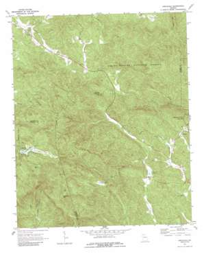
Amicalola Topo Map Georgia
To zoom in, hover over the map of Amicalola
USGS Topo Quad 34084e3 - 1:24,000 scale
| Topo Map Name: | Amicalola |
| USGS Topo Quad ID: | 34084e3 |
| Print Size: | ca. 21 1/4" wide x 27" high |
| Southeast Coordinates: | 34.5° N latitude / 84.25° W longitude |
| Map Center Coordinates: | 34.5625° N latitude / 84.3125° W longitude |
| U.S. State: | GA |
| Filename: | o34084e3.jpg |
| Download Map JPG Image: | Amicalola topo map 1:24,000 scale |
| Map Type: | Topographic |
| Topo Series: | 7.5´ |
| Map Scale: | 1:24,000 |
| Source of Map Images: | United States Geological Survey (USGS) |
| Alternate Map Versions: |
Amicalola GA 1971, updated 1973 Download PDF Buy paper map Amicalola GA 1971, updated 1987 Download PDF Buy paper map Amicalola GA 2011 Download PDF Buy paper map Amicalola GA 2014 Download PDF Buy paper map |
| FStopo: | US Forest Service topo Amicalola is available: Download FStopo PDF Download FStopo TIF |
1:24,000 Topo Quads surrounding Amicalola
> Back to 34084e1 at 1:100,000 scale
> Back to 34084a1 at 1:250,000 scale
> Back to U.S. Topo Maps home
Amicalola topo map: Gazetteer
Amicalola: Dams
Amicalola Creek Watershed Structure Number One Dam elevation 477m 1564′Fausett Lake Dam elevation 493m 1617′
Sequoyah Lake Dam elevation 844m 2769′
Amicalola: Populated Places
Amicalola elevation 535m 1755′Burnt Mountain Estates elevation 858m 2814′
Johntown (historical) elevation 467m 1532′
Licklog (historical) elevation 558m 1830′
Snider (historical) elevation 580m 1902′
Amicalola: Reservoirs
Fausett Lake elevation 493m 1617′Kincaid Lake elevation 477m 1564′
Sequoyah Lake elevation 844m 2769′
Amicalola: Streams
Eagle Branch elevation 482m 1581′Fall Creek elevation 500m 1640′
Huckleberry Branch elevation 571m 1873′
Amicalola: Summits
Bird Mountain elevation 807m 2647′Burnt Mountain elevation 1002m 3287′
Sassafras Mountain elevation 983m 3225′
Amicalola: Valleys
Horse Cove elevation 490m 1607′Amicalola digital topo map on disk
Buy this Amicalola topo map showing relief, roads, GPS coordinates and other geographical features, as a high-resolution digital map file on DVD:


