Houston Topo Map Alabama
To zoom in, hover over the map of Houston
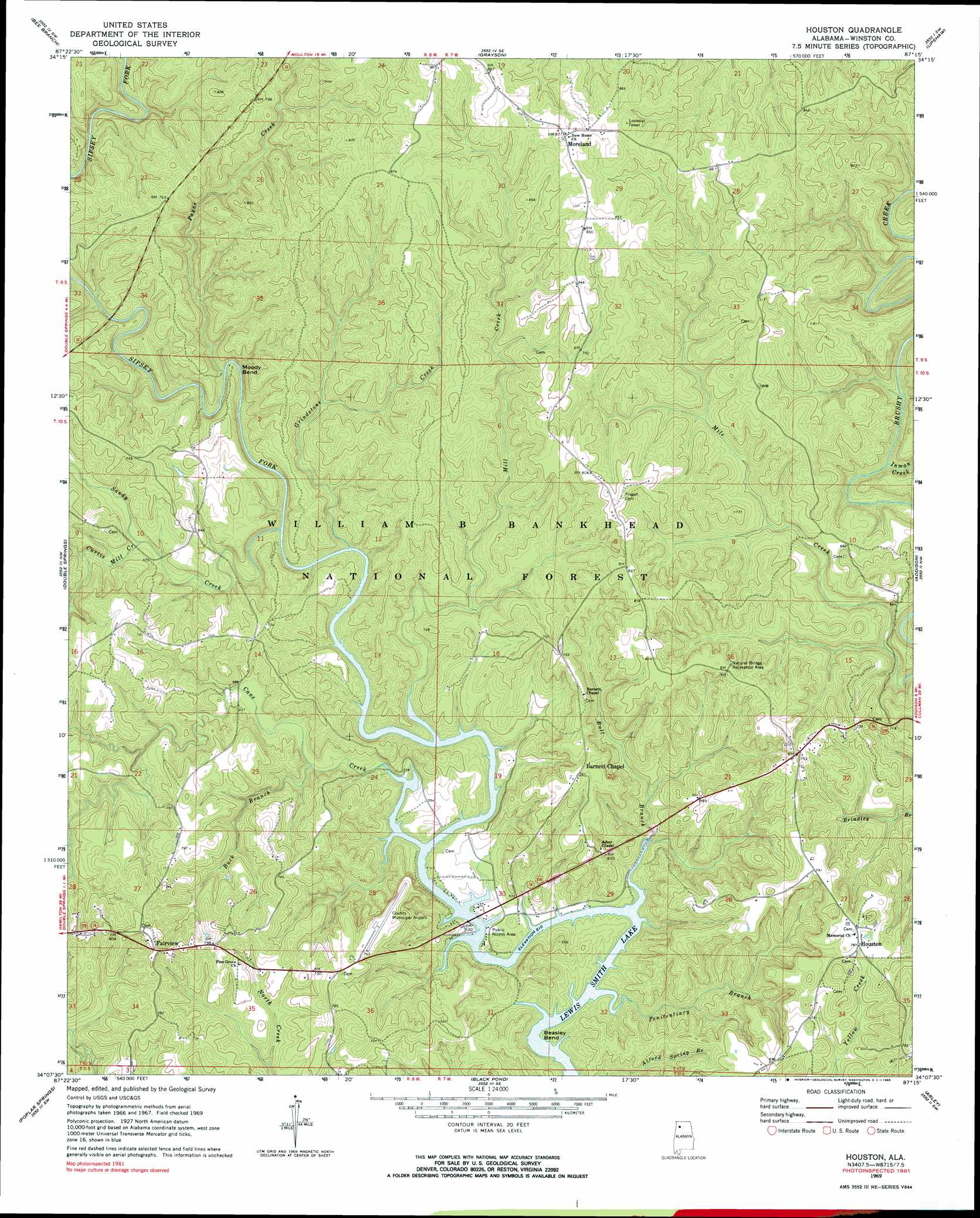
USGS Topo Quad 34087b3 - 1:24,000 scale
| Topo Map Name: | Houston |
| USGS Topo Quad ID: | 34087b3 |
| Print Size: | ca. 21 1/4" wide x 27" high |
| Southeast Coordinates: | 34.125° N latitude / 87.25° W longitude |
| Map Center Coordinates: | 34.1875° N latitude / 87.3125° W longitude |
| U.S. State: | AL |
| Filename: | o34087b3.jpg |
| Download Map JPG Image: | Houston topo map 1:24,000 scale |
| Map Type: | Topographic |
| Topo Series: | 7.5´ |
| Map Scale: | 1:24,000 |
| Source of Map Images: | United States Geological Survey (USGS) |
| Alternate Map Versions: |
Houston AL 1969, updated 1973 Download PDF Buy paper map Houston AL 1969, updated 1985 Download PDF Buy paper map Houston AL 2000, updated 2003 Download PDF Buy paper map Houston AL 2011 Download PDF Buy paper map Houston AL 2014 Download PDF Buy paper map |
| FStopo: | US Forest Service topo Houston is available: Download FStopo PDF Download FStopo TIF |
1:24,000 Topo Quads surrounding Houston
Newburg |
Landersville |
Moulton |
Oakville |
Danville |
Kinlock Spring |
Bee Branch |
Grayson |
Upshaw |
Massey |
Haleyville East |
Double Springs |
Houston |
Addison |
Jones Chapel |
Lynn |
Poplar Springs |
Black Pond |
Arley |
Crane Hill |
Carbon Hill |
Nauvoo |
Manchester |
Sunlight |
Cold Springs |
> Back to 34087a1 at 1:100,000 scale
> Back to 34086a1 at 1:250,000 scale
> Back to U.S. Topo Maps home
Houston topo map: Gazetteer
Houston: Airports
Double Springs-Winston County Airport elevation 227m 744′Houston: Arches
Natural Bridge elevation 219m 718′Houston: Bends
Beasley Bend elevation 155m 508′Moody Bend elevation 173m 567′
Houston: Forests
William B. Bankhead National Forest elevation 216m 708′Houston: Populated Places
Barnett Chapel elevation 232m 761′Fairview elevation 245m 803′
Houston elevation 232m 761′
Moreland elevation 268m 879′
Houston: Post Offices
Houston Post Office elevation 231m 757′Houston: Streams
Buck Branch elevation 163m 534′Bull Branch elevation 155m 508′
Cane Creek elevation 155m 508′
Curtis Mill Creek elevation 165m 541′
Grindstone Creek elevation 156m 511′
Inman Creek elevation 159m 521′
Mill Creek elevation 155m 508′
Payne Creek elevation 161m 528′
Penitentiary Branch elevation 155m 508′
Sandy Creek elevation 156m 511′
Houston digital topo map on disk
Buy this Houston topo map showing relief, roads, GPS coordinates and other geographical features, as a high-resolution digital map file on DVD: