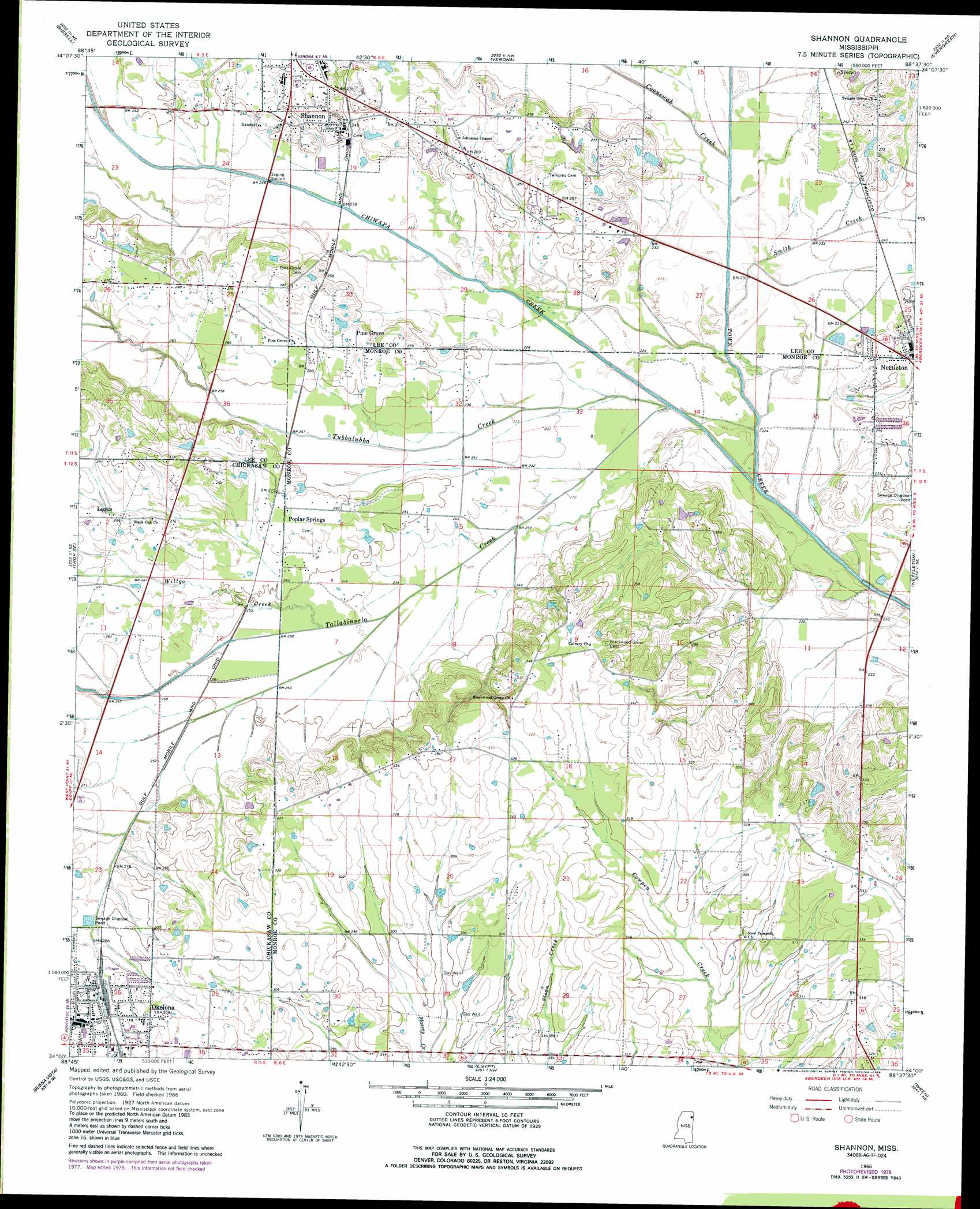
Shannon Topo Map Mississippi
To zoom in, hover over the map of Shannon
USGS Topo Quad 34088a6 - 1:24,000 scale
| Topo Map Name: | Shannon |
| USGS Topo Quad ID: | 34088a6 |
| Print Size: | ca. 21 1/4" wide x 27" high |
| Southeast Coordinates: | 34° N latitude / 88.625° W longitude |
| Map Center Coordinates: | 34.0625° N latitude / 88.6875° W longitude |
| U.S. State: | MS |
| Filename: | o34088a6.jpg |
| Download Map JPG Image: | Shannon topo map 1:24,000 scale |
| Map Type: | Topographic |
| Topo Series: | 7.5´ |
| Map Scale: | 1:24,000 |
| Source of Map Images: | United States Geological Survey (USGS) |
| Alternate Map Versions: |
Shannon MS 1966, updated 1967 Download PDF Buy paper map Shannon MS 1966, updated 1988 Download PDF Buy paper map Shannon MS 2012 Download PDF Buy paper map Shannon MS 2015 Download PDF Buy paper map |
1:24,000 Topo Quads surrounding Shannon
Northeast Pontotoc |
Sherman |
Tupelo |
Mooreville |
Fulton |
Southeast Pontotoc |
Bissell |
Verona |
Evergreen |
Beans Ferry |
Troy |
Troy Se |
Shannon |
Nettleton |
Smithville |
Houston East |
Buena Vista |
Egypt |
Wren |
Amory |
Sparta |
Trebloc |
Prairie |
Aberdeen |
Amory Sw |
> Back to 34088a1 at 1:100,000 scale
> Back to 34088a1 at 1:250,000 scale
> Back to U.S. Topo Maps home
Shannon topo map: Gazetteer
Shannon: Crossings
Camargo Ferry (historical) elevation 62m 203′Shannon: Populated Places
Camargo (historical) elevation 67m 219′Coggin Subdivision elevation 74m 242′
Leotis elevation 88m 288′
Pine Grove elevation 83m 272′
Poplar Springs elevation 82m 269′
Shannon elevation 78m 255′
Shannon: Streams
Chiwapa Creek elevation 62m 203′Coonewah Creek elevation 66m 216′
Smith Creek elevation 64m 209′
Tallabinnela Creek elevation 65m 213′
Tubbalubba Creek elevation 63m 206′
Willgo Creek elevation 72m 236′
Shannon digital topo map on disk
Buy this Shannon topo map showing relief, roads, GPS coordinates and other geographical features, as a high-resolution digital map file on DVD: