Vina Topo Map Alabama
To zoom in, hover over the map of Vina
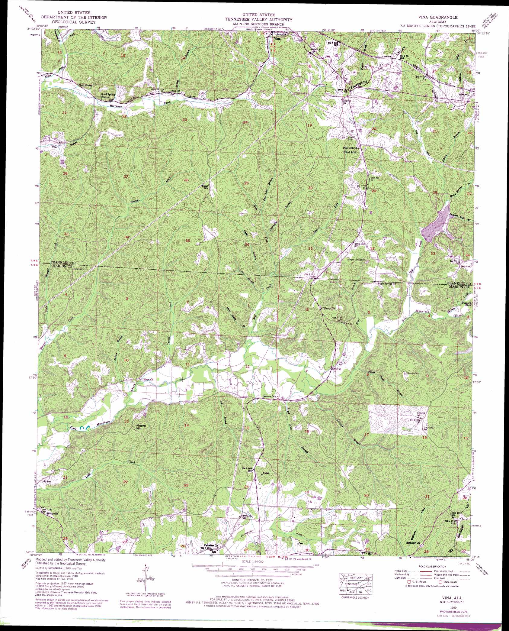
USGS Topo Quad 34088c1 - 1:24,000 scale
| Topo Map Name: | Vina |
| USGS Topo Quad ID: | 34088c1 |
| Print Size: | ca. 21 1/4" wide x 27" high |
| Southeast Coordinates: | 34.25° N latitude / 88° W longitude |
| Map Center Coordinates: | 34.3125° N latitude / 88.0625° W longitude |
| U.S. State: | AL |
| Filename: | o34088c1.jpg |
| Download Map JPG Image: | Vina topo map 1:24,000 scale |
| Map Type: | Topographic |
| Topo Series: | 7.5´ |
| Map Scale: | 1:24,000 |
| Source of Map Images: | United States Geological Survey (USGS) |
| Alternate Map Versions: |
Vina AL 1936 Download PDF Buy paper map Vina AL 1950, updated 1977 Download PDF Buy paper map Vina AL 1951 Download PDF Buy paper map Vina AL 2011 Download PDF Buy paper map Vina AL 2014 Download PDF Buy paper map |
1:24,000 Topo Quads surrounding Vina
Paden Se |
Belmont |
Pleasant Site |
Pleasant Grove |
Frankfort |
Fulton Ne |
Red Bay |
Halltown |
Guinn Cross Roads |
Isbell |
Fulton Se |
Shottsville |
Vina |
Hodges |
Hackleburg |
Tremont |
Bexar |
Weston |
Hamilton |
Hamilton Ne |
Turon |
Detroit |
Henson Springs |
Hamilton Sw |
Brilliant |
> Back to 34088a1 at 1:100,000 scale
> Back to 34088a1 at 1:250,000 scale
> Back to U.S. Topo Maps home
Vina topo map: Gazetteer
Vina: Dams
Mobley Dam elevation 153m 501′Vina: Oilfields
Bluegut Creek Gas Field elevation 176m 577′Vina: Reservoirs
Mobley Lake elevation 153m 501′Vina: Springs
Good Spring elevation 165m 541′Vina: Streams
Bear Branch elevation 185m 606′Beaver Dam Branch elevation 144m 472′
Bluegut Creek elevation 128m 419′
Bridge Branch elevation 170m 557′
Childers Mill Branch elevation 164m 538′
Deadman Branch elevation 161m 528′
Deer Lick Branch elevation 163m 534′
Dry Creek elevation 149m 488′
East Fork Mill Creek elevation 151m 495′
Holly Spring Branch elevation 170m 557′
Hurricane Branch elevation 158m 518′
Jim Branch elevation 137m 449′
Lane Branch elevation 146m 479′
Latchie Branch elevation 142m 465′
Little Bluegut Creek elevation 135m 442′
Loyd Mill Branch elevation 141m 462′
Mill Branch elevation 148m 485′
Mill Creek elevation 139m 456′
Mule Stable Branch elevation 139m 456′
Nettles Branch elevation 133m 436′
Roberts Branch elevation 170m 557′
Skirum Creek elevation 149m 488′
Turkey Creek elevation 133m 436′
West Fork Mill Creek elevation 151m 495′
Vina: Summits
Moore Hill elevation 219m 718′Pilot Hill elevation 236m 774′
Vina digital topo map on disk
Buy this Vina topo map showing relief, roads, GPS coordinates and other geographical features, as a high-resolution digital map file on DVD: