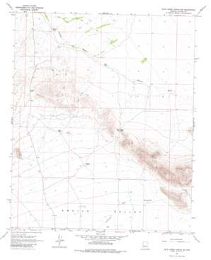
Date Creek Ranch Sw Topo Map Arizona
To zoom in, hover over the map of Date Creek Ranch Sw
USGS Topo Quad 34113a2 - 1:24,000 scale
| Topo Map Name: | Date Creek Ranch Sw |
| USGS Topo Quad ID: | 34113a2 |
| Print Size: | ca. 21 1/4" wide x 27" high |
| Southeast Coordinates: | 34° N latitude / 113.125° W longitude |
| Map Center Coordinates: | 34.0625° N latitude / 113.1875° W longitude |
| U.S. State: | AZ |
| Filename: | o34113a2.jpg |
| Download Map JPG Image: | Date Creek Ranch Sw topo map 1:24,000 scale |
| Map Type: | Topographic |
| Topo Series: | 7.5´ |
| Map Scale: | 1:24,000 |
| Source of Map Images: | United States Geological Survey (USGS) |
| Alternate Map Versions: |
Date Creek Ranch SW AZ 1967, updated 1970 Download PDF Buy paper map Date Creek Ranch SW AZ 2011 Download PDF Buy paper map Date Creek Ranch SW AZ 2014 Download PDF Buy paper map |
1:24,000 Topo Quads surrounding Date Creek Ranch Sw
> Back to 34113a1 at 1:100,000 scale
> Back to 34112a1 at 1:250,000 scale
> Back to U.S. Topo Maps home
Date Creek Ranch Sw topo map: Gazetteer
Date Creek Ranch Sw: Airports
Flying Dares Ranch Airport elevation 667m 2188′Date Creek Ranch Sw: Gaps
Bullard Pass elevation 753m 2470′Rudy Pass elevation 0m 0′
Date Creek Ranch Sw: Mines
Nellie-Meda Mine elevation 721m 2365′Date Creek Ranch Sw: Reservoirs
East Tank elevation 712m 2335′Eight Tank elevation 715m 2345′
Harcuvar Tank elevation 678m 2224′
Holder Tank elevation 696m 2283′
Sixteen Tank elevation 0m 0′
Thirtyfive Tank elevation 675m 2214′
Date Creek Ranch Sw: Wells
Wood Well elevation 762m 2500′Date Creek Ranch Sw digital topo map on disk
Buy this Date Creek Ranch Sw topo map showing relief, roads, GPS coordinates and other geographical features, as a high-resolution digital map file on DVD:


