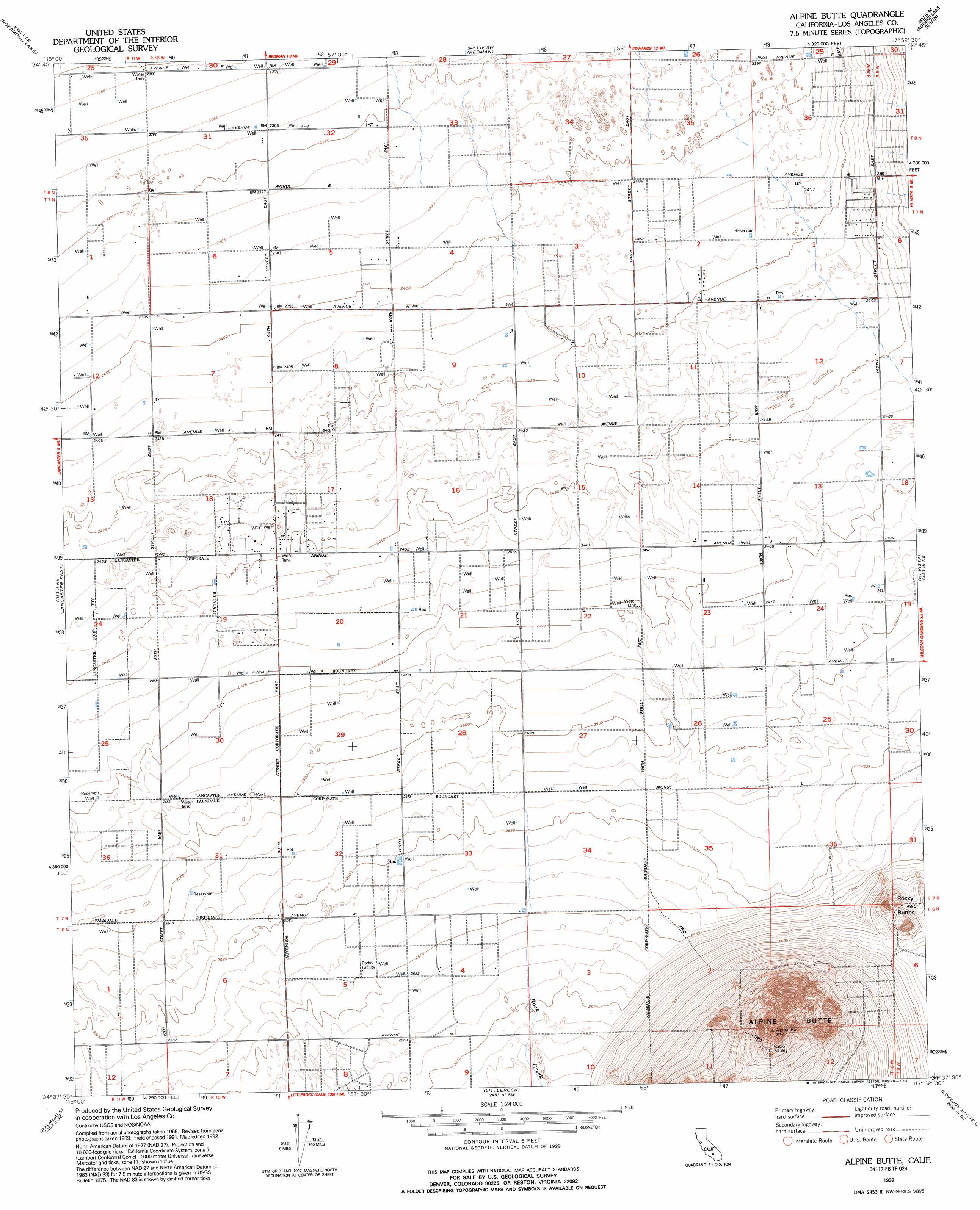
Alpine Butte Topo Map California
To zoom in, hover over the map of Alpine Butte
USGS Topo Quad 34117f8 - 1:24,000 scale
| Topo Map Name: | Alpine Butte |
| USGS Topo Quad ID: | 34117f8 |
| Print Size: | ca. 21 1/4" wide x 27" high |
| Southeast Coordinates: | 34.625° N latitude / 117.875° W longitude |
| Map Center Coordinates: | 34.6875° N latitude / 117.9375° W longitude |
| U.S. State: | CA |
| Filename: | o34117f8.jpg |
| Download Map JPG Image: | Alpine Butte topo map 1:24,000 scale |
| Map Type: | Topographic |
| Topo Series: | 7.5´ |
| Map Scale: | 1:24,000 |
| Source of Map Images: | United States Geological Survey (USGS) |
| Alternate Map Versions: |
Alpine Butte CA 1957, updated 1958 Download PDF Buy paper map Alpine Butte CA 1957, updated 1964 Download PDF Buy paper map Alpine Butte CA 1957, updated 1964 Download PDF Buy paper map Alpine Butte CA 1957, updated 1975 Download PDF Buy paper map Alpine Butte CA 1992, updated 1993 Download PDF Buy paper map Alpine Butte CA 2012 Download PDF Buy paper map Alpine Butte CA 2015 Download PDF Buy paper map |
1:24,000 Topo Quads surrounding Alpine Butte
Soledad Mountain |
Bissell |
Edwards |
Rogers Lake North |
Leuhman Ridge |
Rosamond |
Rosamond Lake |
Redman |
Rogers Lake South |
Jackrabbit Hill |
Lancaster West |
Lancaster East |
Alpine Butte |
Hi Vista |
Adobe Mountain |
Ritter Ridge |
Palmdale |
Littlerock |
Lovejoy Buttes |
El Mirage |
Acton |
Pacifico Mountain |
Juniper Hills |
Valyermo |
Mescal Creek |
> Back to 34117e1 at 1:100,000 scale
> Back to 34116a1 at 1:250,000 scale
> Back to U.S. Topo Maps home
Alpine Butte topo map: Gazetteer
Alpine Butte: Streams
Rock Creek elevation 783m 2568′Alpine Butte: Summits
Alpine Butte elevation 990m 3248′Alpine Butte digital topo map on disk
Buy this Alpine Butte topo map showing relief, roads, GPS coordinates and other geographical features, as a high-resolution digital map file on DVD: