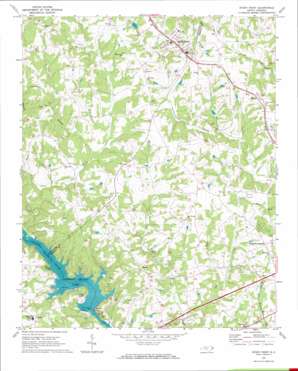
Stony Point Topo Map North Carolina
To zoom in, hover over the map of Stony Point
USGS Topo Quad 35081g1 - 1:24,000 scale
| Topo Map Name: | Stony Point |
| USGS Topo Quad ID: | 35081g1 |
| Print Size: | ca. 21 1/4" wide x 27" high |
| Southeast Coordinates: | 35.75° N latitude / 81° W longitude |
| Map Center Coordinates: | 35.8125° N latitude / 81.0625° W longitude |
| U.S. State: | NC |
| Filename: | o35081g1.jpg |
| Download Map JPG Image: | Stony Point topo map 1:24,000 scale |
| Map Type: | Topographic |
| Topo Series: | 7.5´ |
| Map Scale: | 1:24,000 |
| Source of Map Images: | United States Geological Survey (USGS) |
| Alternate Map Versions: |
Stony Point NC 1970, updated 1973 Download PDF Buy paper map Stony Point NC 1970, updated 1973 Download PDF Buy paper map Stony Point NC 2010 Download PDF Buy paper map Stony Point NC 2013 Download PDF Buy paper map Stony Point NC 2016 Download PDF Buy paper map |
1:24,000 Topo Quads surrounding Stony Point
> Back to 35081e1 at 1:100,000 scale
> Back to 35080a1 at 1:250,000 scale
> Back to U.S. Topo Maps home
Stony Point topo map: Gazetteer
Stony Point: Dams
C A Lackey Dam elevation 305m 1000′Hill Lake Dam elevation 304m 997′
Lookout Shoals Dam elevation 233m 764′
Third Creek Watershed Dam Number Nine elevation 280m 918′
Third Creek Watershed Dam Ten elevation 282m 925′
Stony Point: Populated Places
Bradford Crossroads elevation 311m 1020′Brevard (historical) elevation 311m 1020′
Catfish elevation 301m 987′
Moores (historical) elevation 233m 764′
Scotts elevation 311m 1020′
Sharon elevation 304m 997′
Stony Point elevation 323m 1059′
Sunrise Beach elevation 283m 928′
Stony Point: Reservoirs
Hill Lake elevation 304m 997′Lake Lookout elevation 233m 764′
Lookout Shoals Lake elevation 233m 764′
Noname elevation 305m 1000′
Stony Point: Streams
Big Branch elevation 271m 889′Doctors Branch elevation 273m 895′
Elk Shoals Creek elevation 255m 836′
Goble Creek elevation 250m 820′
Guys Branch elevation 276m 905′
Stony Point digital topo map on disk
Buy this Stony Point topo map showing relief, roads, GPS coordinates and other geographical features, as a high-resolution digital map file on DVD:
South Carolina, Western North Carolina & Northeastern Georgia
Buy digital topo maps: South Carolina, Western North Carolina & Northeastern Georgia


