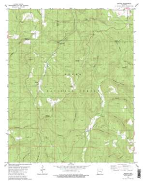
Smyrna Topo Map Arkansas
To zoom in, hover over the map of Smyrna
USGS Topo Quad 35092f8 - 1:24,000 scale
| Topo Map Name: | Smyrna |
| USGS Topo Quad ID: | 35092f8 |
| Print Size: | ca. 21 1/4" wide x 27" high |
| Southeast Coordinates: | 35.625° N latitude / 92.875° W longitude |
| Map Center Coordinates: | 35.6875° N latitude / 92.9375° W longitude |
| U.S. State: | AR |
| Filename: | o35092f8.jpg |
| Download Map JPG Image: | Smyrna topo map 1:24,000 scale |
| Map Type: | Topographic |
| Topo Series: | 7.5´ |
| Map Scale: | 1:24,000 |
| Source of Map Images: | United States Geological Survey (USGS) |
| Alternate Map Versions: |
Smyrna NW AR 1974, updated 1975 Download PDF Buy paper map Smyrna AR 1980, updated 1980 Download PDF Buy paper map Smyrna AR 1980, updated 1980 Download PDF Buy paper map Smyrna AR 2011 Download PDF Buy paper map Smyrna AR 2014 Download PDF Buy paper map |
| FStopo: | US Forest Service topo Smyrna is available: Download FStopo PDF Download FStopo TIF |
1:24,000 Topo Quads surrounding Smyrna
> Back to 35092e1 at 1:100,000 scale
> Back to 35092a1 at 1:250,000 scale
> Back to U.S. Topo Maps home
Smyrna topo map: Gazetteer
Smyrna: Dams
Winrock Farms Lake Dam elevation 383m 1256′Smyrna: Falls
Falling Water Falls elevation 417m 1368′Falling Water Falls elevation 422m 1384′
Smyrna: Populated Places
Ben Hur elevation 527m 1729′Nogo elevation 525m 1722′
Raspberry elevation 589m 1932′
Smyrna elevation 282m 925′
Smyrna: Reservoirs
Winrock Farms Lake elevation 383m 1256′Smyrna: Streams
Bailey Cole Creek elevation 373m 1223′Bailey Cole Creek elevation 372m 1220′
Raspberry Creek elevation 284m 931′
Reeves Branch elevation 320m 1049′
Smyrna: Summits
Chinquapin Knob elevation 606m 1988′Mulberry Mountain elevation 647m 2122′
Raspberry Mountain elevation 623m 2043′
Smyrna: Valleys
Brogden Hollow elevation 333m 1092′Dave Millsaps Hollow elevation 316m 1036′
Graveyard Hollow elevation 298m 977′
Graveyard Hollow elevation 300m 984′
Knob Hollow elevation 302m 990′
Knob Hollow elevation 302m 990′
Mill Hollow elevation 381m 1250′
Neely Hollow elevation 366m 1200′
Pack Hollow elevation 300m 984′
Pack Hollow elevation 306m 1003′
Treadwell Hollow elevation 314m 1030′
Smyrna digital topo map on disk
Buy this Smyrna topo map showing relief, roads, GPS coordinates and other geographical features, as a high-resolution digital map file on DVD:


