Soda Lake South Topo Map California
To zoom in, hover over the map of Soda Lake South
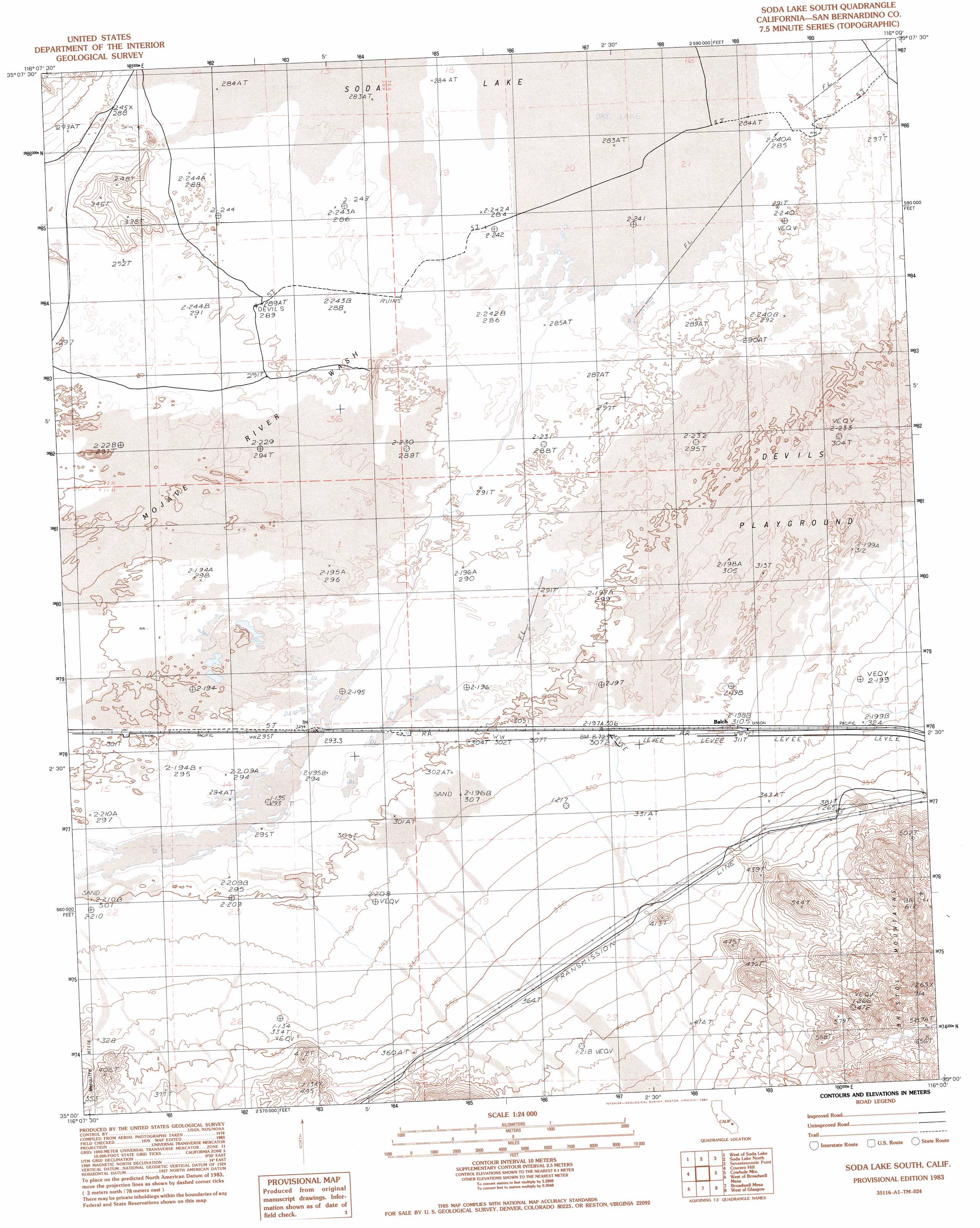
USGS Topo Quad 35116a1 - 1:24,000 scale
| Topo Map Name: | Soda Lake South |
| USGS Topo Quad ID: | 35116a1 |
| Print Size: | ca. 21 1/4" wide x 27" high |
| Southeast Coordinates: | 35° N latitude / 116° W longitude |
| Map Center Coordinates: | 35.0625° N latitude / 116.0625° W longitude |
| U.S. State: | CA |
| Filename: | o35116a1.jpg |
| Download Map JPG Image: | Soda Lake South topo map 1:24,000 scale |
| Map Type: | Topographic |
| Topo Series: | 7.5´ |
| Map Scale: | 1:24,000 |
| Source of Map Images: | United States Geological Survey (USGS) |
| Alternate Map Versions: |
Soda Lake South CA 1983, updated 1983 Download PDF Buy paper map Soda Lake South CA 1983, updated 1987 Download PDF Buy paper map Soda Lake South CA 2012 Download PDF Buy paper map Soda Lake South CA 2015 Download PDF Buy paper map |
1:24,000 Topo Quads surrounding Soda Lake South
Red Pass Lake |
West Of Baker |
Baker |
Halloran Spring |
Granite Spring |
Cronise Lakes |
West Of Soda Lake |
Soda Lake North |
Seventeenmile Point |
Indian Spring |
Cave Mountain |
Crucero Hill |
Soda Lake South |
Cowhole Mountain |
Old Dad Mountain |
Hidden Valley East |
West Of Broadwell Mesa |
Broadwell Mesa |
West Of Glasgow |
Glasgow |
Sleeping Beauty |
Broadwell Lake |
East Of Broadwell Lake |
West Of Budweiser Wash |
Budweiser Wash |
> Back to 35116a1 at 1:100,000 scale
> Back to 35116a1 at 1:250,000 scale
> Back to U.S. Topo Maps home
Soda Lake South topo map: Gazetteer
Soda Lake South: Populated Places
Balch elevation 311m 1020′Belfast (historical) elevation 297m 974′
Soda Lake South: Streams
Kelso Wash elevation 332m 1089′Mojave River elevation 285m 935′
Mojave River Wash elevation 285m 935′
Soda Lake South digital topo map on disk
Buy this Soda Lake South topo map showing relief, roads, GPS coordinates and other geographical features, as a high-resolution digital map file on DVD:
Southern Sierra Nevada, California & Southern Nevada
Buy digital topo maps: Southern Sierra Nevada, California & Southern Nevada