Indian Spring Topo Map California
To zoom in, hover over the map of Indian Spring
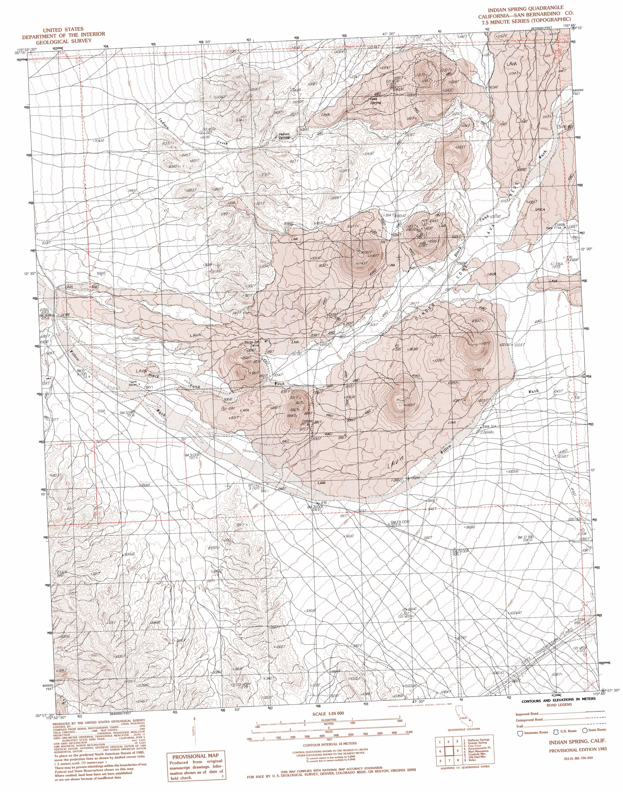
USGS Topo Quad 35115b7 - 1:24,000 scale
| Topo Map Name: | Indian Spring |
| USGS Topo Quad ID: | 35115b7 |
| Print Size: | ca. 21 1/4" wide x 27" high |
| Southeast Coordinates: | 35.125° N latitude / 115.75° W longitude |
| Map Center Coordinates: | 35.1875° N latitude / 115.8125° W longitude |
| U.S. State: | CA |
| Filename: | o35115b7.jpg |
| Download Map JPG Image: | Indian Spring topo map 1:24,000 scale |
| Map Type: | Topographic |
| Topo Series: | 7.5´ |
| Map Scale: | 1:24,000 |
| Source of Map Images: | United States Geological Survey (USGS) |
| Alternate Map Versions: |
Indian Spring CA 1983, updated 1983 Download PDF Buy paper map Indian Spring CA 1983, updated 1986 Download PDF Buy paper map Indian Spring CA 2012 Download PDF Buy paper map Indian Spring CA 2015 Download PDF Buy paper map |
1:24,000 Topo Quads surrounding Indian Spring
North Of Baker |
Turquoise Mountain |
Solomons Knob |
Valley Wells |
Mescal Range |
Baker |
Halloran Spring |
Granite Spring |
Cow Cove |
Cima Dome |
Soda Lake North |
Seventeenmile Point |
Indian Spring |
Marl Mountains |
Cima |
Soda Lake South |
Cowhole Mountain |
Old Dad Mountain |
Kelso |
Hayden |
Broadwell Mesa |
West Of Glasgow |
Glasgow |
Kelso Dunes |
Fountain Peak |
> Back to 35115a1 at 1:100,000 scale
> Back to 35114a1 at 1:250,000 scale
> Back to U.S. Topo Maps home
Indian Spring topo map: Gazetteer
Indian Spring: Lavas
Cinder Cone Lava Beds elevation 1103m 3618′Indian Spring: Mines
Rainy Day Mine elevation 852m 2795′Indian Spring: Reservoirs
Tank Seven elevation 746m 2447′Tank Six elevation 988m 3241′
Indian Spring: Springs
Cane Spring elevation 987m 3238′Indian Spring elevation 887m 2910′
Indian Spring: Streams
Black Tank Wash elevation 681m 2234′Indian Spring digital topo map on disk
Buy this Indian Spring topo map showing relief, roads, GPS coordinates and other geographical features, as a high-resolution digital map file on DVD:
Southern Sierra Nevada, California & Southern Nevada
Buy digital topo maps: Southern Sierra Nevada, California & Southern Nevada