Ducor Topo Map California
To zoom in, hover over the map of Ducor
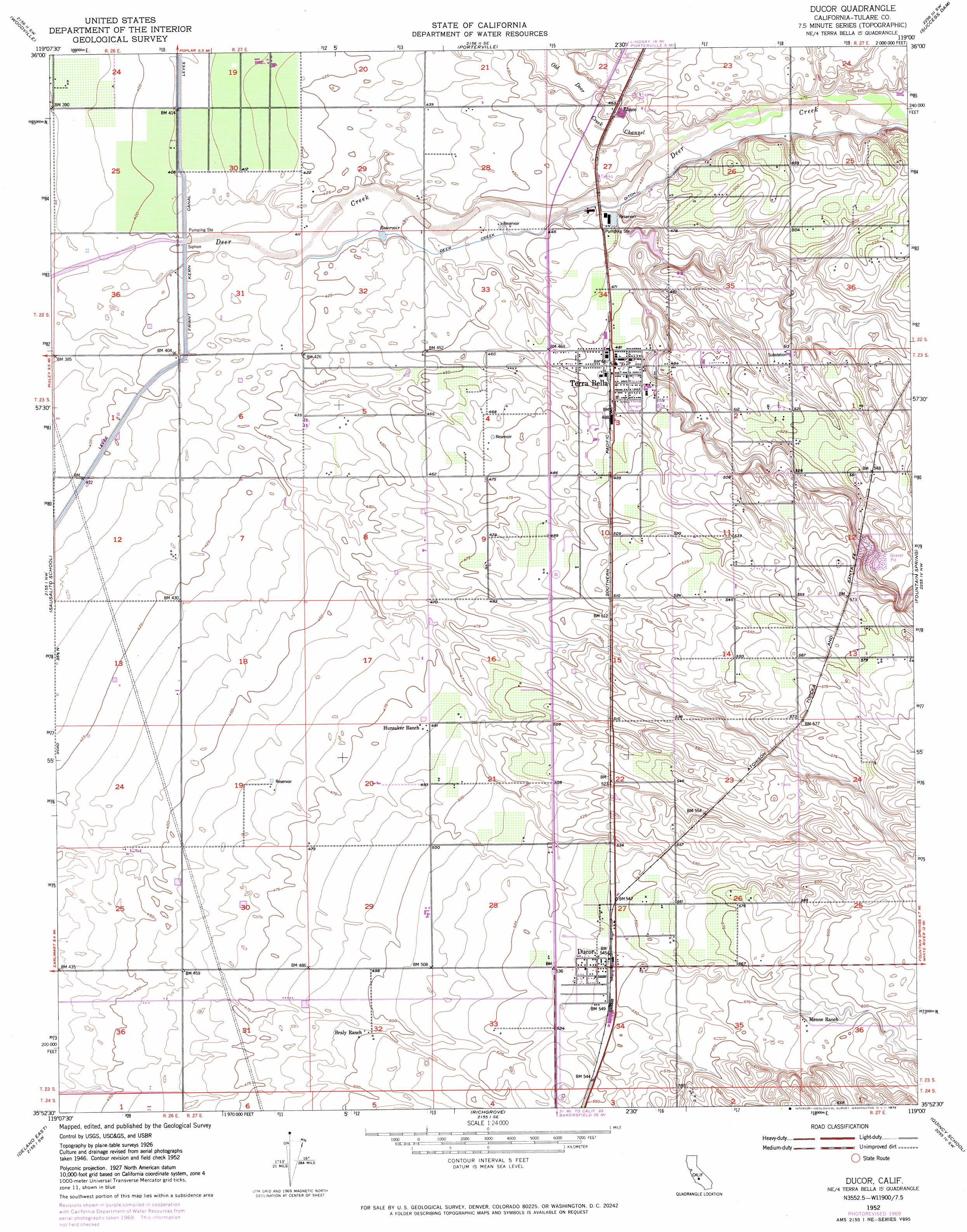
USGS Topo Quad 35119h1 - 1:24,000 scale
| Topo Map Name: | Ducor |
| USGS Topo Quad ID: | 35119h1 |
| Print Size: | ca. 21 1/4" wide x 27" high |
| Southeast Coordinates: | 35.875° N latitude / 119° W longitude |
| Map Center Coordinates: | 35.9375° N latitude / 119.0625° W longitude |
| U.S. State: | CA |
| Filename: | o35119h1.jpg |
| Download Map JPG Image: | Ducor topo map 1:24,000 scale |
| Map Type: | Topographic |
| Topo Series: | 7.5´ |
| Map Scale: | 1:24,000 |
| Source of Map Images: | United States Geological Survey (USGS) |
| Alternate Map Versions: |
Ducor CA 1952, updated 1954 Download PDF Buy paper map Ducor CA 1952, updated 1972 Download PDF Buy paper map Ducor CA 1952, updated 1972 Download PDF Buy paper map Ducor CA 2012 Download PDF Buy paper map Ducor CA 2015 Download PDF Buy paper map |
1:24,000 Topo Quads surrounding Ducor
Tulare |
Cairns Corner |
Lindsay |
Frazier Valley |
Springville |
Tipton |
Woodville |
Porterville |
Success Dam |
Globe |
Pixley |
Sausalito School |
Ducor |
Fountain Springs |
Gibbon Peak |
Delano West |
Delano East |
Richgrove |
Quincy School |
White River |
Pond |
Mcfarland |
Deepwell Ranch |
Sand Canyon |
Woody |
> Back to 35119e1 at 1:100,000 scale
> Back to 35118a1 at 1:250,000 scale
> Back to U.S. Topo Maps home
Ducor topo map: Gazetteer
Ducor: Canals
Deer Creek Ditch elevation 139m 456′Ducor: Populated Places
Deer Creek Colony elevation 165m 541′Ducor elevation 167m 547′
Elmco elevation 141m 462′
Terra Bella elevation 148m 485′
Ducor: Post Offices
Terra Bella Post Office elevation 149m 488′Ducor: Valleys
Fountain Springs Gulch elevation 138m 452′Ducor digital topo map on disk
Buy this Ducor topo map showing relief, roads, GPS coordinates and other geographical features, as a high-resolution digital map file on DVD:
Southern Sierra Nevada, California & Southern Nevada
Buy digital topo maps: Southern Sierra Nevada, California & Southern Nevada