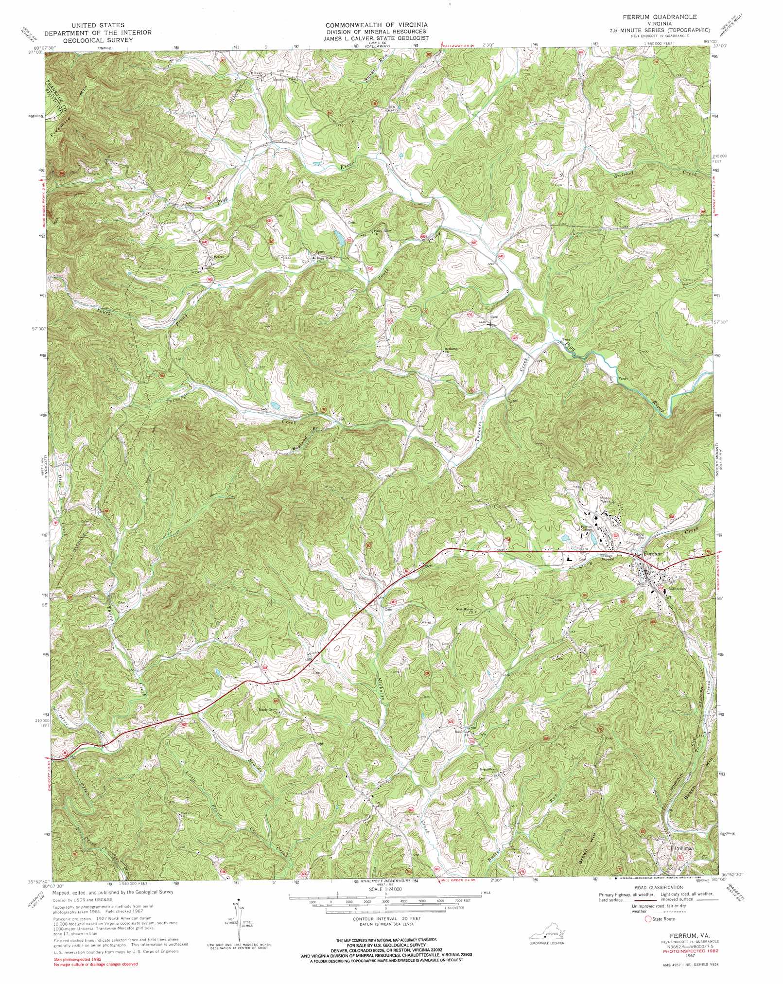
Ferrum Topo Map Virginia
To zoom in, hover over the map of Ferrum
USGS Topo Quad 36080h1 - 1:24,000 scale
| Topo Map Name: | Ferrum |
| USGS Topo Quad ID: | 36080h1 |
| Print Size: | ca. 21 1/4" wide x 27" high |
| Southeast Coordinates: | 36.875° N latitude / 80° W longitude |
| Map Center Coordinates: | 36.9375° N latitude / 80.0625° W longitude |
| U.S. State: | VA |
| Filename: | o36080h1.jpg |
| Download Map JPG Image: | Ferrum topo map 1:24,000 scale |
| Map Type: | Topographic |
| Topo Series: | 7.5´ |
| Map Scale: | 1:24,000 |
| Source of Map Images: | United States Geological Survey (USGS) |
| Alternate Map Versions: |
Ferrum VA 1967, updated 1969 Download PDF Buy paper map Ferrum VA 1967, updated 1984 Download PDF Buy paper map Ferrum VA 1967, updated 1985 Download PDF Buy paper map Ferrum VA 2010 Download PDF Buy paper map Ferrum VA 2013 Download PDF Buy paper map Ferrum VA 2016 Download PDF Buy paper map |
1:24,000 Topo Quads surrounding Ferrum
Ironto |
Elliston |
Bent Mountain |
Garden City |
Hardy |
Pilot |
Check |
Callaway |
Boones Mill |
Redwood |
Floyd |
Endicott |
Ferrum |
Rocky Mount |
Gladehill |
Woolwine |
Charity |
Philpott Reservoir |
Bassett |
Snow Creek |
Stuart |
Patrick Springs |
Sanville |
Martinsville West |
Martinsville East |
> Back to 36080e1 at 1:100,000 scale
> Back to 36080a1 at 1:250,000 scale
> Back to U.S. Topo Maps home
Ferrum topo map: Gazetteer
Ferrum: Bridges
Sheriff Shively Memorial Bridge elevation 401m 1315′Ferrum: Dams
Adams Dam elevation 402m 1318′Ferrum: Populated Places
Cross Roads elevation 405m 1328′Ferrum elevation 395m 1295′
Ingramville elevation 391m 1282′
Ferrum: Reservoirs
Adams Pond elevation 402m 1318′Ferrum: Streams
Little Beards Creek elevation 327m 1072′Ragland Branch elevation 418m 1371′
Snake Run elevation 383m 1256′
South Prong Pigg River elevation 377m 1236′
Tharp Creek elevation 333m 1092′
Turners Creek elevation 368m 1207′
Ferrum: Summits
Brown Hill elevation 556m 1824′Ferrum digital topo map on disk
Buy this Ferrum topo map showing relief, roads, GPS coordinates and other geographical features, as a high-resolution digital map file on DVD:
Western Virginia & Southern West Virginia
Buy digital topo maps: Western Virginia & Southern West Virginia