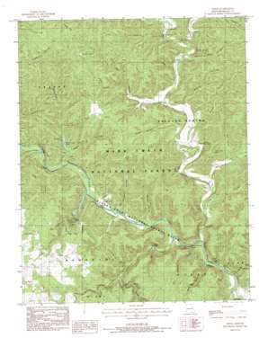
Greer Topo Map Missouri
To zoom in, hover over the map of Greer
USGS Topo Quad 36091g3 - 1:24,000 scale
| Topo Map Name: | Greer |
| USGS Topo Quad ID: | 36091g3 |
| Print Size: | ca. 21 1/4" wide x 27" high |
| Southeast Coordinates: | 36.75° N latitude / 91.25° W longitude |
| Map Center Coordinates: | 36.8125° N latitude / 91.3125° W longitude |
| U.S. State: | MO |
| Filename: | o36091g3.jpg |
| Download Map JPG Image: | Greer topo map 1:24,000 scale |
| Map Type: | Topographic |
| Topo Series: | 7.5´ |
| Map Scale: | 1:24,000 |
| Source of Map Images: | United States Geological Survey (USGS) |
| Alternate Map Versions: |
Greer MO 1983, updated 1984 Download PDF Buy paper map Greer MO 1997, updated 2000 Download PDF Buy paper map Greer MO 2011 Download PDF Buy paper map Greer MO 2015 Download PDF Buy paper map |
| FStopo: | US Forest Service topo Greer is available: Download FStopo PDF Download FStopo TIF |
1:24,000 Topo Quads surrounding Greer
> Back to 36091e1 at 1:100,000 scale
> Back to 36090a1 at 1:250,000 scale
> Back to U.S. Topo Maps home
Greer topo map: Gazetteer
Greer: Bars
Mary Deckard Shoals elevation 152m 498′Greer: Cliffs
Brawley Bluff elevation 217m 711′Greer: Dams
McCormack Lake Dam elevation 176m 577′Greer: Lakes
Blue Hole elevation 159m 521′Brushy Pond elevation 280m 918′
Flat Pond elevation 285m 935′
Greer: Populated Places
Brawley elevation 264m 866′Greer elevation 263m 862′
McFry Ford elevation 151m 495′
New Liberty elevation 198m 649′
Ross (historical) elevation 235m 770′
Turners Mill elevation 153m 501′
Greer: Rapids
Bellah Falls elevation 160m 524′Greer: Reservoirs
McCormack Lake elevation 176m 577′Greer: Springs
Barrett Spring elevation 191m 626′Falling Spring elevation 199m 652′
Greer Spring elevation 236m 774′
Gusty Spring elevation 170m 557′
McCormack Spring elevation 189m 620′
Ross Spring elevation 179m 587′
Turners Spring elevation 170m 557′
Walters Spring elevation 177m 580′
Greer: Streams
Greer Spring Branch elevation 179m 587′Hurricane Creek elevation 152m 498′
Little Hurricane Creek elevation 154m 505′
Long Hollow Creek elevation 165m 541′
Greer: Summits
Mosby Hill elevation 294m 964′Greer: Valleys
Big Bottom Hollow elevation 149m 488′Bill Deckard Hollow elevation 151m 495′
Brown Hollow elevation 177m 580′
Buck Bay Hollow elevation 152m 498′
Butler Hollow elevation 182m 597′
Carters Shop Hollow elevation 192m 629′
Cave Hollow elevation 177m 580′
Cook Hollow elevation 185m 606′
Douglas Hollow elevation 183m 600′
Duncan Hollow elevation 161m 528′
Fox Hollow elevation 159m 521′
Graveyard Hollow elevation 159m 521′
Gusty Hollow elevation 169m 554′
Hackleton Hollow elevation 164m 538′
Kelly Hollow elevation 164m 538′
Lime Kiln Hollow elevation 171m 561′
Long Hollow elevation 174m 570′
McCormack Hollow elevation 165m 541′
Pigpen Hollow elevation 163m 534′
Reader Hollow elevation 171m 561′
Sisco Hollow elevation 177m 580′
Spring Hollow elevation 189m 620′
Stinking Pond Hollow elevation 152m 498′
Thomasville Hollow elevation 195m 639′
Tram Hollow elevation 212m 695′
Van Winkle Hollow elevation 192m 629′
Greer digital topo map on disk
Buy this Greer topo map showing relief, roads, GPS coordinates and other geographical features, as a high-resolution digital map file on DVD:


