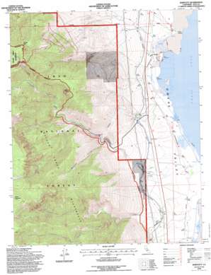
Bartlett Topo Map California
To zoom in, hover over the map of Bartlett
USGS Topo Quad 36118d1 - 1:24,000 scale
| Topo Map Name: | Bartlett |
| USGS Topo Quad ID: | 36118d1 |
| Print Size: | ca. 21 1/4" wide x 27" high |
| Southeast Coordinates: | 36.375° N latitude / 118° W longitude |
| Map Center Coordinates: | 36.4375° N latitude / 118.0625° W longitude |
| U.S. State: | CA |
| Filename: | o36118d1.jpg |
| Download Map JPG Image: | Bartlett topo map 1:24,000 scale |
| Map Type: | Topographic |
| Topo Series: | 7.5´ |
| Map Scale: | 1:24,000 |
| Source of Map Images: | United States Geological Survey (USGS) |
| Alternate Map Versions: |
Bartlett CA 1987, updated 1987 Download PDF Buy paper map Bartlett CA 1987, updated 1991 Download PDF Buy paper map Bartlett CA 1994, updated 1997 Download PDF Buy paper map Bartlett CA 2012 Download PDF Buy paper map Bartlett CA 2015 Download PDF Buy paper map |
| FStopo: | US Forest Service topo Bartlett is available: Download FStopo PDF Download FStopo TIF |
1:24,000 Topo Quads surrounding Bartlett
> Back to 36118a1 at 1:100,000 scale
> Back to 36118a1 at 1:250,000 scale
> Back to U.S. Topo Maps home
Bartlett topo map: Gazetteer
Bartlett: Capes
Point Bartlett elevation 1099m 3605′Bartlett: Populated Places
Bartlett elevation 1103m 3618′Bartlett: Streams
Ash Creek elevation 1097m 3599′Carroll Creek elevation 1096m 3595′
Cottonwood Creek elevation 1098m 3602′
Diaz Creek elevation 1572m 5157′
Little Cottonwood Creek elevation 2237m 7339′
South Fork Ash Creek elevation 1387m 4550′
Bartlett: Summits
Muah Mountain elevation 3339m 10954′Timosea Peak elevation 2591m 8500′
Wonoga Peak elevation 3095m 10154′
Bartlett: Valleys
Slide Canyon elevation 1111m 3645′Wormhole Canyon elevation 1451m 4760′
Bartlett digital topo map on disk
Buy this Bartlett topo map showing relief, roads, GPS coordinates and other geographical features, as a high-resolution digital map file on DVD:
Southern Sierra Nevada, California & Southern Nevada
Buy digital topo maps: Southern Sierra Nevada, California & Southern Nevada


