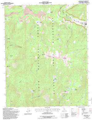
Kern Peak Topo Map California
To zoom in, hover over the map of Kern Peak
USGS Topo Quad 36118c3 - 1:24,000 scale
| Topo Map Name: | Kern Peak |
| USGS Topo Quad ID: | 36118c3 |
| Print Size: | ca. 21 1/4" wide x 27" high |
| Southeast Coordinates: | 36.25° N latitude / 118.25° W longitude |
| Map Center Coordinates: | 36.3125° N latitude / 118.3125° W longitude |
| U.S. State: | CA |
| Filename: | o36118c3.jpg |
| Download Map JPG Image: | Kern Peak topo map 1:24,000 scale |
| Map Type: | Topographic |
| Topo Series: | 7.5´ |
| Map Scale: | 1:24,000 |
| Source of Map Images: | United States Geological Survey (USGS) |
| Alternate Map Versions: |
Kern Peak CA 1988, updated 1988 Download PDF Buy paper map Kern Peak CA 1988, updated 1994 Download PDF Buy paper map Kern Peak CA 1994, updated 1997 Download PDF Buy paper map Kern Peak CA 2012 Download PDF Buy paper map Kern Peak CA 2015 Download PDF Buy paper map |
| FStopo: | US Forest Service topo Kern Peak is available: Download FStopo PDF Download FStopo TIF |
1:24,000 Topo Quads surrounding Kern Peak
> Back to 36118a1 at 1:100,000 scale
> Back to 36118a1 at 1:250,000 scale
> Back to U.S. Topo Maps home
Kern Peak topo map: Gazetteer
Kern Peak: Arches
Natural Bridge elevation 2422m 7946′Kern Peak: Basins
Chinaquapin Basin elevation 2607m 8553′Chinquapin Basin elevation 2607m 8553′
Kern Peak: Flats
Bear Meadow elevation 2970m 9744′Cold Meadows elevation 2808m 9212′
Groundhog Meadows elevation 2679m 8789′
Little Whitney Meadow elevation 2570m 8431′
Ramshaw Meadows elevation 2642m 8667′
Redrocks Meadows elevation 2660m 8727′
Sidehill Meadow elevation 2460m 8070′
Volcano Meadow elevation 2648m 8687′
Kern Peak: Gaps
Right Stringer Pass elevation 2840m 9317′Saddle Camp Pass elevation 2700m 8858′
West Stringer Saddle elevation 3102m 10177′
Kern Peak: Ridges
Kern Ridge elevation 2736m 8976′Toowa Range elevation 3161m 10370′
Kern Peak: Springs
River Spring elevation 2646m 8681′Kern Peak: Streams
Johnson Creek elevation 2571m 8435′Kern Peak Stringer elevation 2654m 8707′
Left Stringer elevation 2525m 8284′
Right Stringer elevation 2635m 8645′
Volcanic Creek elevation 2534m 8313′
West Stringer elevation 2263m 7424′
Kern Peak: Summits
Indian Head elevation 2716m 8910′Kern Peak elevation 3488m 11443′
Overlook Mountain elevation 3108m 10196′
Red Hill elevation 2870m 9416′
Three Rocks elevation 3227m 10587′
Kern Peak digital topo map on disk
Buy this Kern Peak topo map showing relief, roads, GPS coordinates and other geographical features, as a high-resolution digital map file on DVD:
Southern Sierra Nevada, California & Southern Nevada
Buy digital topo maps: Southern Sierra Nevada, California & Southern Nevada


