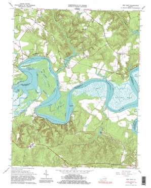
New Kent Topo Map Virginia
To zoom in, hover over the map of New Kent
USGS Topo Quad 37076e8 - 1:24,000 scale
| Topo Map Name: | New Kent |
| USGS Topo Quad ID: | 37076e8 |
| Print Size: | ca. 21 1/4" wide x 27" high |
| Southeast Coordinates: | 37.5° N latitude / 76.875° W longitude |
| Map Center Coordinates: | 37.5625° N latitude / 76.9375° W longitude |
| U.S. State: | VA |
| Filename: | o37076e8.jpg |
| Download Map JPG Image: | New Kent topo map 1:24,000 scale |
| Map Type: | Topographic |
| Topo Series: | 7.5´ |
| Map Scale: | 1:24,000 |
| Source of Map Images: | United States Geological Survey (USGS) |
| Alternate Map Versions: |
New Kent VA 1949 Download PDF Buy paper map New Kent VA 1949 Download PDF Buy paper map New Kent VA 1965, updated 1967 Download PDF Buy paper map New Kent VA 1965, updated 1981 Download PDF Buy paper map New Kent VA 1965, updated 1985 Download PDF Buy paper map New Kent VA 1965, updated 1985 Download PDF Buy paper map New Kent VA 1973, updated 1977 Download PDF Buy paper map New Kent VA 2011 Download PDF Buy paper map New Kent VA 2013 Download PDF Buy paper map New Kent VA 2016 Download PDF Buy paper map |
1:24,000 Topo Quads surrounding New Kent
> Back to 37076e1 at 1:100,000 scale
> Back to 37076a1 at 1:250,000 scale
> Back to U.S. Topo Maps home
New Kent topo map: Gazetteer
New Kent: Capes
Chamberlayne Point elevation 1m 3′New Kent: Channels
Bell Thorofare elevation 7m 22′New Kent: Crossings
Ruffins Ferry (historical) elevation 0m 0′New Kent: Dams
Cooks Mill Dam elevation 6m 19′Fern Dam elevation 18m 59′
Harrell Dam elevation 3m 9′
Johnsons Dam elevation 5m 16′
Old Town Farm Dam elevation 1m 3′
New Kent: Guts
Cumberland Thorofare elevation 1m 3′New Kent: Islands
Chandlers Island elevation 0m 0′West Island elevation 3m 9′
New Kent: Populated Places
Cohoke elevation 11m 36′Cumberland Landing elevation 36m 118′
Cumnberland (historical) elevation 6m 19′
Gordon Landing elevation 1m 3′
Johnson Landing elevation 14m 45′
Lanesville elevation 34m 111′
New Kent elevation 44m 144′
Riverview Landing elevation 12m 39′
White Oak Landing elevation 9m 29′
New Kent: Post Offices
New Kent Post Office elevation 37m 121′New Kent: Reservoirs
Cohoke Millpond elevation 2m 6′Cooks Millpond elevation 6m 19′
Fern Lake elevation 18m 59′
Harrell Pond elevation 3m 9′
Old Town Farm Pond elevation 1m 3′
New Kent: Streams
Big Creek elevation 1m 3′Bull Swamp elevation 10m 32′
Cohoke Creek elevation 0m 0′
Cohoke Mill Creek elevation 5m 16′
Holts Creek elevation 0m 0′
Mill Creek elevation 0m 0′
Turkey Creek elevation 1m 3′
Williams Creek elevation 4m 13′
New Kent: Swamps
Cohoke Marsh elevation 7m 22′Cousiac Marsh elevation 8m 26′
Lilly Point Marsh elevation 1m 3′
Sweet Hall Marsh elevation 4m 13′
New Kent digital topo map on disk
Buy this New Kent topo map showing relief, roads, GPS coordinates and other geographical features, as a high-resolution digital map file on DVD:
Atlantic Coast (NY, NJ, PA, DE, MD, VA, NC)
Buy digital topo maps: Atlantic Coast (NY, NJ, PA, DE, MD, VA, NC)


