Model Topo Map Colorado
To zoom in, hover over the map of Model
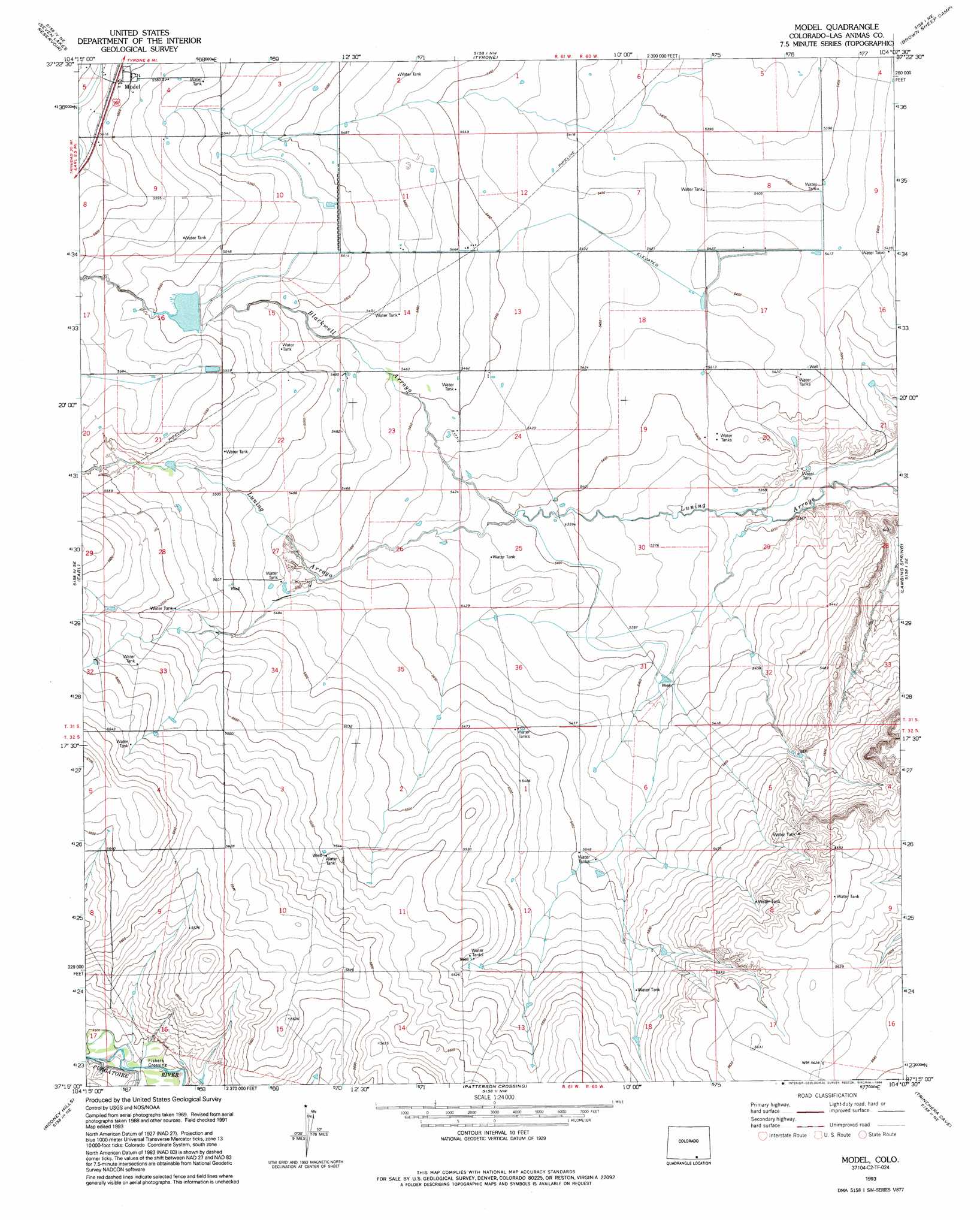
USGS Topo Quad 37104c2 - 1:24,000 scale
| Topo Map Name: | Model |
| USGS Topo Quad ID: | 37104c2 |
| Print Size: | ca. 21 1/4" wide x 27" high |
| Southeast Coordinates: | 37.25° N latitude / 104.125° W longitude |
| Map Center Coordinates: | 37.3125° N latitude / 104.1875° W longitude |
| U.S. State: | CO |
| Filename: | o37104c2.jpg |
| Download Map JPG Image: | Model topo map 1:24,000 scale |
| Map Type: | Topographic |
| Topo Series: | 7.5´ |
| Map Scale: | 1:24,000 |
| Source of Map Images: | United States Geological Survey (USGS) |
| Alternate Map Versions: |
Model CO 1971, updated 1974 Download PDF Buy paper map Model CO 1971, updated 1974 Download PDF Buy paper map Model CO 1993, updated 1994 Download PDF Buy paper map Model CO 2010 Download PDF Buy paper map Model CO 2013 Download PDF Buy paper map Model CO 2016 Download PDF Buy paper map |
1:24,000 Topo Quads surrounding Model
Little Dome |
Hidden Valley Ranch |
Bates Lake |
Thatcher |
Lockwood Arroyo |
Vega Corral |
Seven Lakes Reservoir |
Tyrone |
Brown Sheep Camp |
Rock Crossing |
Hoehne |
Earl |
Model |
Lambing Spring |
Painted Canyon |
Trinidad East |
Mooney Hills |
Patterson Crossing |
Trinchera Cave |
Trementina Canyon |
Fishers Peak |
Barela |
Abeyta |
Trinchera |
Branson |
> Back to 37104a1 at 1:100,000 scale
> Back to 37104a1 at 1:250,000 scale
> Back to U.S. Topo Maps home
Model topo map: Gazetteer
Model: Dams
Hignio Cordova Number 1 Dam elevation 1689m 5541′Model: Populated Places
Model elevation 1712m 5616′Model: Reservoirs
Hignio Cordova Reservoir Number 1 elevation 1689m 5541′Model: Streams
Blackwell Arroyo elevation 1647m 5403′Model digital topo map on disk
Buy this Model topo map showing relief, roads, GPS coordinates and other geographical features, as a high-resolution digital map file on DVD: