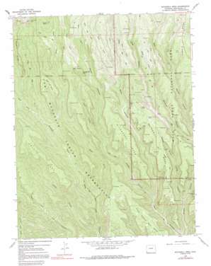
Wetherill Mesa Topo Map Colorado
To zoom in, hover over the map of Wetherill Mesa
USGS Topo Quad 37108b5 - 1:24,000 scale
| Topo Map Name: | Wetherill Mesa |
| USGS Topo Quad ID: | 37108b5 |
| Print Size: | ca. 21 1/4" wide x 27" high |
| Southeast Coordinates: | 37.125° N latitude / 108.5° W longitude |
| Map Center Coordinates: | 37.1875° N latitude / 108.5625° W longitude |
| U.S. State: | CO |
| Filename: | o37108b5.jpg |
| Download Map JPG Image: | Wetherill Mesa topo map 1:24,000 scale |
| Map Type: | Topographic |
| Topo Series: | 7.5´ |
| Map Scale: | 1:24,000 |
| Source of Map Images: | United States Geological Survey (USGS) |
| Alternate Map Versions: |
Wetherill Mesa CO 1966, updated 1969 Download PDF Buy paper map Wetherill Mesa CO 1966, updated 1969 Download PDF Buy paper map Wetherill Mesa CO 1966, updated 1986 Download PDF Buy paper map Wetherill Mesa CO 1966, updated 1991 Download PDF Buy paper map Wetherill Mesa CO 2010 Download PDF Buy paper map Wetherill Mesa CO 2013 Download PDF Buy paper map Wetherill Mesa CO 2016 Download PDF Buy paper map |
1:24,000 Topo Quads surrounding Wetherill Mesa
> Back to 37108a1 at 1:100,000 scale
> Back to 37108a1 at 1:250,000 scale
> Back to U.S. Topo Maps home
Wetherill Mesa topo map: Gazetteer
Wetherill Mesa: Airports
Mesa Verde Heliport elevation 2406m 7893′Wetherill Mesa: Cliffs
Pictograph Point elevation 2259m 7411′Wetherill Mesa: Mines
Jackson Mine elevation 2220m 7283′Mesa Verde Mine elevation 2230m 7316′
Wetherill Mesa: Populated Places
Badger House Community (historical) elevation 2172m 7125′Echo House (historical) elevation 2038m 6686′
Wetherill Mesa: Ridges
Mesa Verde elevation 2062m 6765′Rocky Ridge elevation 2308m 7572′
Wetherill Mesa: Springs
Horse Springs elevation 2258m 7408′Rock Springs elevation 2258m 7408′
Wetherill Mesa: Summits
Basin Butte elevation 2169m 7116′Coyote Mesa elevation 2272m 7454′
Eagle Eye Mesa elevation 2142m 7027′
East Eagle Eye Mesa elevation 2063m 6768′
East Ute Mesa elevation 2318m 7604′
Pulpit Rock elevation 2397m 7864′
West Ute Mesa elevation 2163m 7096′
Wetherill Mesa elevation 2215m 7267′
Wildhorse Mesa elevation 2263m 7424′
Wetherill Mesa: Trails
Pinyon Pack Trail elevation 2063m 6768′Rock Springs Trail elevation 2091m 6860′
Trail Cross Trail elevation 2300m 7545′
Ute Springs Trail elevation 1956m 6417′
Ute Trail elevation 2334m 7657′
Wetherill Mesa: Valleys
Bobcat Canyon elevation 1911m 6269′Coyote Canyon elevation 1781m 5843′
East Fork Horse Canyon elevation 2125m 6971′
East Fork Navajo Canyon elevation 2055m 6742′
East Fork Rock Canyon elevation 2097m 6879′
East Fork Ute Canyon elevation 1814m 5951′
East Fork Wickiup Canyon elevation 2125m 6971′
Horse Canyon elevation 1823m 5980′
Long Canyon elevation 1811m 5941′
Middle Fork Ute Canyon elevation 1814m 5951′
Pony Canyon elevation 1974m 6476′
West Fork Horse Canyon elevation 2125m 6971′
West Fork Long Canyon elevation 2121m 6958′
West Fork Middle Fork Ute Canyon elevation 1976m 6482′
West Fork Navajo Canyon elevation 2055m 6742′
West Fork Rock Canyon elevation 2097m 6879′
West Fork Wickiup Canyon elevation 2125m 6971′
Wickiup Canyon elevation 1927m 6322′
Wetherill Mesa digital topo map on disk
Buy this Wetherill Mesa topo map showing relief, roads, GPS coordinates and other geographical features, as a high-resolution digital map file on DVD:


