Trail Canyon Topo Map Colorado
To zoom in, hover over the map of Trail Canyon
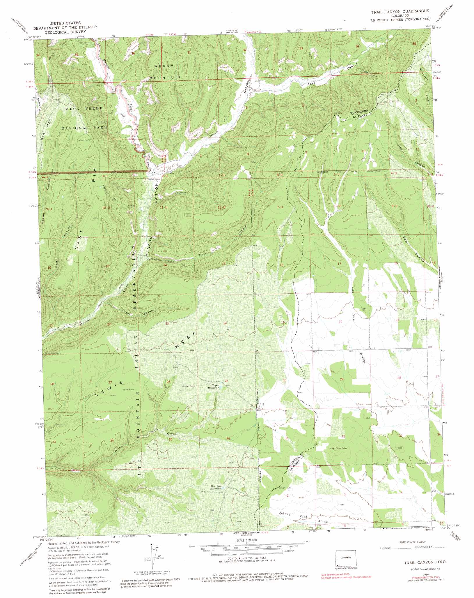
USGS Topo Quad 37108b3 - 1:24,000 scale
| Topo Map Name: | Trail Canyon |
| USGS Topo Quad ID: | 37108b3 |
| Print Size: | ca. 21 1/4" wide x 27" high |
| Southeast Coordinates: | 37.125° N latitude / 108.25° W longitude |
| Map Center Coordinates: | 37.1875° N latitude / 108.3125° W longitude |
| U.S. State: | CO |
| Filename: | o37108b3.jpg |
| Download Map JPG Image: | Trail Canyon topo map 1:24,000 scale |
| Map Type: | Topographic |
| Topo Series: | 7.5´ |
| Map Scale: | 1:24,000 |
| Source of Map Images: | United States Geological Survey (USGS) |
| Alternate Map Versions: |
Trail Canyon CO 1966, updated 1969 Download PDF Buy paper map Trail Canyon CO 1966, updated 1969 Download PDF Buy paper map Trail Canyon CO 1966, updated 1980 Download PDF Buy paper map Trail Canyon CO 2010 Download PDF Buy paper map Trail Canyon CO 2013 Download PDF Buy paper map Trail Canyon CO 2016 Download PDF Buy paper map |
1:24,000 Topo Quads surrounding Trail Canyon
Dolores West |
Dolores East |
Millwood |
Rampart Hills |
La Plata |
Cortez |
Point Lookout |
Mancos |
Thompson Park |
Hesperus |
Wetherill Mesa |
Moccasin Mesa |
Trail Canyon |
Mormon Reservoir |
Kline |
Moqui Canyon |
Greasewood Canyon |
Red Horse Gulch |
Redmesa |
Pinkerton Mesa |
Palmer Mesa |
Heifer Point |
Purgatory Canyon |
La Plata |
Abode Downs Ranch |
> Back to 37108a1 at 1:100,000 scale
> Back to 37108a1 at 1:250,000 scale
> Back to U.S. Topo Maps home
Trail Canyon topo map: Gazetteer
Trail Canyon: Reservoirs
Harrison Reservoir elevation 2057m 6748′Upper Reservoir elevation 2086m 6843′
Trail Canyon: Summits
Big Mesa elevation 2384m 7821′Lewis Mesa elevation 2261m 7417′
Trail Canyon: Trails
Wheeler Trail elevation 2213m 7260′Whites Trail elevation 2002m 6568′
Trail Canyon: Valleys
East Canyon elevation 1954m 6410′Horse Canyon elevation 1850m 6069′
Swift Canyon elevation 1843m 6046′
Trail Canyon elevation 1868m 6128′
Weber Canyon elevation 1882m 6174′
Trail Canyon digital topo map on disk
Buy this Trail Canyon topo map showing relief, roads, GPS coordinates and other geographical features, as a high-resolution digital map file on DVD: