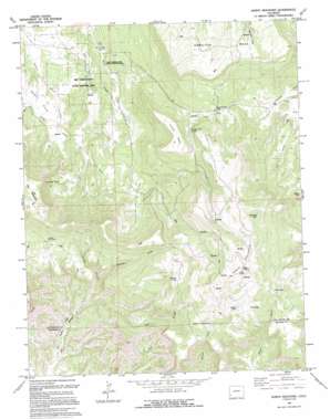
North Mountain Topo Map Colorado
To zoom in, hover over the map of North Mountain
USGS Topo Quad 37108h4 - 1:24,000 scale
| Topo Map Name: | North Mountain |
| USGS Topo Quad ID: | 37108h4 |
| Print Size: | ca. 21 1/4" wide x 27" high |
| Southeast Coordinates: | 37.875° N latitude / 108.375° W longitude |
| Map Center Coordinates: | 37.9375° N latitude / 108.4375° W longitude |
| U.S. State: | CO |
| Filename: | o37108h4.jpg |
| Download Map JPG Image: | North Mountain topo map 1:24,000 scale |
| Map Type: | Topographic |
| Topo Series: | 7.5´ |
| Map Scale: | 1:24,000 |
| Source of Map Images: | United States Geological Survey (USGS) |
| Alternate Map Versions: |
North Mountain CO 1964, updated 1968 Download PDF Buy paper map North Mountain CO 1964, updated 1968 Download PDF Buy paper map North Mountain CO 1994, updated 1994 Download PDF Buy paper map North Mountain CO 2010 Download PDF Buy paper map North Mountain CO 2013 Download PDF Buy paper map North Mountain CO 2016 Download PDF Buy paper map |
1:24,000 Topo Quads surrounding North Mountain
> Back to 37108e1 at 1:100,000 scale
> Back to 37108a1 at 1:250,000 scale
> Back to U.S. Topo Maps home
North Mountain topo map: Gazetteer
North Mountain: Canals
Desert Claim Ditch elevation 2270m 7447′North Mountain: Cliffs
Lavender Point elevation 2654m 8707′North Mountain: Flats
Desert Claim elevation 2164m 7099′North Mountain: Gaps
Sandys Fort Pass elevation 2534m 8313′North Mountain: Lakes
Bull Lake elevation 2701m 8861′Galloway Lake elevation 2907m 9537′
Jensen Lake elevation 2715m 8907′
Mud Lake elevation 2705m 8874′
Spencer Lake elevation 2662m 8733′
North Mountain: Springs
Fall Camp Spring elevation 2231m 7319′Sandys Fort Spring elevation 2551m 8369′
North Mountain: Summits
Hamilton Mesa elevation 2735m 8973′Island Mesa elevation 2689m 8822′
North Mountain elevation 3014m 9888′
The Butterfly elevation 2715m 8907′
North Mountain: Valleys
Dawson Draw elevation 2312m 7585′Knight Canyon elevation 2227m 7306′
North Mountain digital topo map on disk
Buy this North Mountain topo map showing relief, roads, GPS coordinates and other geographical features, as a high-resolution digital map file on DVD:


