Triangle Mountain Topo Map Nevada
To zoom in, hover over the map of Triangle Mountain
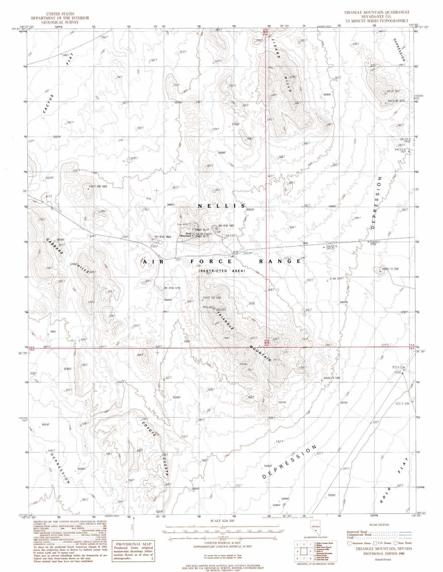
USGS Topo Quad 37116e5 - 1:24,000 scale
| Topo Map Name: | Triangle Mountain |
| USGS Topo Quad ID: | 37116e5 |
| Print Size: | ca. 21 1/4" wide x 27" high |
| Southeast Coordinates: | 37.5° N latitude / 116.5° W longitude |
| Map Center Coordinates: | 37.5625° N latitude / 116.5625° W longitude |
| U.S. State: | NV |
| Filename: | o37116e5.jpg |
| Download Map JPG Image: | Triangle Mountain topo map 1:24,000 scale |
| Map Type: | Topographic |
| Topo Series: | 7.5´ |
| Map Scale: | 1:24,000 |
| Source of Map Images: | United States Geological Survey (USGS) |
| Alternate Map Versions: |
Triangle Mountain NV 1988, updated 1988 Download PDF Buy paper map |
1:24,000 Topo Quads surrounding Triangle Mountain
East Of Cactus Peak |
Stinking Spring Sw |
Breen Creek |
Kawich Peak Sw |
Georges Well |
Cactus Spring |
Roller Coaster Knob |
Mellan |
Wild Horse Ranch |
Cedar Pass |
Civet Cat Cave |
Trappman Hills |
Triangle Mountain |
West Of Quartzite Mountain |
Quartzite Mountain |
Tolicha Peak Ne |
Mount Helen |
Gold Flat West |
Gold Flat East |
Apache Tear Canyon |
Tolicha Peak |
Black Mountain |
Trail Ridge |
Silent Butte |
Dead Horse Flat |
> Back to 37116e1 at 1:100,000 scale
> Back to 37116a1 at 1:250,000 scale
> Back to U.S. Topo Maps home
Triangle Mountain topo map: Gazetteer
Triangle Mountain: Ridges
Coyote Cuesta elevation 1749m 5738′Triangle Mountain: Summits
Gabbard Hills elevation 1776m 5826′Gold Mountain elevation 1838m 6030′
Lizard Hills elevation 1891m 6204′
Triangle Mountain elevation 1891m 6204′
Triangle Mountain digital topo map on disk
Buy this Triangle Mountain topo map showing relief, roads, GPS coordinates and other geographical features, as a high-resolution digital map file on DVD: