Mount Stakes Topo Map California
To zoom in, hover over the map of Mount Stakes
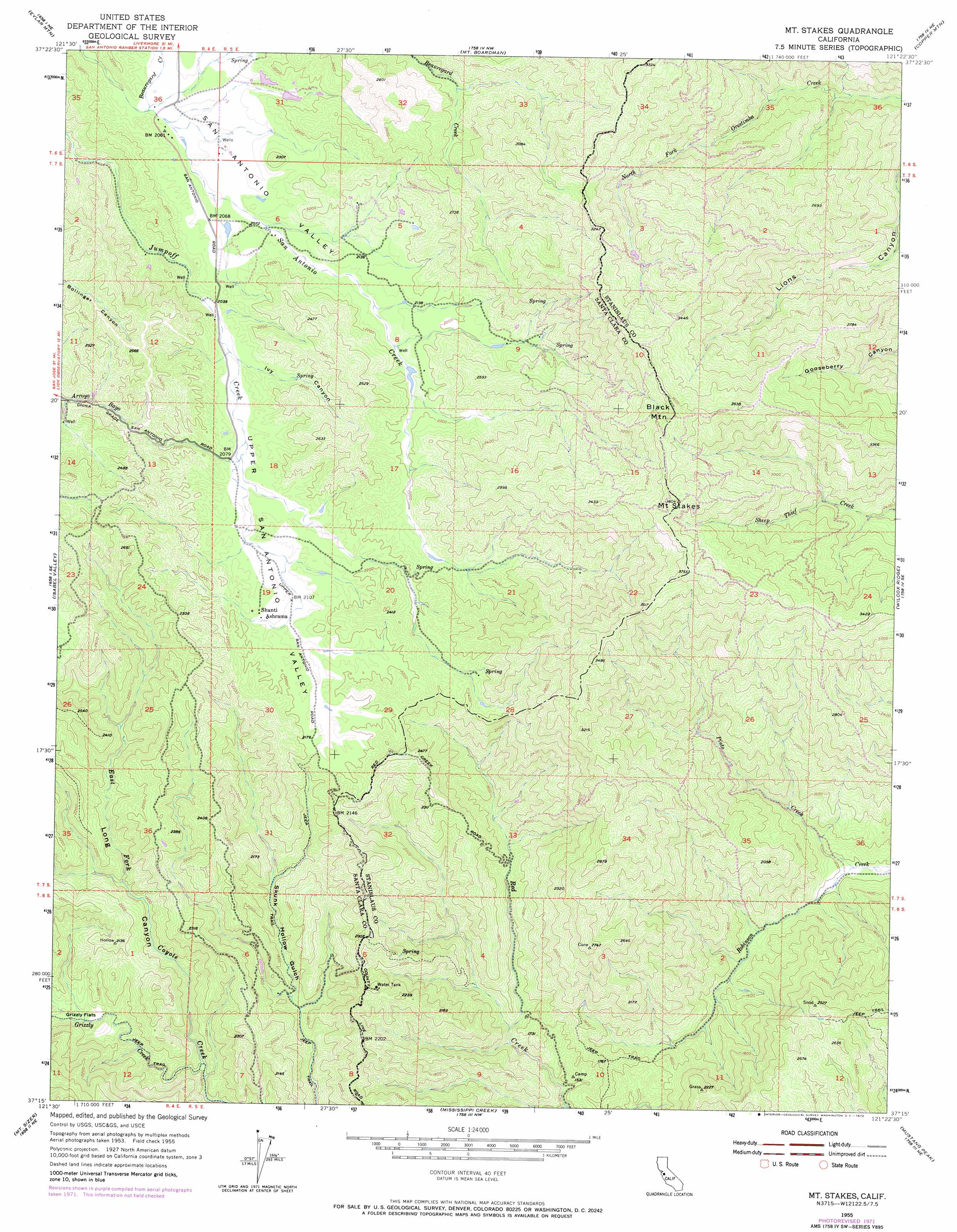
USGS Topo Quad 37121c4 - 1:24,000 scale
| Topo Map Name: | Mount Stakes |
| USGS Topo Quad ID: | 37121c4 |
| Print Size: | ca. 21 1/4" wide x 27" high |
| Southeast Coordinates: | 37.25° N latitude / 121.375° W longitude |
| Map Center Coordinates: | 37.3125° N latitude / 121.4375° W longitude |
| U.S. State: | CA |
| Filename: | o37121c4.jpg |
| Download Map JPG Image: | Mount Stakes topo map 1:24,000 scale |
| Map Type: | Topographic |
| Topo Series: | 7.5´ |
| Map Scale: | 1:24,000 |
| Source of Map Images: | United States Geological Survey (USGS) |
| Alternate Map Versions: |
Mt. Stakes CA 1955, updated 1957 Download PDF Buy paper map Mt. Stakes CA 1955, updated 1963 Download PDF Buy paper map Mt. Stakes CA 1955, updated 1972 Download PDF Buy paper map Mount Stakes CA 2012 Download PDF Buy paper map Mount Stakes CA 2015 Download PDF Buy paper map |
1:24,000 Topo Quads surrounding Mount Stakes
Mendenhall Springs |
Cedar Mountain |
Lone Tree Creek |
Solyo |
Westley |
Mount Day |
Eylar Mountain |
Mount Boardman |
Copper Mountain |
Patterson |
Lick Observatory |
Isabel Valley |
Mount Stakes |
Wilcox Ridge |
Orestimba Peak |
Morgan Hill |
Mount Sizer |
Mississippi Creek |
Mustang Peak |
Crevison Peak |
Mount Madonna |
Gilroy |
Gilroy Hot Springs |
Pacheco Peak |
Pacheco Pass |
> Back to 37121a1 at 1:100,000 scale
> Back to 37120a1 at 1:250,000 scale
> Back to U.S. Topo Maps home
Mount Stakes topo map: Gazetteer
Mount Stakes: Populated Places
Ashrama elevation 647m 2122′Mount Stakes: Streams
Beauregard Creek elevation 621m 2037′Grizzly Creek elevation 477m 1564′
Pinto Creek elevation 357m 1171′
Mount Stakes: Summits
Black Mountain elevation 1144m 3753′Mount Stakes elevation 1157m 3795′
Mount Stakes: Valleys
Ivy Canyon elevation 626m 2053′Long Canyon elevation 487m 1597′
San Antonio Valley elevation 647m 2122′
Skunk Hollow Gulch elevation 511m 1676′
Upper San Antonio Valley elevation 622m 2040′
Mount Stakes digital topo map on disk
Buy this Mount Stakes topo map showing relief, roads, GPS coordinates and other geographical features, as a high-resolution digital map file on DVD: