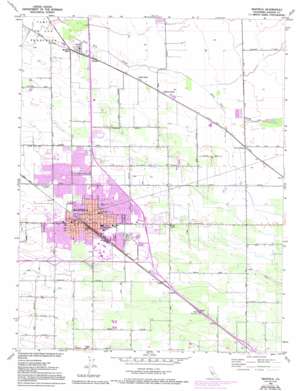
Manteca Topo Map California
To zoom in, hover over the map of Manteca
USGS Topo Quad 37121g2 - 1:24,000 scale
| Topo Map Name: | Manteca |
| USGS Topo Quad ID: | 37121g2 |
| Print Size: | ca. 21 1/4" wide x 27" high |
| Southeast Coordinates: | 37.75° N latitude / 121.125° W longitude |
| Map Center Coordinates: | 37.8125° N latitude / 121.1875° W longitude |
| U.S. State: | CA |
| Filename: | o37121g2.jpg |
| Download Map JPG Image: | Manteca topo map 1:24,000 scale |
| Map Type: | Topographic |
| Topo Series: | 7.5´ |
| Map Scale: | 1:24,000 |
| Source of Map Images: | United States Geological Survey (USGS) |
| Alternate Map Versions: |
Manteca CA 1952, updated 1953 Download PDF Buy paper map Manteca CA 1952, updated 1969 Download PDF Buy paper map Manteca CA 1952, updated 1977 Download PDF Buy paper map Manteca CA 1952, updated 1987 Download PDF Buy paper map Manteca CA 1952, updated 1994 Download PDF Buy paper map Manteca CA 1952, updated 1994 Download PDF Buy paper map Manteca CA 2012 Download PDF Buy paper map Manteca CA 2015 Download PDF Buy paper map |
1:24,000 Topo Quads surrounding Manteca
> Back to 37121e1 at 1:100,000 scale
> Back to 37120a1 at 1:250,000 scale
> Back to U.S. Topo Maps home
Manteca topo map: Gazetteer
Manteca: Parks
Baccileri Park elevation 11m 36′Baymeadows Park elevation 11m 36′
Button Estates Park elevation 14m 45′
Colony Park elevation 10m 32′
Cotta Way Park elevation 14m 45′
Crestwood Park elevation 11m 36′
Doxey Park elevation 10m 32′
Franciscan Park elevation 10m 32′
Gresytone Park elevation 10m 32′
Gus Schmiedt Stadium elevation 12m 39′
Hildebrand Park elevation 11m 36′
Lincoln Park elevation 12m 39′
Martin Park elevation 10m 32′
Mayors Park elevation 10m 32′
North Gate Park elevation 10m 32′
Quail Ridge Park elevation 11m 36′
Raymus Village Park elevation 12m 39′
Saint Francis Park elevation 10m 32′
Sequoia Park elevation 11m 36′
Shasta Park elevation 13m 42′
South Side Park elevation 10m 32′
Springtime Park elevation 11m 36′
Union Park elevation 10m 32′
Union Road Park elevation 9m 29′
Wilson Park elevation 11m 36′
Woodward Park elevation 11m 36′
Yosemite Village Park elevation 10m 32′
Manteca: Populated Places
Bardi elevation 16m 52′Calla elevation 14m 45′
Five Corners elevation 16m 52′
Manteca elevation 11m 36′
Manteca Junction elevation 8m 26′
Summer Home elevation 13m 42′
Turner elevation 10m 32′
Manteca: Post Offices
Manteca Post Office elevation 11m 36′Manteca digital topo map on disk
Buy this Manteca topo map showing relief, roads, GPS coordinates and other geographical features, as a high-resolution digital map file on DVD:


