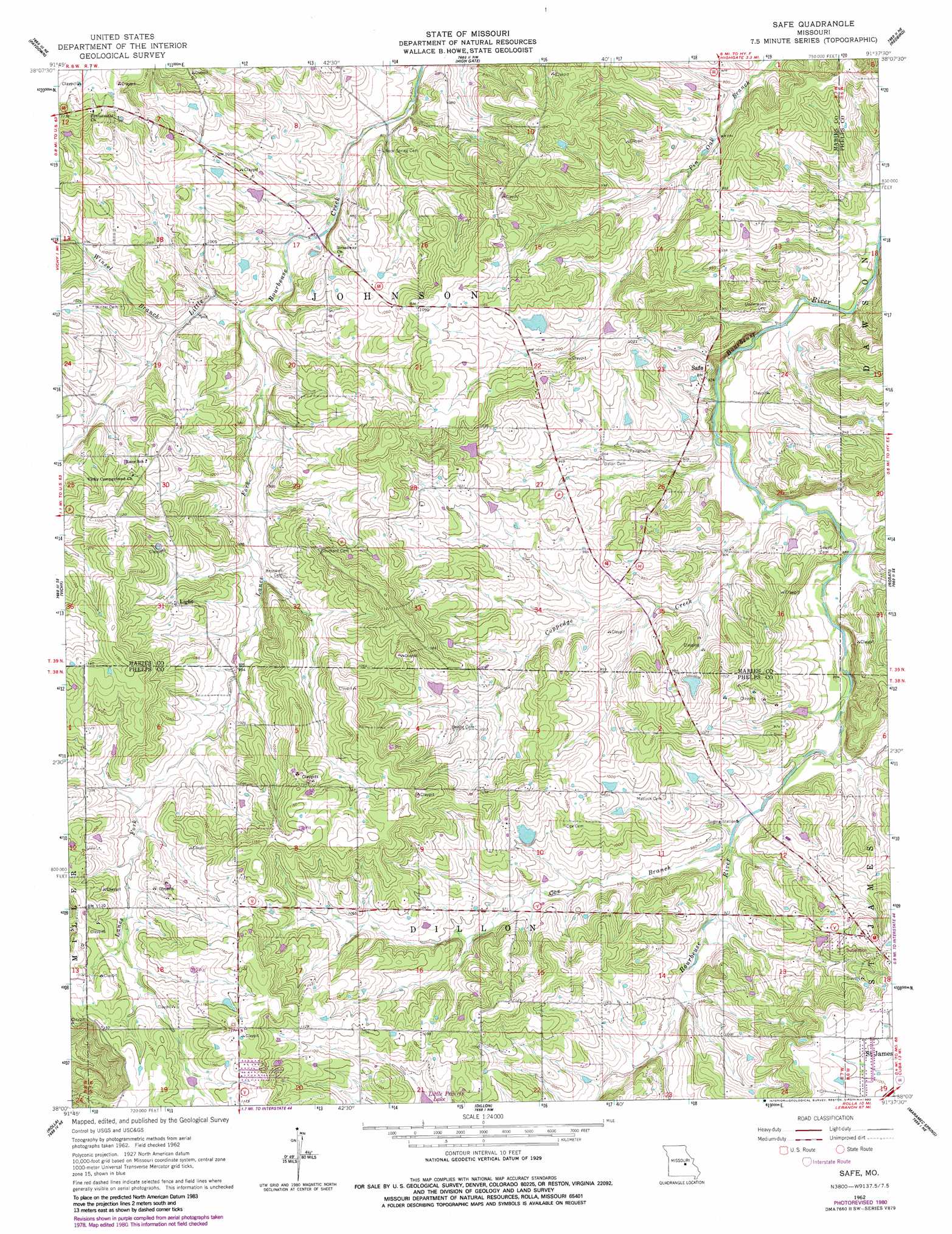
Safe Topo Map Missouri
To zoom in, hover over the map of Safe
USGS Topo Quad 38091a6 - 1:24,000 scale
| Topo Map Name: | Safe |
| USGS Topo Quad ID: | 38091a6 |
| Print Size: | ca. 21 1/4" wide x 27" high |
| Southeast Coordinates: | 38° N latitude / 91.625° W longitude |
| Map Center Coordinates: | 38.0625° N latitude / 91.6875° W longitude |
| U.S. State: | MO |
| Filename: | o38091a6.jpg |
| Download Map JPG Image: | Safe topo map 1:24,000 scale |
| Map Type: | Topographic |
| Topo Series: | 7.5´ |
| Map Scale: | 1:24,000 |
| Source of Map Images: | United States Geological Survey (USGS) |
| Alternate Map Versions: |
Safe MO 1962, updated 1964 Download PDF Buy paper map Safe MO 1962, updated 1980 Download PDF Buy paper map Safe MO 2012 Download PDF Buy paper map Safe MO 2015 Download PDF Buy paper map |
1:24,000 Topo Quads surrounding Safe
Freeburg |
Summerfield |
Belle |
Owensville West |
Owensville East |
Vienna |
Paydown |
High Gate |
Redbird |
Oak Hill |
Nagogami Lodge |
Vichy |
Safe |
Rosati |
Cuba |
Newburg |
Rolla |
Dillon |
Maramec Spring |
Indian Springs |
Kaintuck Hollow |
Yancy Mills |
Lecoma |
Seaton |
Cook Station |
> Back to 38091a1 at 1:100,000 scale
> Back to 38090a1 at 1:250,000 scale
> Back to U.S. Topo Maps home
Safe topo map: Gazetteer
Safe: Areas
Northern Ozark Border elevation 272m 892′Safe: Dams
Amos Lake Dam elevation 307m 1007′Dillon Lake Dam elevation 313m 1026′
Essie Dam elevation 289m 948′
Safe: Populated Places
Broadway (historical) elevation 296m 971′Safe elevation 286m 938′
Safe: Post Offices
Broadway Post Office (historical) elevation 296m 971′Safe: Reservoirs
Amos Lake elevation 307m 1007′I-38 Lake elevation 280m 918′
Vernon Dillon Lake elevation 313m 1026′
Safe: Streams
Bailey Creek elevation 282m 925′Coppedge Creek elevation 262m 859′
Cox Branch elevation 277m 908′
Robinson Creek elevation 271m 889′
Winsel Branch elevation 287m 941′
Safe digital topo map on disk
Buy this Safe topo map showing relief, roads, GPS coordinates and other geographical features, as a high-resolution digital map file on DVD: