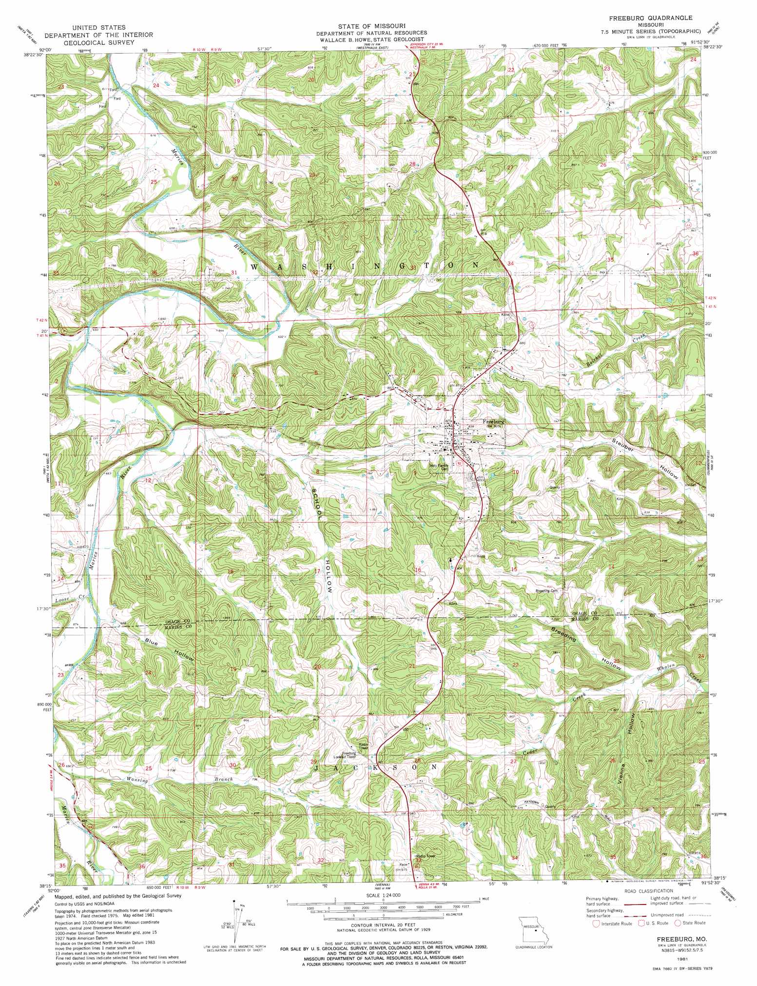
Freeburg Topo Map Missouri
To zoom in, hover over the map of Freeburg
USGS Topo Quad 38091c8 - 1:24,000 scale
| Topo Map Name: | Freeburg |
| USGS Topo Quad ID: | 38091c8 |
| Print Size: | ca. 21 1/4" wide x 27" high |
| Southeast Coordinates: | 38.25° N latitude / 91.875° W longitude |
| Map Center Coordinates: | 38.3125° N latitude / 91.9375° W longitude |
| U.S. State: | MO |
| Filename: | o38091c8.jpg |
| Download Map JPG Image: | Freeburg topo map 1:24,000 scale |
| Map Type: | Topographic |
| Topo Series: | 7.5´ |
| Map Scale: | 1:24,000 |
| Source of Map Images: | United States Geological Survey (USGS) |
| Alternate Map Versions: |
Freeburg MO 1981, updated 1981 Download PDF Buy paper map Freeburg MO 2012 Download PDF Buy paper map Freeburg MO 2015 Download PDF Buy paper map |
1:24,000 Topo Quads surrounding Freeburg
Jefferson City |
Osage City |
Loose Creek |
Luystown |
Fredericksburg |
Wardsville |
Westphalia West |
Westphalia East |
Linn |
Cooper Hill |
Meta |
Argyle |
Freeburg |
Summerfield |
Belle |
Van Cleve |
Brinktown |
Vienna |
Paydown |
High Gate |
Brays |
Big Bend |
Nagogami Lodge |
Vichy |
Safe |
> Back to 38091a1 at 1:100,000 scale
> Back to 38090a1 at 1:250,000 scale
> Back to U.S. Topo Maps home
Freeburg topo map: Gazetteer
Freeburg: Dams
Welschmeyers Dam elevation 233m 764′Freeburg: Populated Places
Freeburg elevation 275m 902′Freeburg: Reservoirs
Welschmeyers Lake elevation 233m 764′Freeburg: Streams
Cedar Creek elevation 189m 620′Loose Creek elevation 201m 659′
Wansing Branch elevation 207m 679′
Freeburg: Valleys
Blue Hollow elevation 209m 685′Breeding Hollow elevation 186m 610′
School Hollow elevation 202m 662′
Vienna Hollow elevation 186m 610′
Freeburg digital topo map on disk
Buy this Freeburg topo map showing relief, roads, GPS coordinates and other geographical features, as a high-resolution digital map file on DVD: