Spring Bluff Topo Map Missouri
To zoom in, hover over the map of Spring Bluff
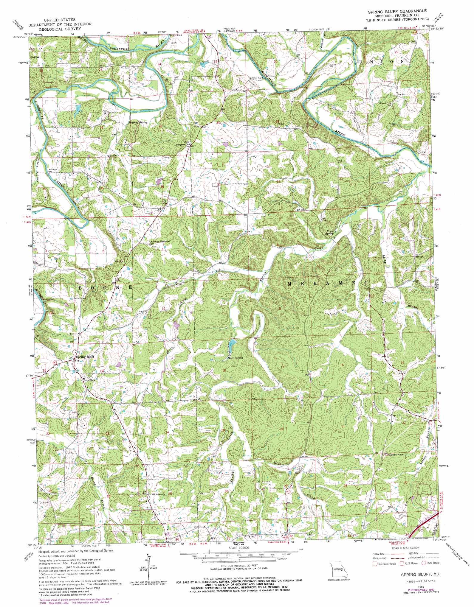
USGS Topo Quad 38091c2 - 1:24,000 scale
| Topo Map Name: | Spring Bluff |
| USGS Topo Quad ID: | 38091c2 |
| Print Size: | ca. 21 1/4" wide x 27" high |
| Southeast Coordinates: | 38.25° N latitude / 91.125° W longitude |
| Map Center Coordinates: | 38.3125° N latitude / 91.1875° W longitude |
| U.S. State: | MO |
| Filename: | o38091c2.jpg |
| Download Map JPG Image: | Spring Bluff topo map 1:24,000 scale |
| Map Type: | Topographic |
| Topo Series: | 7.5´ |
| Map Scale: | 1:24,000 |
| Source of Map Images: | United States Geological Survey (USGS) |
| Alternate Map Versions: |
Spring Bluff MO 1966, updated 1967 Download PDF Buy paper map Spring Bluff MO 1966, updated 1977 Download PDF Buy paper map Spring Bluff MO 1966, updated 1980 Download PDF Buy paper map Spring Bluff MO 2012 Download PDF Buy paper map Spring Bluff MO 2015 Download PDF Buy paper map |
1:24,000 Topo Quads surrounding Spring Bluff
Swiss |
Dissen |
New Haven |
Washington West |
Washington East |
Rosebud |
Gerald |
Leslie |
Union |
Moselle |
Owensville East |
Strain |
Spring Bluff |
Stanton |
Saint Clair |
Oak Hill |
Argo |
Sullivan |
Meramec State Park |
Cyclone Hollow |
Cuba |
Leasburg |
Onondaga Cave |
Anthonies Mill |
Ebo |
> Back to 38091a1 at 1:100,000 scale
> Back to 38090a1 at 1:250,000 scale
> Back to U.S. Topo Maps home
Spring Bluff topo map: Gazetteer
Spring Bluff: Airports
Evergreen Landing Field (historical) elevation 257m 843′Spring Bluff: Dams
Duncan Lake Dam elevation 212m 695′Friedel Lake Dam elevation 197m 646′
Koedding Lake Dam elevation 218m 715′
Pieper Lake Dam elevation 226m 741′
Schroepfer Lake Dam elevation 201m 659′
Spring Bluff: Mines
Rueppele Mine elevation 256m 839′Spring Bluff: Populated Places
Laubinger Ford elevation 189m 620′Peters Ford elevation 188m 616′
Schmitt Ford elevation 177m 580′
Spring Bluff elevation 276m 905′
Spring Bluff: Reservoirs
Lawrence Schroepfer Reservoir elevation 201m 659′Spring Bluff: Springs
Kratz Spring elevation 184m 603′Roaring Spring elevation 190m 623′
Sour Spring elevation 218m 715′
Spring Bluff: Streams
Ausbin Creek elevation 188m 616′Big Creek elevation 188m 616′
Boehms Creek elevation 177m 580′
Little Spring Creek elevation 189m 620′
Lollar Branch elevation 208m 682′
Spring Creek elevation 176m 577′
Winsel Creek elevation 224m 734′
Spring Bluff digital topo map on disk
Buy this Spring Bluff topo map showing relief, roads, GPS coordinates and other geographical features, as a high-resolution digital map file on DVD: