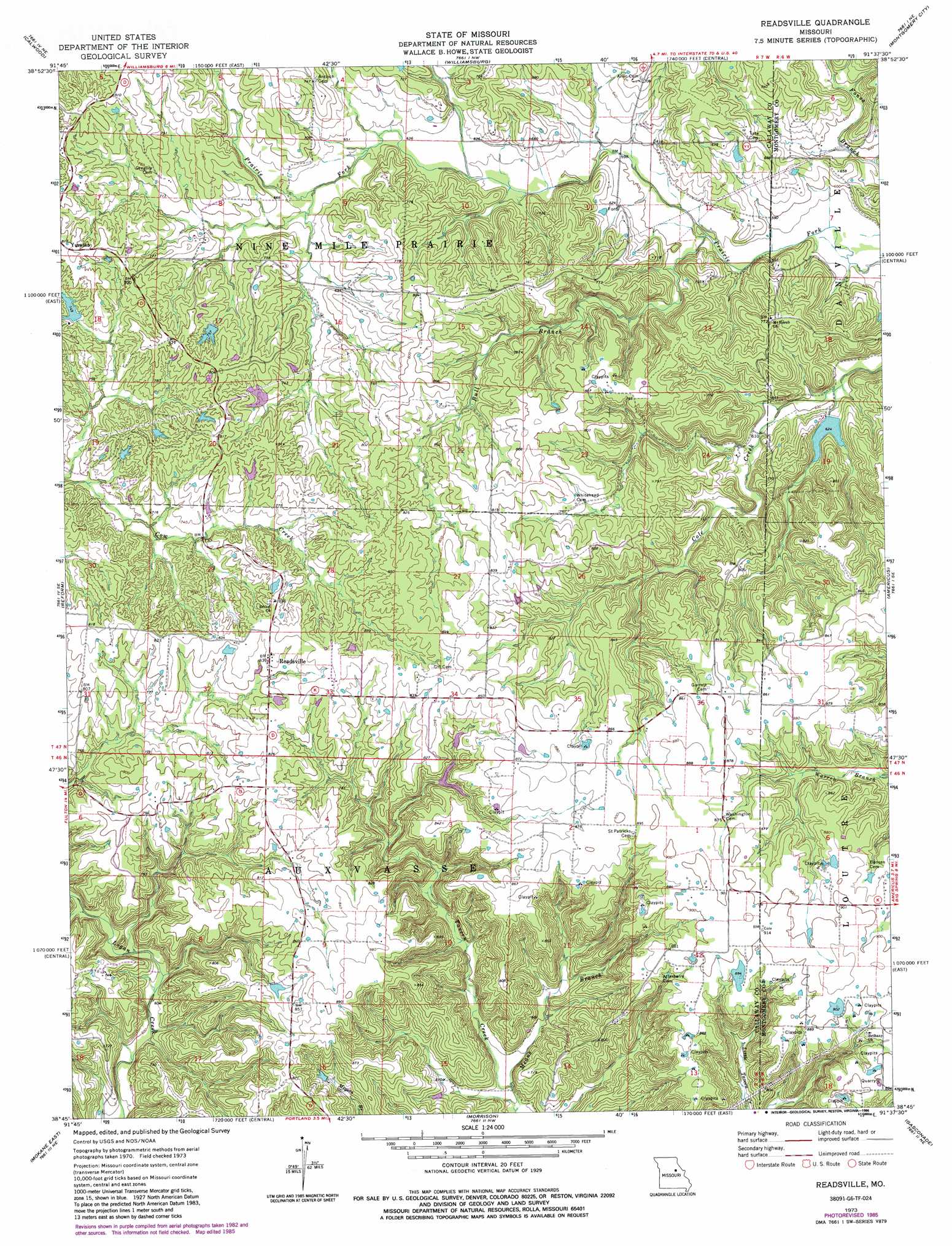
Readsville Topo Map Missouri
To zoom in, hover over the map of Readsville
USGS Topo Quad 38091g6 - 1:24,000 scale
| Topo Map Name: | Readsville |
| USGS Topo Quad ID: | 38091g6 |
| Print Size: | ca. 21 1/4" wide x 27" high |
| Southeast Coordinates: | 38.75° N latitude / 91.625° W longitude |
| Map Center Coordinates: | 38.8125° N latitude / 91.6875° W longitude |
| U.S. State: | MO |
| Filename: | o38091g6.jpg |
| Download Map JPG Image: | Readsville topo map 1:24,000 scale |
| Map Type: | Topographic |
| Topo Series: | 7.5´ |
| Map Scale: | 1:24,000 |
| Source of Map Images: | United States Geological Survey (USGS) |
| Alternate Map Versions: |
Readsville MO 1973, updated 1975 Download PDF Buy paper map Readsville MO 1973, updated 1986 Download PDF Buy paper map Readsville MO 2012 Download PDF Buy paper map Readsville MO 2015 Download PDF Buy paper map |
1:24,000 Topo Quads surrounding Readsville
Auxvasse |
Mexico Se |
Martinsburg |
Wellsville |
Buell |
Kingdom City |
Calwood |
Williamsburg |
Montgomery City |
New Florence |
Fulton |
Reform |
Readsville |
Americus |
Pinnacle Lake |
Mokane West |
Mokane East |
Morrison |
Gasconade |
Hermann |
Loose Creek |
Luystown |
Fredericksburg |
Pershing |
Swiss |
> Back to 38091e1 at 1:100,000 scale
> Back to 38090a1 at 1:250,000 scale
> Back to U.S. Topo Maps home
Readsville topo map: Gazetteer
Readsville: Areas
Hancock Prairie elevation 265m 869′Readsville: Dams
Embree Lake Dam elevation 234m 767′Gross Dam elevation 223m 731′
Mathews Lake Dam elevation 272m 892′
Saint Joseph Lake Dam elevation 190m 623′
Wright Lake Dam elevation 231m 757′
Readsville: Populated Places
Egbert elevation 273m 895′Garrett (historical) elevation 262m 859′
Readsville elevation 251m 823′
Readsville: Post Offices
Egbert Post Office (historical) elevation 273m 895′Readsville: Reservoirs
Saint Joseph Lake elevation 190m 623′Readsville: Streams
Bull Branch elevation 176m 577′Means Branch elevation 184m 603′
Readsville digital topo map on disk
Buy this Readsville topo map showing relief, roads, GPS coordinates and other geographical features, as a high-resolution digital map file on DVD: