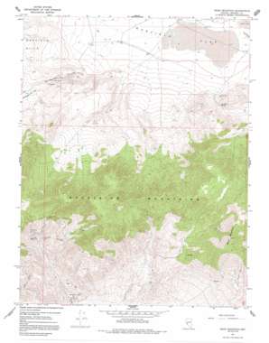
Moho Mountain Topo Map Nevada
To zoom in, hover over the map of Moho Mountain
USGS Topo Quad 38118c3 - 1:24,000 scale
| Topo Map Name: | Moho Mountain |
| USGS Topo Quad ID: | 38118c3 |
| Print Size: | ca. 21 1/4" wide x 27" high |
| Southeast Coordinates: | 38.25° N latitude / 118.25° W longitude |
| Map Center Coordinates: | 38.3125° N latitude / 118.3125° W longitude |
| U.S. State: | NV |
| Filename: | o38118c3.jpg |
| Download Map JPG Image: | Moho Mountain topo map 1:24,000 scale |
| Map Type: | Topographic |
| Topo Series: | 7.5´ |
| Map Scale: | 1:24,000 |
| Source of Map Images: | United States Geological Survey (USGS) |
| Alternate Map Versions: |
Moho Mountain NV 1967, updated 1969 Download PDF Buy paper map Moho Mountain NV 1967, updated 1981 Download PDF Buy paper map Moho Mountain NV 1967, updated 1991 Download PDF Buy paper map Moho Mountain NV 2011 Download PDF Buy paper map Moho Mountain NV 2014 Download PDF Buy paper map |
1:24,000 Topo Quads surrounding Moho Mountain
> Back to 38118a1 at 1:100,000 scale
> Back to 38118a1 at 1:250,000 scale
> Back to U.S. Topo Maps home
Moho Mountain topo map: Gazetteer
Moho Mountain: Flats
Garfield Flat elevation 1694m 5557′Moho Mountain: Mines
Badger Mine elevation 2013m 6604′Birdsong Mine elevation 2049m 6722′
Black Hawk Mine elevation 1941m 6368′
Combination Mining Company Mine elevation 2106m 6909′
Endowment Mine elevation 2106m 6909′
Marietta Mines elevation 1624m 5328′
Moho Mine elevation 2197m 7208′
Rip Van Winkle Mine elevation 1676m 5498′
Rutty Mine elevation 1785m 5856′
San Francisco Bell Mine elevation 2090m 6856′
Silver Gulch Mine elevation 2011m 6597′
Moho Mountain: Reservoirs
Garfield Reservoir Number One elevation 1692m 5551′Garfield Reservoir Number Two elevation 1697m 5567′
Moho Mountain: Springs
Belleville Springs elevation 1951m 6400′Garfield Spring elevation 1834m 6017′
Moho Mountain: Summits
Moho Mountain elevation 2679m 8789′Moho Mountain: Valleys
Rattlesnake Canyon elevation 1714m 5623′Moho Mountain digital topo map on disk
Buy this Moho Mountain topo map showing relief, roads, GPS coordinates and other geographical features, as a high-resolution digital map file on DVD:


