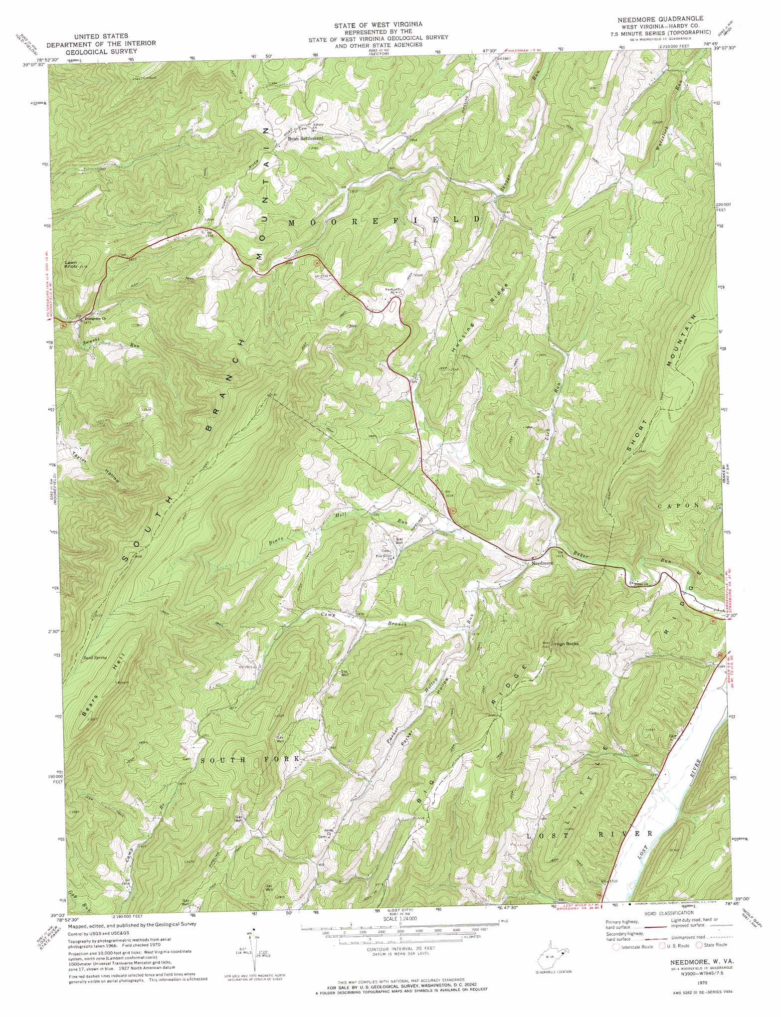
Needmore Topo Map West Virginia
To zoom in, hover over the map of Needmore
USGS Topo Quad 39078a7 - 1:24,000 scale
| Topo Map Name: | Needmore |
| USGS Topo Quad ID: | 39078a7 |
| Print Size: | ca. 21 1/4" wide x 27" high |
| Southeast Coordinates: | 39° N latitude / 78.75° W longitude |
| Map Center Coordinates: | 39.0625° N latitude / 78.8125° W longitude |
| U.S. State: | WV |
| Filename: | o39078a7.jpg |
| Download Map JPG Image: | Needmore topo map 1:24,000 scale |
| Map Type: | Topographic |
| Topo Series: | 7.5´ |
| Map Scale: | 1:24,000 |
| Source of Map Images: | United States Geological Survey (USGS) |
| Alternate Map Versions: |
Needmore WV 1970, updated 1973 Download PDF Buy paper map Needmore WV 2011 Download PDF Buy paper map Needmore WV 2014 Download PDF Buy paper map Needmore WV 2016 Download PDF Buy paper map |
| FStopo: | US Forest Service topo Needmore is available: Download FStopo PDF Download FStopo TIF |
1:24,000 Topo Quads surrounding Needmore
Antioch |
Burlington |
Romney |
Augusta |
Hanging Rock |
Medley |
Old Fields |
Sector |
Rio |
Yellow Spring |
Rig |
Moorefield |
Needmore |
Baker |
Wardensville |
Petersburg East |
Lost River State Park |
Lost City |
Wolf Gap |
Woodstock |
Milam |
Bergton |
Orkney Springs |
Conicville |
Edinburg |
> Back to 39078a1 at 1:100,000 scale
> Back to 39078a1 at 1:250,000 scale
> Back to U.S. Topo Maps home
Needmore topo map: Gazetteer
Needmore: Pillars
High Rocks elevation 743m 2437′Needmore: Populated Places
Bean Settlement elevation 639m 2096′Doman (historical) elevation 570m 1870′
Fabius (historical) elevation 638m 2093′
Needmore elevation 457m 1499′
Needmore: Ridges
Bears Hell elevation 1013m 3323′Hunting Ridge elevation 654m 2145′
Needmore: Springs
Sand Spring elevation 913m 2995′Webster Spring elevation 543m 1781′
Needmore: Streams
Bears Hell Run elevation 449m 1473′Camp Branch elevation 474m 1555′
Long Lick Run elevation 443m 1453′
Parker Hollow elevation 451m 1479′
Swartz Run elevation 450m 1476′
Needmore: Summits
Lawn Knob elevation 643m 2109′Needmore: Valleys
Parker Hollow elevation 449m 1473′Taylor Hollow elevation 513m 1683′
Needmore digital topo map on disk
Buy this Needmore topo map showing relief, roads, GPS coordinates and other geographical features, as a high-resolution digital map file on DVD:
 map DVD")