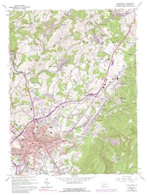
Uniontown Topo Map Pennsylvania
To zoom in, hover over the map of Uniontown
USGS Topo Quad 39079h6 - 1:24,000 scale
| Topo Map Name: | Uniontown |
| USGS Topo Quad ID: | 39079h6 |
| Print Size: | ca. 21 1/4" wide x 27" high |
| Southeast Coordinates: | 39.875° N latitude / 79.625° W longitude |
| Map Center Coordinates: | 39.9375° N latitude / 79.6875° W longitude |
| U.S. State: | PA |
| Filename: | o39079h6.jpg |
| Download Map JPG Image: | Uniontown topo map 1:24,000 scale |
| Map Type: | Topographic |
| Topo Series: | 7.5´ |
| Map Scale: | 1:24,000 |
| Source of Map Images: | United States Geological Survey (USGS) |
| Alternate Map Versions: |
Uniontown PA 1963, updated 1965 Download PDF Buy paper map Uniontown PA 1963, updated 1973 Download PDF Buy paper map Uniontown PA 1963, updated 1988 Download PDF Buy paper map Uniontown PA 2010 Download PDF Buy paper map Uniontown PA 2013 Download PDF Buy paper map Uniontown PA 2016 Download PDF Buy paper map |
1:24,000 Topo Quads surrounding Uniontown
> Back to 39079e1 at 1:100,000 scale
> Back to 39078a1 at 1:250,000 scale
> Back to U.S. Topo Maps home
Uniontown topo map: Gazetteer
Uniontown: Airports
Connellsville Airport elevation 385m 1263′Uniontown: Cliffs
Jumonville Rocks elevation 713m 2339′Uniontown: Dams
Cool Spring Dam Number Two elevation 418m 1371′Uniontown: Parks
Bailey Park elevation 299m 980′Saint Cecilias Park elevation 334m 1095′
Shady Grove Park elevation 349m 1145′
Uniontown: Populated Places
Bethelboro elevation 320m 1049′Bitner elevation 319m 1046′
Bute elevation 308m 1010′
Coolspring elevation 320m 1049′
East Uniontown elevation 374m 1227′
Elm Grove elevation 329m 1079′
Evans elevation 305m 1000′
Evans Manor elevation 325m 1066′
Graham Crossing elevation 315m 1033′
Hatfield elevation 354m 1161′
Hogsett elevation 300m 984′
Hopwood elevation 339m 1112′
Jumonville elevation 669m 2194′
Juniata elevation 338m 1108′
Laurel Hill elevation 299m 980′
Leisenring elevation 318m 1043′
Leith elevation 338m 1108′
Lemont Furnace elevation 318m 1043′
Little Summit elevation 366m 1200′
Mahoning elevation 326m 1069′
Monarch elevation 370m 1213′
Morgan elevation 354m 1161′
Mount Braddock elevation 354m 1161′
Mount Hope elevation 296m 971′
Mount Independence elevation 414m 1358′
Oliver elevation 306m 1003′
Percy elevation 376m 1233′
Phillips elevation 301m 987′
South Uniontown elevation 329m 1079′
Uniontown elevation 328m 1076′
Vances Mill elevation 289m 948′
Walker elevation 302m 990′
West Leisenring elevation 318m 1043′
Youngstown elevation 340m 1115′
Uniontown: Springs
Cool Spring elevation 399m 1309′Uniontown: Streams
Bennington Spring Run elevation 324m 1062′Bute Run elevation 283m 928′
Coal Lick Run elevation 293m 961′
Coolspring Run elevation 330m 1082′
Cove Run elevation 290m 951′
Craig Branch elevation 303m 994′
Fans Run elevation 311m 1020′
Ferguson Run elevation 347m 1138′
Jennings Run elevation 332m 1089′
Laurel Run elevation 347m 1138′
Lick Run elevation 315m 1033′
Rankin Run elevation 285m 935′
Shutes Run elevation 297m 974′
Uniontown: Valleys
Berger Hollow elevation 324m 1062′Uniontown digital topo map on disk
Buy this Uniontown topo map showing relief, roads, GPS coordinates and other geographical features, as a high-resolution digital map file on DVD:


