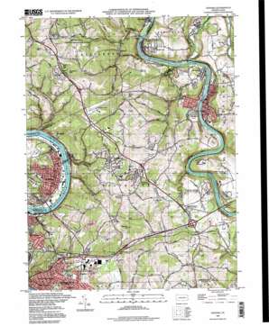
Donora Topo Map Pennsylvania
To zoom in, hover over the map of Donora
USGS Topo Quad 40079b7 - 1:24,000 scale
| Topo Map Name: | Donora |
| USGS Topo Quad ID: | 40079b7 |
| Print Size: | ca. 21 1/4" wide x 27" high |
| Southeast Coordinates: | 40.125° N latitude / 79.75° W longitude |
| Map Center Coordinates: | 40.1875° N latitude / 79.8125° W longitude |
| U.S. State: | PA |
| Filename: | o40079b7.jpg |
| Download Map JPG Image: | Donora topo map 1:24,000 scale |
| Map Type: | Topographic |
| Topo Series: | 7.5´ |
| Map Scale: | 1:24,000 |
| Source of Map Images: | United States Geological Survey (USGS) |
| Alternate Map Versions: |
Donora PA 1954, updated 1955 Download PDF Buy paper map Donora PA 1954, updated 1970 Download PDF Buy paper map Donora PA 1954, updated 1979 Download PDF Buy paper map Donora PA 1954, updated 1984 Download PDF Buy paper map Donora PA 1993, updated 1993 Download PDF Buy paper map Donora PA 1993, updated 1998 Download PDF Buy paper map Donora PA 2010 Download PDF Buy paper map Donora PA 2013 Download PDF Buy paper map Donora PA 2016 Download PDF Buy paper map |
1:24,000 Topo Quads surrounding Donora
> Back to 40079a1 at 1:100,000 scale
> Back to 40078a1 at 1:250,000 scale
> Back to U.S. Topo Maps home
Donora topo map: Gazetteer
Donora: Airports
Rostraver Airport elevation 373m 1223′Donora: Bridges
Donora Webster Bridge elevation 221m 725′West Newton Bridge elevation 225m 738′
Donora: Dams
Griffin Dam elevation 278m 912′Donora: Parks
Palmer Park elevation 316m 1036′Round Hill County Regional Park elevation 316m 1036′
Donora: Populated Places
Allens Crossroads elevation 282m 925′Belle Vernon elevation 246m 807′
Blackburn (historical) elevation 233m 764′
Blythedale elevation 236m 774′
Collinsburg elevation 239m 784′
Crestview elevation 326m 1069′
Donora elevation 252m 826′
Douglass elevation 236m 774′
Fellsburg elevation 336m 1102′
Fitz Henry elevation 294m 964′
Grandview elevation 279m 915′
Gratztown elevation 234m 767′
Lowber elevation 238m 780′
Millesville elevation 338m 1108′
Mustard elevation 249m 816′
North Belle Vernon elevation 281m 921′
Port Royal elevation 300m 984′
Pricedale elevation 277m 908′
Rankins Corners elevation 317m 1040′
Reduction elevation 278m 912′
Smithdale elevation 241m 790′
Sutersville elevation 287m 941′
Sweeneys Crossroads elevation 308m 1010′
Webster elevation 236m 774′
West Newton elevation 237m 777′
Wilko Hill elevation 278m 912′
Donora: Post Offices
Belle Vernon Branch Post Office elevation 285m 935′Donora Post Office elevation 237m 777′
West Newton Post Office elevation 234m 767′
Donora: Reservoirs
Arrowhead Lakes elevation 308m 1010′Mirror Lake elevation 332m 1089′
Donora: Streams
Beckets Run elevation 221m 725′Cedar Creek elevation 225m 738′
Douglass Run elevation 243m 797′
Gillespie Run elevation 222m 728′
Pollock Run elevation 225m 738′
Sewickley Creek elevation 219m 718′
Donora: Summits
Sheppler Hill elevation 429m 1407′Donora: Valleys
Kelly Hollow elevation 235m 770′Donora digital topo map on disk
Buy this Donora topo map showing relief, roads, GPS coordinates and other geographical features, as a high-resolution digital map file on DVD:


