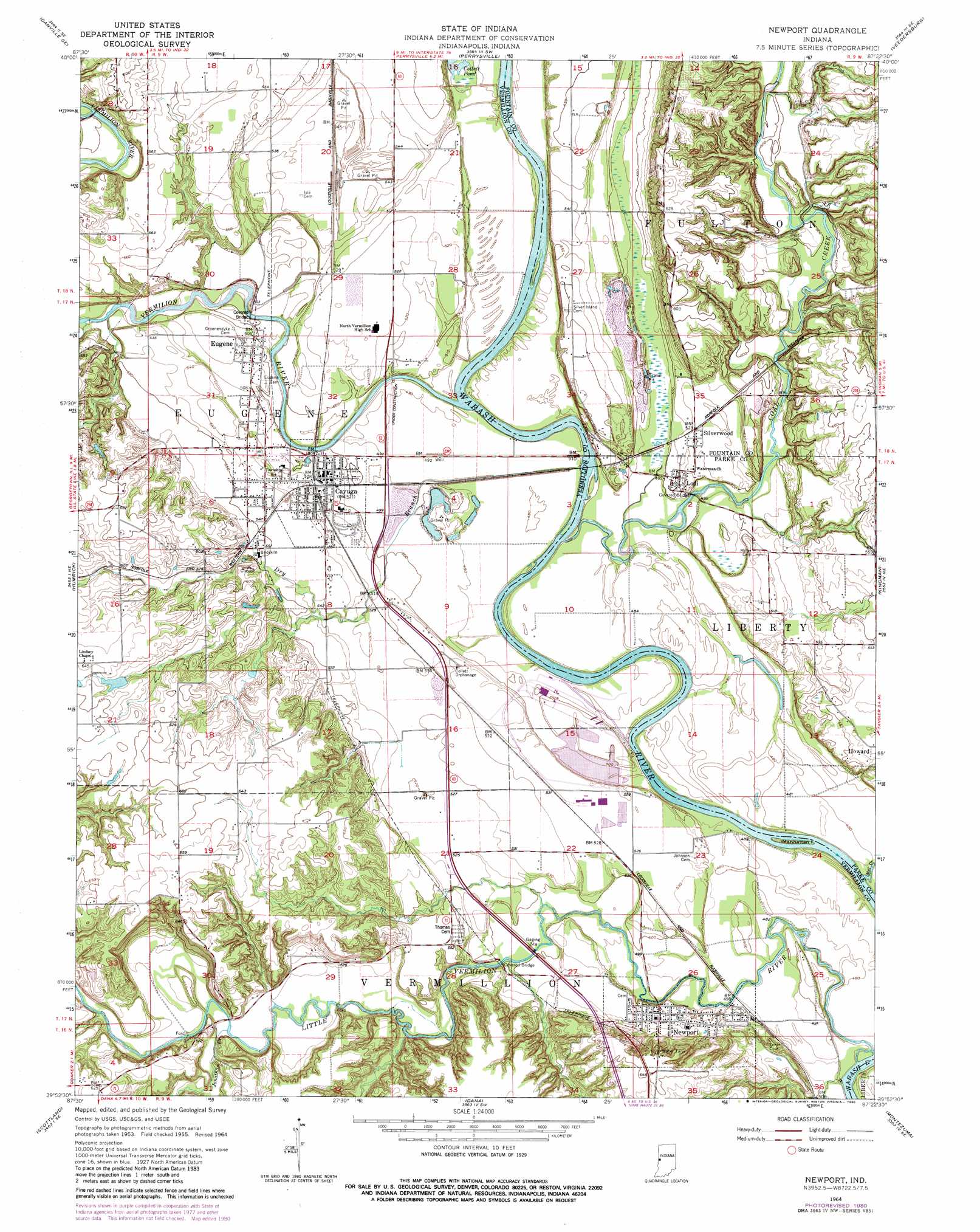
Newport Topo Map Indiana
To zoom in, hover over the map of Newport
USGS Topo Quad 39087h4 - 1:24,000 scale
| Topo Map Name: | Newport |
| USGS Topo Quad ID: | 39087h4 |
| Print Size: | ca. 21 1/4" wide x 27" high |
| Southeast Coordinates: | 39.875° N latitude / 87.375° W longitude |
| Map Center Coordinates: | 39.9375° N latitude / 87.4375° W longitude |
| U.S. State: | IN |
| Filename: | o39087h4.jpg |
| Download Map JPG Image: | Newport topo map 1:24,000 scale |
| Map Type: | Topographic |
| Topo Series: | 7.5´ |
| Map Scale: | 1:24,000 |
| Source of Map Images: | United States Geological Survey (USGS) |
| Alternate Map Versions: |
Newport IN 1955, updated 1957 Download PDF Buy paper map Newport IN 1964, updated 1965 Download PDF Buy paper map Newport IN 1964, updated 1980 Download PDF Buy paper map Newport IN 2010 Download PDF Buy paper map Newport IN 2013 Download PDF Buy paper map Newport IN 2016 Download PDF Buy paper map |
1:24,000 Topo Quads surrounding Newport
Danville Nw |
Danville Ne |
Covington |
Stone Bluff |
Mellott |
Danville Sw |
Danville Se |
Perrysville |
Veedersburg |
Hillsboro |
Georgetown |
Humrick |
Newport |
Kingman |
Wallace |
Chrisman |
Scottland |
Dana |
Montezuma |
Rockville |
Paris North |
Saint Bernice |
Clinton |
Mecca |
Catlin |
> Back to 39087e1 at 1:100,000 scale
> Back to 39086a1 at 1:250,000 scale
> Back to U.S. Topo Maps home
Newport topo map: Gazetteer
Newport: Bridges
Coal Creek Covered Bridge elevation 147m 482′Newport: Dams
Chew Lake Dam elevation 192m 629′Newport: Islands
Manhattan Island elevation 146m 479′Newport: Populated Places
Cayuga elevation 155m 508′Eugene elevation 155m 508′
Howard elevation 169m 554′
Lodi elevation 154m 505′
Newport elevation 161m 528′
Silverwood elevation 160m 524′
Newport: Reservoirs
Chew Lake elevation 192m 629′Newport: Streams
Coal Creek elevation 145m 475′Dry Branch elevation 147m 482′
Jonathan Creek elevation 157m 515′
Little Vermilion River elevation 147m 482′
Mill Creek elevation 146m 479′
Vermilion River elevation 144m 472′
Newport digital topo map on disk
Buy this Newport topo map showing relief, roads, GPS coordinates and other geographical features, as a high-resolution digital map file on DVD:
Northern Illinois, Northern Indiana & Southwestern Michigan
Buy digital topo maps: Northern Illinois, Northern Indiana & Southwestern Michigan