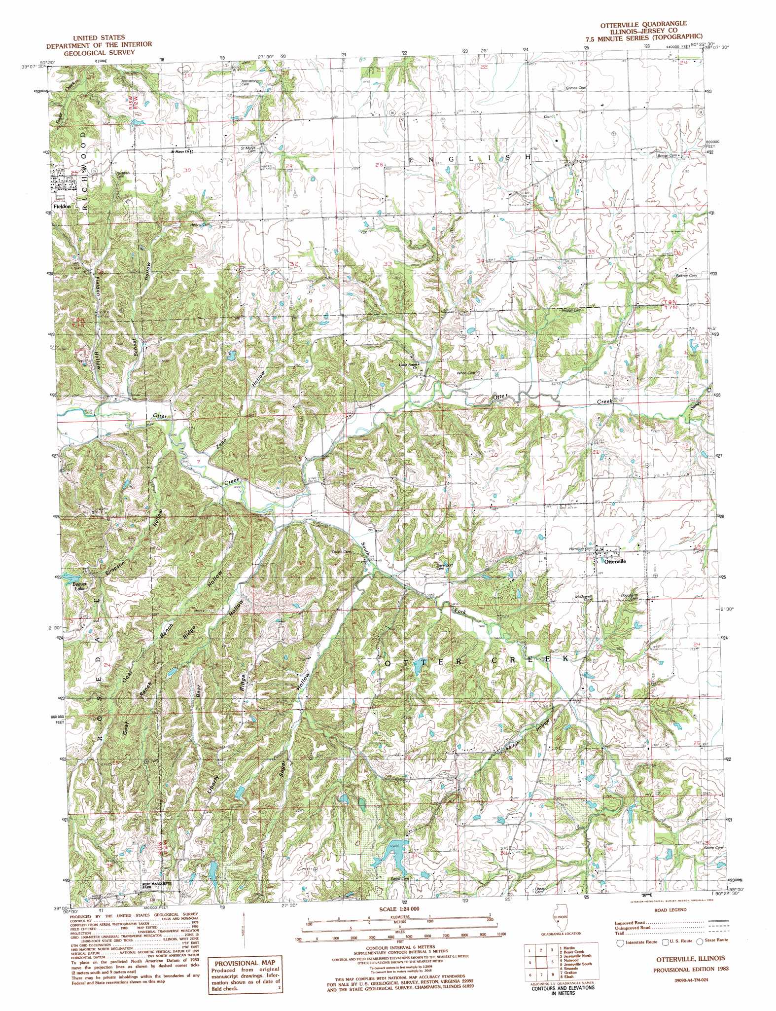
Otterville Topo Map Illinois
To zoom in, hover over the map of Otterville
USGS Topo Quad 39090a4 - 1:24,000 scale
| Topo Map Name: | Otterville |
| USGS Topo Quad ID: | 39090a4 |
| Print Size: | ca. 21 1/4" wide x 27" high |
| Southeast Coordinates: | 39° N latitude / 90.375° W longitude |
| Map Center Coordinates: | 39.0625° N latitude / 90.4375° W longitude |
| U.S. State: | IL |
| Filename: | o39090a4.jpg |
| Download Map JPG Image: | Otterville topo map 1:24,000 scale |
| Map Type: | Topographic |
| Topo Series: | 7.5´ |
| Map Scale: | 1:24,000 |
| Source of Map Images: | United States Geological Survey (USGS) |
| Alternate Map Versions: |
Otterville IL 1983, updated 1984 Download PDF Buy paper map Otterville IL 2012 Download PDF Buy paper map Otterville IL 2015 Download PDF Buy paper map |
1:24,000 Topo Quads surrounding Otterville
Pleasant Dale Valley |
Kampsville |
Carrollton |
Daum |
Greenfield |
Hamburg |
Hardin |
Boyer Creek |
Jerseyville North |
Medora |
Foley |
Nutwood |
Otterville |
Jerseyville South |
Brighton |
Winfield |
Brussels |
Grafton |
Elsah |
Alton |
O'Fallon |
Kampville |
Saint Charles |
Florissant |
Columbia Bottom |
> Back to 39090a1 at 1:100,000 scale
> Back to 39090a1 at 1:250,000 scale
> Back to U.S. Topo Maps home
Otterville topo map: Gazetteer
Otterville: Dams
Nugent-Schpanski Number 4 Dam elevation 205m 672′Otterville: Lakes
Beaver Lake elevation 196m 643′Otterville: Populated Places
Democrat Spring elevation 148m 485′Fieldon elevation 211m 692′
Otterville elevation 191m 626′
Otterville: Reservoirs
Nugent-Schpanski Number 4 Lake elevation 205m 672′Otterville: Ridges
Goat Ranch Ridge elevation 196m 643′Otterville: Streams
Sandy Creek elevation 156m 511′South Fork Otter Creek elevation 142m 465′
Otterville: Valleys
Bear Hollow elevation 144m 472′Fieldon Hollow elevation 140m 459′
Goat Ranch Hollow elevation 143m 469′
Schaaf Hollow elevation 138m 452′
Shiloh Hollow elevation 158m 518′
Simpson Hollow elevation 138m 452′
Sugar Hollow elevation 149m 488′
Zahn Hollow elevation 142m 465′
Otterville digital topo map on disk
Buy this Otterville topo map showing relief, roads, GPS coordinates and other geographical features, as a high-resolution digital map file on DVD: