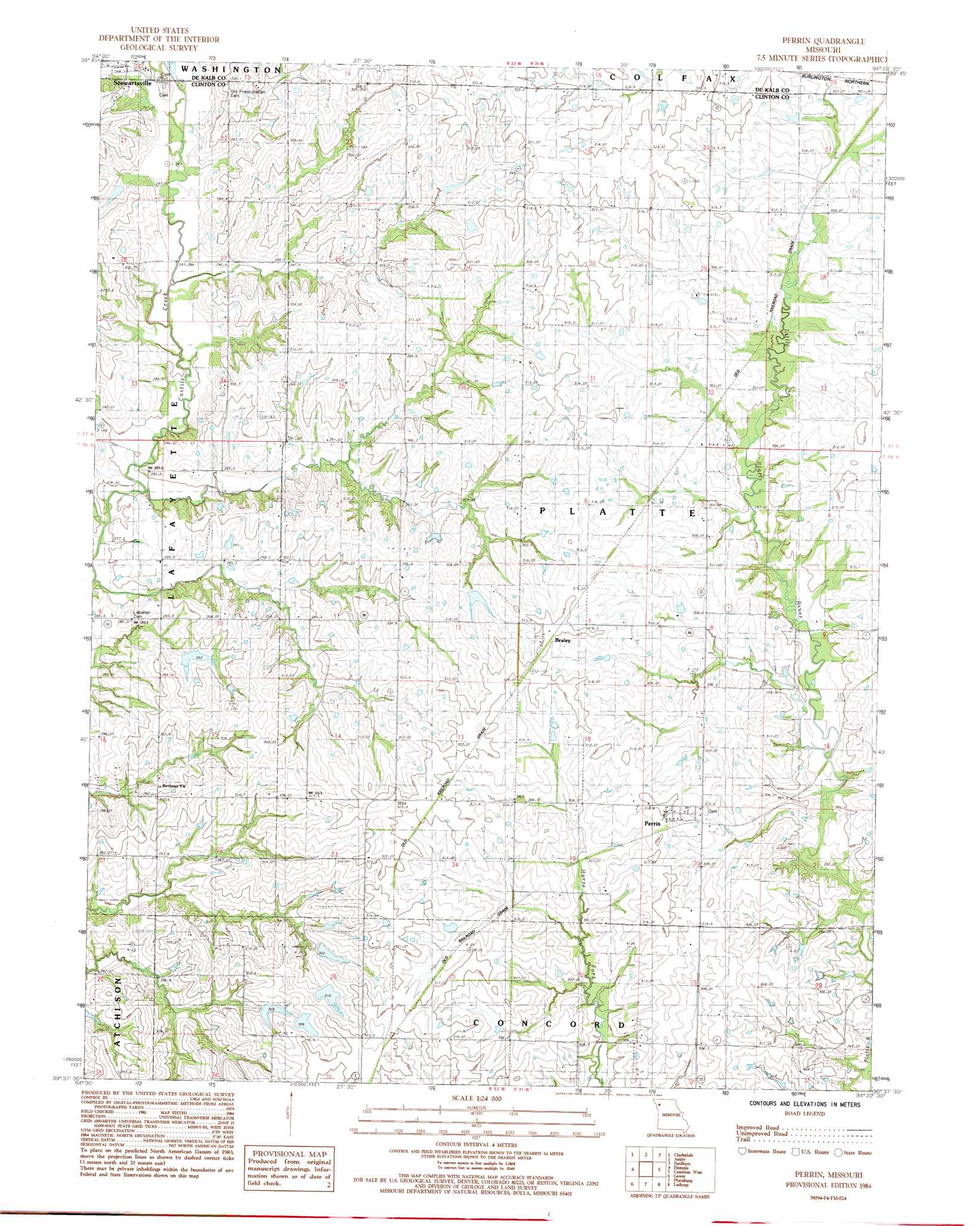
Perrin Topo Map Missouri
To zoom in, hover over the map of Perrin
USGS Topo Quad 39094f4 - 1:24,000 scale
| Topo Map Name: | Perrin |
| USGS Topo Quad ID: | 39094f4 |
| Print Size: | ca. 21 1/4" wide x 27" high |
| Southeast Coordinates: | 39.625° N latitude / 94.375° W longitude |
| Map Center Coordinates: | 39.6875° N latitude / 94.4375° W longitude |
| U.S. State: | MO |
| Filename: | o39094f4.jpg |
| Download Map JPG Image: | Perrin topo map 1:24,000 scale |
| Map Type: | Topographic |
| Topo Series: | 7.5´ |
| Map Scale: | 1:24,000 |
| Source of Map Images: | United States Geological Survey (USGS) |
| Alternate Map Versions: |
Perrin MO 1984, updated 1984 Download PDF Buy paper map Perrin MO 2012 Download PDF Buy paper map Perrin MO 2015 Download PDF Buy paper map |
1:24,000 Topo Quads surrounding Perrin
Helena |
Union Star |
Wood |
Maysville |
Weatherby |
Cosby |
Clarksdale |
Amity |
Fordham |
Winston |
Agency |
Hemple |
Perrin |
Cameron West |
Cameron East |
Edgerton |
Gower |
Plattsburg |
Lathrop |
Elmira |
Camden Point |
Smithville |
Arley |
Holt |
Lawson |
> Back to 39094e1 at 1:100,000 scale
> Back to 39094a1 at 1:250,000 scale
> Back to U.S. Topo Maps home
Perrin topo map: Gazetteer
Perrin: Dams
Freeman Farm Number Three Dam elevation 309m 1013′Freeman Farm Number Two Dam elevation 306m 1003′
Freeman Farms Dam Number One elevation 305m 1000′
Freemans Farm Dam Number Four elevation 311m 1020′
Jones Lake Section 10 Dam elevation 293m 961′
Lake Joseph Dam elevation 302m 990′
Perrin: Populated Places
Braley elevation 321m 1053′Delaney elevation 321m 1053′
Maple Hill elevation 310m 1017′
Moors elevation 304m 997′
Perrin elevation 314m 1030′
Perrin: Post Offices
Eskin Post Office elevation 310m 1017′Perrin: Reservoirs
Number 17 Reservoir elevation 311m 1020′Perrin digital topo map on disk
Buy this Perrin topo map showing relief, roads, GPS coordinates and other geographical features, as a high-resolution digital map file on DVD: