Goshute Canyon Topo Map Utah
To zoom in, hover over the map of Goshute Canyon
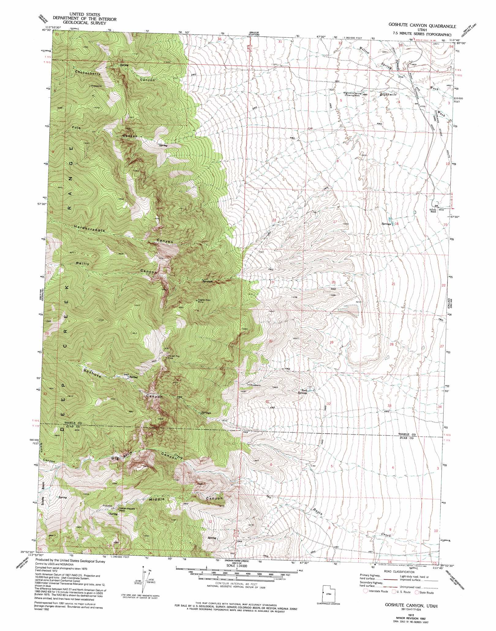
USGS Topo Quad 39113h7 - 1:24,000 scale
| Topo Map Name: | Goshute Canyon |
| USGS Topo Quad ID: | 39113h7 |
| Print Size: | ca. 21 1/4" wide x 27" high |
| Southeast Coordinates: | 39.875° N latitude / 113.75° W longitude |
| Map Center Coordinates: | 39.9375° N latitude / 113.8125° W longitude |
| U.S. State: | UT |
| Filename: | o39113h7.jpg |
| Download Map JPG Image: | Goshute Canyon topo map 1:24,000 scale |
| Map Type: | Topographic |
| Topo Series: | 7.5´ |
| Map Scale: | 1:24,000 |
| Source of Map Images: | United States Geological Survey (USGS) |
| Alternate Map Versions: |
Goshute Canyon UT 1972, updated 1975 Download PDF Buy paper map Goshute Canyon UT 1972, updated 1985 Download PDF Buy paper map Goshute Canyon UT 1972, updated 1992 Download PDF Buy paper map Goshute Canyon UT 2011 Download PDF Buy paper map Goshute Canyon UT 2014 Download PDF Buy paper map |
1:24,000 Topo Quads surrounding Goshute Canyon
Ferber Peak |
Ochre Mountain |
Gold Hill |
Gold Hill 4 Nw |
Gold Hill 4 Ne |
Ferber Peak Se |
Ibapah |
Clifton |
Gold Hill 4 Sw |
Gold Hill 4 Se |
Georgetta Ranch |
Goshute |
Goshute Canyon |
Callao |
Callao Ne |
Weaver Canyon |
Ibapah Peak |
Indian Farm Creek |
Mud Lake Reservoir |
Boyd Station |
Skinner Canyon |
Partoun |
Trout Creek |
Hole-In-The-Wall Reservoir |
Middle Range North |
> Back to 39113e1 at 1:100,000 scale
> Back to 39112a1 at 1:250,000 scale
> Back to U.S. Topo Maps home
Goshute Canyon topo map: Gazetteer
Goshute Canyon: Mines
Eagles Nest Mine elevation 2406m 7893′Oro del Rey Mine elevation 2669m 8756′
Goshute Canyon: Pillars
Indian Squaw Rock elevation 2334m 7657′Goshute Canyon: Springs
Eightmile Spring elevation 1490m 4888′Rock Springs elevation 1609m 5278′
Goshute Canyon: Valleys
Big Canyon elevation 1745m 5725′Chokecherry Canyon elevation 1641m 5383′
Goshute Canyon elevation 1704m 5590′
Hardscrabble Canyon elevation 1516m 4973′
Middle Canyon elevation 1732m 5682′
North Canyon elevation 2304m 7559′
Pole Canyon elevation 1766m 5793′
Reilly Canyon elevation 1567m 5141′
Goshute Canyon digital topo map on disk
Buy this Goshute Canyon topo map showing relief, roads, GPS coordinates and other geographical features, as a high-resolution digital map file on DVD: