Rock Springs Pass Topo Map Nevada
To zoom in, hover over the map of Rock Springs Pass
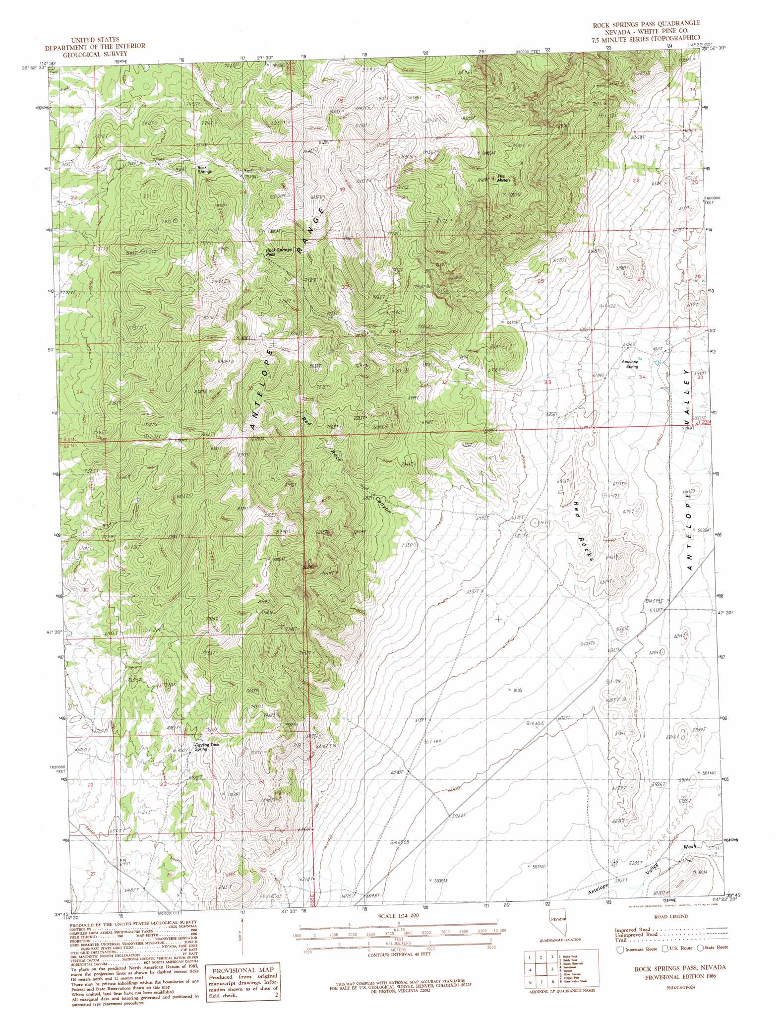
USGS Topo Quad 39114g4 - 1:24,000 scale
| Topo Map Name: | Rock Springs Pass |
| USGS Topo Quad ID: | 39114g4 |
| Print Size: | ca. 21 1/4" wide x 27" high |
| Southeast Coordinates: | 39.75° N latitude / 114.375° W longitude |
| Map Center Coordinates: | 39.8125° N latitude / 114.4375° W longitude |
| U.S. State: | NV |
| Filename: | o39114g4.jpg |
| Download Map JPG Image: | Rock Springs Pass topo map 1:24,000 scale |
| Map Type: | Topographic |
| Topo Series: | 7.5´ |
| Map Scale: | 1:24,000 |
| Source of Map Images: | United States Geological Survey (USGS) |
| Alternate Map Versions: |
Rock Springs Pass NV 1986, updated 1986 Download PDF Buy paper map Rock Springs Pass NV 2012 Download PDF Buy paper map Rock Springs Pass NV 2014 Download PDF Buy paper map |
1:24,000 Topo Quads surrounding Rock Springs Pass
Goshute Lake South |
Lages Station |
Chin Creek Spring |
Chin Creek Reservoir |
Ayarbe Spring |
Cherry Spring |
Becky Peak |
Baldy Peak |
Sunset Reservoir |
Spring Creek Flat Nw |
Schellbourne |
Stonehouse |
Rock Springs Pass |
Tippett |
Tippett Canyon |
Mattier Creek |
Silver Canyon |
Tippett Pass |
Grass Valley Wash |
Blue Mass Canyon |
Kalamazoo Summit |
Kalamazoo Creek |
Big Hard Pan |
White Cloud Point |
Government Peak |
> Back to 39114e1 at 1:100,000 scale
> Back to 39114a1 at 1:250,000 scale
> Back to U.S. Topo Maps home
Rock Springs Pass topo map: Gazetteer
Rock Springs Pass: Gaps
Rock Springs Pass elevation 2408m 7900′Rock Springs Pass: Springs
Antelope Spring elevation 1850m 6069′Blind Spring elevation 2366m 7762′
Dipping Tank Spring elevation 2138m 7014′
Long Spring elevation 2318m 7604′
Rock Springs elevation 2273m 7457′
Rock Springs Pass: Summits
Red Rocks elevation 1979m 6492′The Mitten elevation 2551m 8369′
Rock Springs Pass: Valleys
Red Rock Canyon elevation 2015m 6610′Rock Springs Pass digital topo map on disk
Buy this Rock Springs Pass topo map showing relief, roads, GPS coordinates and other geographical features, as a high-resolution digital map file on DVD: