Spring Creek Flat Nw Topo Map Nevada
To zoom in, hover over the map of Spring Creek Flat Nw
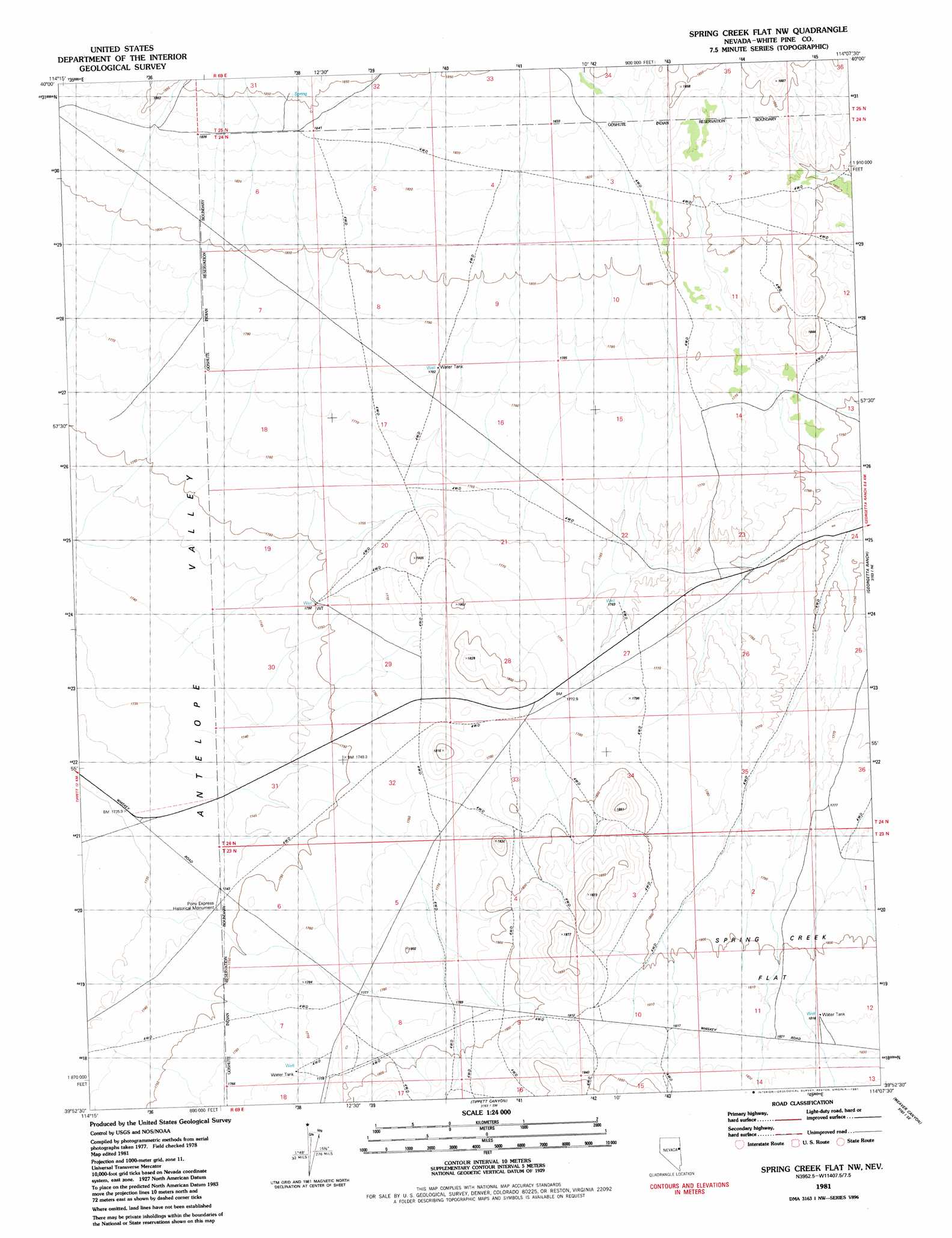
USGS Topo Quad 39114h2 - 1:24,000 scale
| Topo Map Name: | Spring Creek Flat Nw |
| USGS Topo Quad ID: | 39114h2 |
| Print Size: | ca. 21 1/4" wide x 27" high |
| Southeast Coordinates: | 39.875° N latitude / 114.125° W longitude |
| Map Center Coordinates: | 39.9375° N latitude / 114.1875° W longitude |
| U.S. State: | NV |
| Filename: | o39114h2.jpg |
| Download Map JPG Image: | Spring Creek Flat Nw topo map 1:24,000 scale |
| Map Type: | Topographic |
| Topo Series: | 7.5´ |
| Map Scale: | 1:24,000 |
| Source of Map Images: | United States Geological Survey (USGS) |
| Alternate Map Versions: |
Spring Creek Flat NW NV 1981, updated 1981 Download PDF Buy paper map Spring Creek Flat NW NV 2012 Download PDF Buy paper map Spring Creek Flat NW NV 2014 Download PDF Buy paper map |
1:24,000 Topo Quads surrounding Spring Creek Flat Nw
Boone Canyon |
Kinsley Mountain |
Ferber Peak Nw |
Ferber Peak |
Ochre Mountain |
Chin Creek Spring |
Chin Creek Reservoir |
Ayarbe Spring |
Ferber Peak Se |
Ibapah |
Baldy Peak |
Sunset Reservoir |
Spring Creek Flat Nw |
Georgetta Ranch |
Goshute |
Rock Springs Pass |
Tippett |
Tippett Canyon |
Weaver Canyon |
Ibapah Peak |
Tippett Pass |
Grass Valley Wash |
Blue Mass Canyon |
Skinner Canyon |
Partoun |
> Back to 39114e1 at 1:100,000 scale
> Back to 39114a1 at 1:250,000 scale
> Back to U.S. Topo Maps home
Spring Creek Flat Nw topo map: Gazetteer
Spring Creek Flat Nw: Parks
Pony Express Historical Monument elevation 1745m 5725′Spring Creek Flat Nw digital topo map on disk
Buy this Spring Creek Flat Nw topo map showing relief, roads, GPS coordinates and other geographical features, as a high-resolution digital map file on DVD: