Mount Vernon Topo Map Ohio
To zoom in, hover over the map of Mount Vernon
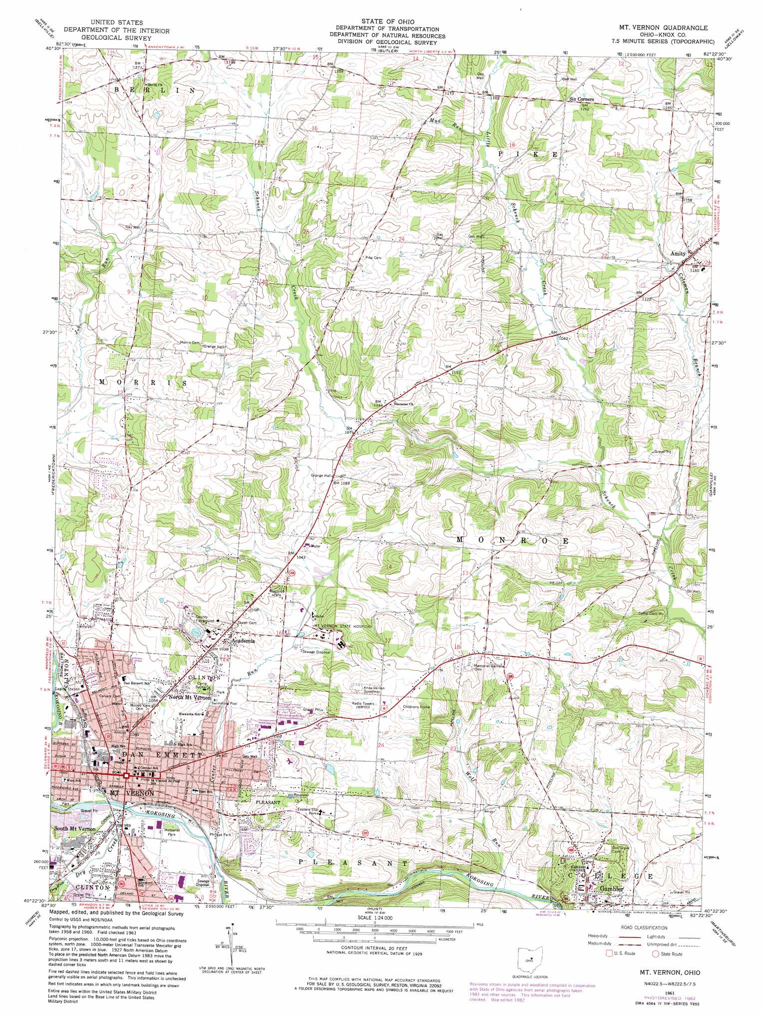
USGS Topo Quad 40082d4 - 1:24,000 scale
| Topo Map Name: | Mount Vernon |
| USGS Topo Quad ID: | 40082d4 |
| Print Size: | ca. 21 1/4" wide x 27" high |
| Southeast Coordinates: | 40.375° N latitude / 82.375° W longitude |
| Map Center Coordinates: | 40.4375° N latitude / 82.4375° W longitude |
| U.S. State: | OH |
| Filename: | o40082d4.jpg |
| Download Map JPG Image: | Mount Vernon topo map 1:24,000 scale |
| Map Type: | Topographic |
| Topo Series: | 7.5´ |
| Map Scale: | 1:24,000 |
| Source of Map Images: | United States Geological Survey (USGS) |
| Alternate Map Versions: |
Mt Vernon OH 1961, updated 1962 Download PDF Buy paper map Mt Vernon OH 1961, updated 1973 Download PDF Buy paper map Mt Vernon OH 1961, updated 1975 Download PDF Buy paper map Mt Vernon OH 1961, updated 1983 Download PDF Buy paper map Mount Vernon OH 2010 Download PDF Buy paper map Mount Vernon OH 2013 Download PDF Buy paper map Mount Vernon OH 2016 Download PDF Buy paper map |
1:24,000 Topo Quads surrounding Mount Vernon
Blooming Grove |
Mansfield South |
Lucas |
Perrysville |
Loudonville |
Shauck |
Bellville |
Butler |
Jelloway |
Greer |
Chesterville |
Fredericktown |
Mount Vernon |
Danville |
Brinkhaven |
Centerburg |
Homer |
Hunt |
Martinsburg |
Walhonding |
Johnstown |
Fredonia |
Utica |
Hickman |
Perryton |
> Back to 40082a1 at 1:100,000 scale
> Back to 40082a1 at 1:250,000 scale
> Back to U.S. Topo Maps home
Mount Vernon topo map: Gazetteer
Mount Vernon: Flats
Pea Vine Flat elevation 365m 1197′Mount Vernon: Parks
Arch Avenue Park elevation 299m 980′East Gambier Street Historic District elevation 311m 1020′
East High Street Historic District elevation 311m 1020′
Knox Woods State Nature Preserve elevation 342m 1122′
Lamartine Square elevation 331m 1085′
Memorial Park elevation 297m 974′
North Main-North Gay Streets Historic District elevation 322m 1056′
Phillips Park elevation 298m 977′
Mount Vernon: Populated Places
Academia elevation 321m 1053′Amity elevation 343m 1125′
Buckingham Court elevation 320m 1049′
Clinton (historical) elevation 309m 1013′
Fleaville (historical) elevation 306m 1003′
Gambier elevation 329m 1079′
Mount Vernon elevation 305m 1000′
North Mount Vernon elevation 328m 1076′
South Mount Vernon elevation 304m 997′
Vaughan Court elevation 315m 1033′
Mount Vernon: Post Offices
Academia Post office (historical) elevation 324m 1062′Gambier Post Office elevation 329m 1079′
Mount Vernon Post Office elevation 303m 994′
Mount Vernon: Reservoirs
Lake Hiawatha elevation 320m 1049′Mount Vernon: Streams
Adams Run elevation 304m 997′Center Run elevation 299m 980′
Coleman Branch elevation 299m 980′
Curtis Run elevation 304m 997′
Dry Creek elevation 300m 984′
Dry Run elevation 304m 997′
Little Schenck Creek elevation 302m 990′
Mud Run elevation 333m 1092′
Wolf Run elevation 292m 958′
Mount Vernon digital topo map on disk
Buy this Mount Vernon topo map showing relief, roads, GPS coordinates and other geographical features, as a high-resolution digital map file on DVD:
 map DVD")