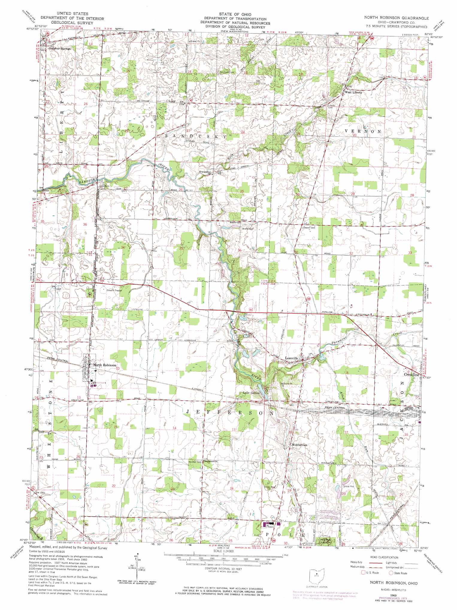
North Robinson Topo Map Ohio
To zoom in, hover over the map of North Robinson
USGS Topo Quad 40082g7 - 1:24,000 scale
| Topo Map Name: | North Robinson |
| USGS Topo Quad ID: | 40082g7 |
| Print Size: | ca. 21 1/4" wide x 27" high |
| Southeast Coordinates: | 40.75° N latitude / 82.75° W longitude |
| Map Center Coordinates: | 40.8125° N latitude / 82.8125° W longitude |
| U.S. State: | OH |
| Filename: | o40082g7.jpg |
| Download Map JPG Image: | North Robinson topo map 1:24,000 scale |
| Map Type: | Topographic |
| Topo Series: | 7.5´ |
| Map Scale: | 1:24,000 |
| Source of Map Images: | United States Geological Survey (USGS) |
| Alternate Map Versions: |
North Robinson OH 1960, updated 1961 Download PDF Buy paper map North Robinson OH 1960, updated 1970 Download PDF Buy paper map North Robinson OH 1960, updated 1974 Download PDF Buy paper map North Robinson OH 1960, updated 1974 Download PDF Buy paper map North Robinson OH 2010 Download PDF Buy paper map North Robinson OH 2013 Download PDF Buy paper map North Robinson OH 2016 Download PDF Buy paper map |
1:24,000 Topo Quads surrounding North Robinson
Bloomville |
Attica |
Centerton |
Willard |
Greenwich |
Lykens |
Chatfield |
New Washington |
Shelby |
Shiloh |
Oceola |
Bucyrus |
North Robinson |
Crestline |
Mansfield North |
Monnett |
Caledonia |
Galion |
Blooming Grove |
Mansfield South |
Marion East |
Denmark |
Mount Gilead |
Shauck |
Bellville |
> Back to 40082e1 at 1:100,000 scale
> Back to 40082a1 at 1:250,000 scale
> Back to U.S. Topo Maps home
North Robinson topo map: Gazetteer
North Robinson: Airports
Cole Airfield elevation 340m 1115′North Robinson: Dams
Pabst Lake Dam elevation 335m 1099′North Robinson: Lakes
Lake Galion elevation 325m 1066′North Robinson: Populated Places
Biddle (historical) elevation 325m 1066′Leesville elevation 342m 1122′
Middletown elevation 344m 1128′
North Robinson elevation 327m 1072′
Olentangy elevation 322m 1056′
West Liberty elevation 335m 1099′
North Robinson: Post Offices
Biddle Mills Post Office (historical) elevation 325m 1066′North Robinson Post Office elevation 326m 1069′
North Robinson: Reservoirs
Pabst Lake elevation 335m 1099′North Robinson: Streams
Allen Run elevation 334m 1095′Loss Creek elevation 308m 1010′
Paramour Creek elevation 334m 1095′
North Robinson digital topo map on disk
Buy this North Robinson topo map showing relief, roads, GPS coordinates and other geographical features, as a high-resolution digital map file on DVD:
 map DVD")