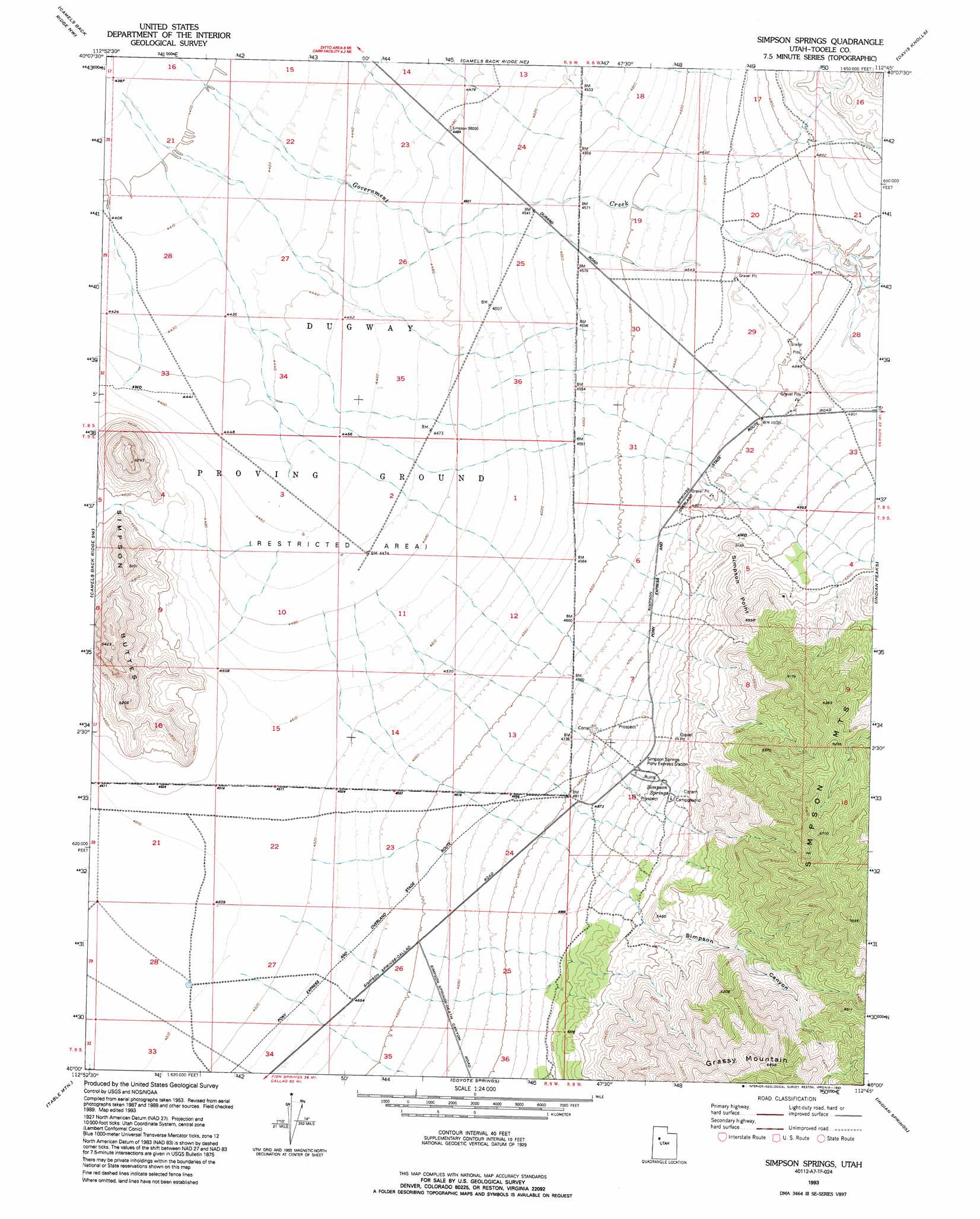
Simpson Springs Topo Map Utah
To zoom in, hover over the map of Simpson Springs
USGS Topo Quad 40112a7 - 1:24,000 scale
| Topo Map Name: | Simpson Springs |
| USGS Topo Quad ID: | 40112a7 |
| Print Size: | ca. 21 1/4" wide x 27" high |
| Southeast Coordinates: | 40° N latitude / 112.75° W longitude |
| Map Center Coordinates: | 40.0625° N latitude / 112.8125° W longitude |
| U.S. State: | UT |
| Filename: | o40112a7.jpg |
| Download Map JPG Image: | Simpson Springs topo map 1:24,000 scale |
| Map Type: | Topographic |
| Topo Series: | 7.5´ |
| Map Scale: | 1:24,000 |
| Source of Map Images: | United States Geological Survey (USGS) |
| Alternate Map Versions: |
Simpson Springs UT 1955, updated 1956 Download PDF Buy paper map Simpson Springs UT 1955, updated 1973 Download PDF Buy paper map Simpson Springs UT 1955, updated 1979 Download PDF Buy paper map Simpson Springs UT 1993, updated 1993 Download PDF Buy paper map Simpson Springs UT 2011 Download PDF Buy paper map Simpson Springs UT 2014 Download PDF Buy paper map |
1:24,000 Topo Quads surrounding Simpson Springs
Wig Mountain |
Tabbys Peak Sw |
Tabbys Peak Se |
Terra |
Johnson Pass |
Dugway Proving Ground Ne |
Camels Back Ridge Nw |
Camels Back Ridge Ne |
Davis Knolls |
Onaqui Mountains South |
Dugway Proving Ground Se |
Camels Back Ridge Sw |
Simpson Springs |
Indian Peaks |
Lookout Pass |
Dugway Range Ne |
Table Mountain |
Coyote Springs |
Indian Springs |
Erickson Knoll |
Dugway Pass |
Keg Pass |
Keg Mountain Ranch |
Erickson Wash Sw |
Desert Mountain Pass |
> Back to 40112a1 at 1:100,000 scale
> Back to 40112a1 at 1:250,000 scale
> Back to U.S. Topo Maps home
Simpson Springs topo map: Gazetteer
Simpson Springs: Capes
Simpson Point elevation 1597m 5239′Simpson Springs: Parks
Pony Express Historic Marker elevation 1500m 4921′Simpson Springs: Springs
Simpson Springs elevation 1552m 5091′Simpson Springs: Summits
Grassy Mountain elevation 2100m 6889′Simpson Springs: Valleys
Simpson Canyon elevation 1607m 5272′Simpson Springs digital topo map on disk
Buy this Simpson Springs topo map showing relief, roads, GPS coordinates and other geographical features, as a high-resolution digital map file on DVD: