Desert Mountain Pass Topo Map Utah
To zoom in, hover over the map of Desert Mountain Pass
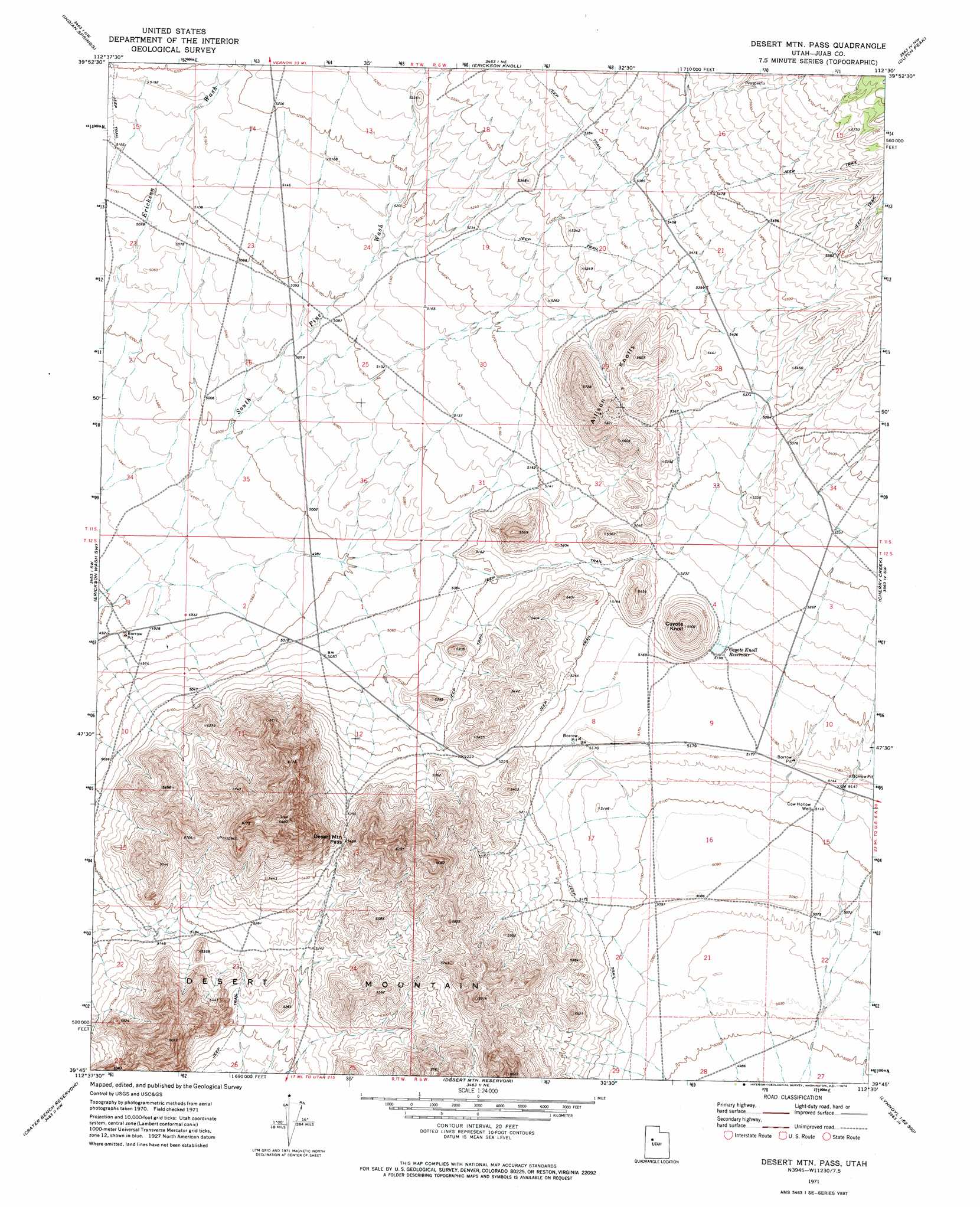
USGS Topo Quad 39112g5 - 1:24,000 scale
| Topo Map Name: | Desert Mountain Pass |
| USGS Topo Quad ID: | 39112g5 |
| Print Size: | ca. 21 1/4" wide x 27" high |
| Southeast Coordinates: | 39.75° N latitude / 112.5° W longitude |
| Map Center Coordinates: | 39.8125° N latitude / 112.5625° W longitude |
| U.S. State: | UT |
| Filename: | o39112g5.jpg |
| Download Map JPG Image: | Desert Mountain Pass topo map 1:24,000 scale |
| Map Type: | Topographic |
| Topo Series: | 7.5´ |
| Map Scale: | 1:24,000 |
| Source of Map Images: | United States Geological Survey (USGS) |
| Alternate Map Versions: |
Desert Mtn Pass UT 1971, updated 1974 Download PDF Buy paper map Desert Mountain Pass UT 2010 Download PDF Buy paper map Desert Mountain Pass UT 2014 Download PDF Buy paper map |
1:24,000 Topo Quads surrounding Desert Mountain Pass
Simpson Springs |
Indian Peaks |
Lookout Pass |
Vernon |
Lofgreen |
Coyote Springs |
Indian Springs |
Erickson Knoll |
Dutch Peak |
Sabie Mountain |
Keg Mountain Ranch |
Erickson Wash Sw |
Desert Mountain Pass |
Cherry Creek |
Maple Peak |
The Hogback |
Crater Bench Reservoir |
Desert Mountain Reservoir |
Lynndyl Nw |
Tanner Creek Narrows |
Fumarole Butte |
Baker Hot Springs |
Rain Lake |
Lynndyl West |
Lynndyl East |
> Back to 39112e1 at 1:100,000 scale
> Back to 39112a1 at 1:250,000 scale
> Back to U.S. Topo Maps home
Desert Mountain Pass topo map: Gazetteer
Desert Mountain Pass: Gaps
Desert Mountain Pass elevation 1674m 5492′Desert Mountain Pass: Reservoirs
Coyote Knoll Reservoir elevation 1586m 5203′Desert Mountain Pass: Summits
Allison Knolls elevation 1723m 5652′Coyote Knoll elevation 1704m 5590′
Desert Mountain elevation 1957m 6420′
Desert Mountain Pass: Wells
Cow Hollow Well elevation 1560m 5118′Desert Mountain Pass digital topo map on disk
Buy this Desert Mountain Pass topo map showing relief, roads, GPS coordinates and other geographical features, as a high-resolution digital map file on DVD: