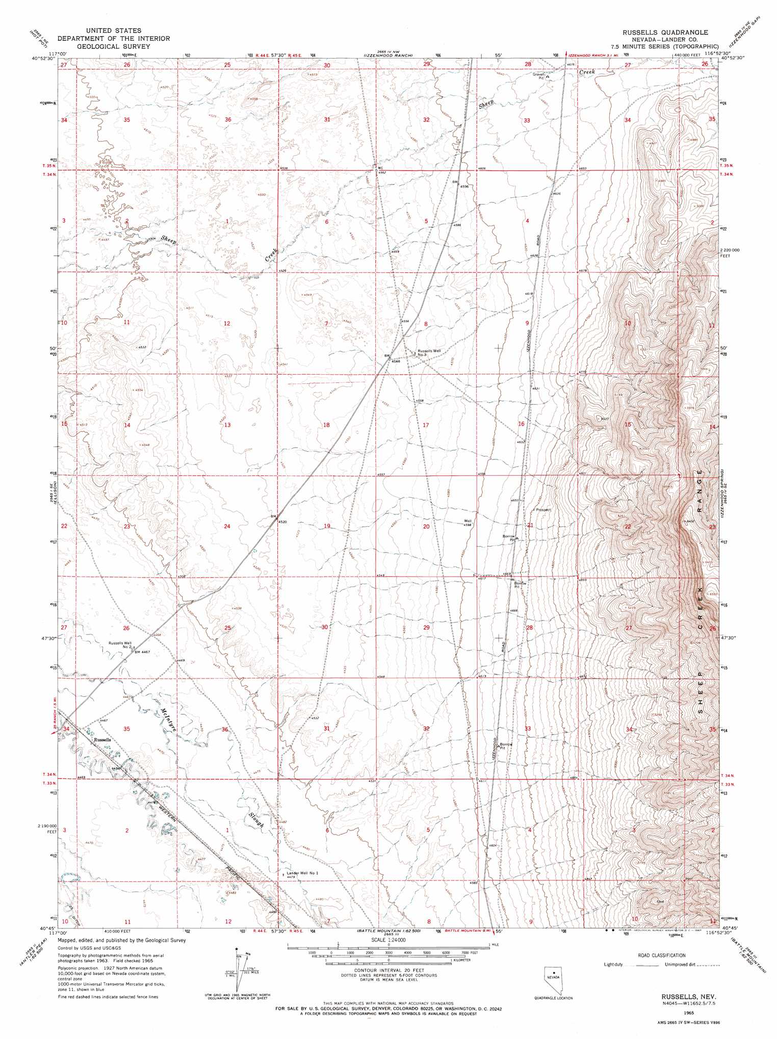
Russells Topo Map Nevada
To zoom in, hover over the map of Russells
USGS Topo Quad 40116g8 - 1:24,000 scale
| Topo Map Name: | Russells |
| USGS Topo Quad ID: | 40116g8 |
| Print Size: | ca. 21 1/4" wide x 27" high |
| Southeast Coordinates: | 40.75° N latitude / 116.875° W longitude |
| Map Center Coordinates: | 40.8125° N latitude / 116.9375° W longitude |
| U.S. State: | NV |
| Filename: | o40116g8.jpg |
| Download Map JPG Image: | Russells topo map 1:24,000 scale |
| Map Type: | Topographic |
| Topo Series: | 7.5´ |
| Map Scale: | 1:24,000 |
| Source of Map Images: | United States Geological Survey (USGS) |
| Alternate Map Versions: |
Russells NV 1965, updated 1967 Download PDF Buy paper map Russells NV 2012 Download PDF Buy paper map Russells NV 2014 Download PDF Buy paper map |
1:24,000 Topo Quads surrounding Russells
Red House Flat East |
Elevenmile Well |
Midas Sw |
Sixmile Hill |
Rock Creek Ranch |
Knight |
Hot Pot |
Izzenhood Ranch |
Izzenhood Gap |
Sheep Creek Range Nw |
Valmy |
Ellison |
Russells |
Izzenhood Spring |
Sheep Creek Range Sw |
North Peak |
Snow Gulch |
Battle Mountain |
Stony Point |
Argenta |
Antler Peak |
Galena |
Blossom Spring |
Bateman Spring |
Mule Canyon |
> Back to 40116e1 at 1:100,000 scale
> Back to 40116a1 at 1:250,000 scale
> Back to U.S. Topo Maps home
Russells topo map: Gazetteer
Russells: Wells
Lander Well Number One elevation 1366m 4481′Russell Well Number Twelve elevation 1363m 4471′
Russells Well Number Three elevation 1391m 4563′
Russells Well Number Two elevation 1363m 4471′
Sheep Mountain Well Number Two-Ten elevation 1392m 4566′
Russells digital topo map on disk
Buy this Russells topo map showing relief, roads, GPS coordinates and other geographical features, as a high-resolution digital map file on DVD: