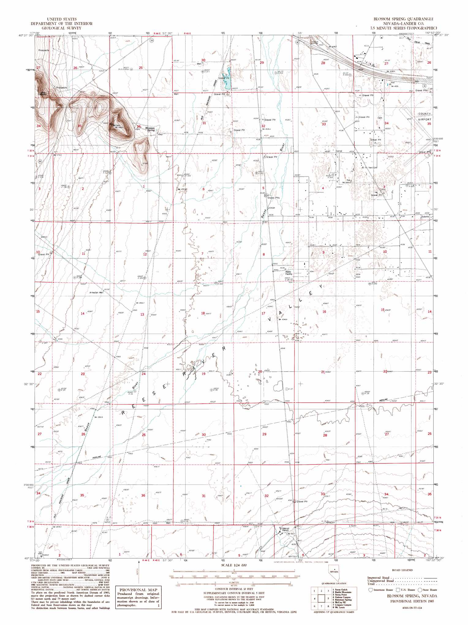
Blossom Spring Topo Map Nevada
To zoom in, hover over the map of Blossom Spring
USGS Topo Quad 40116e8 - 1:24,000 scale
| Topo Map Name: | Blossom Spring |
| USGS Topo Quad ID: | 40116e8 |
| Print Size: | ca. 21 1/4" wide x 27" high |
| Southeast Coordinates: | 40.5° N latitude / 116.875° W longitude |
| Map Center Coordinates: | 40.5625° N latitude / 116.9375° W longitude |
| U.S. State: | NV |
| Filename: | o40116e8.jpg |
| Download Map JPG Image: | Blossom Spring topo map 1:24,000 scale |
| Map Type: | Topographic |
| Topo Series: | 7.5´ |
| Map Scale: | 1:24,000 |
| Source of Map Images: | United States Geological Survey (USGS) |
| Alternate Map Versions: |
Blossom Spring NV 1985, updated 1986 Download PDF Buy paper map Blossom Spring NV 2012 Download PDF Buy paper map Blossom Spring NV 2014 Download PDF Buy paper map |
1:24,000 Topo Quads surrounding Blossom Spring
Valmy |
Ellison |
Russells |
Izzenhood Spring |
Sheep Creek Range Sw |
North Peak |
Snow Gulch |
Battle Mountain |
Stony Point |
Argenta |
Antler Peak |
Galena |
Blossom Spring |
Bateman Spring |
Mule Canyon |
Mccoy Nw |
Mccoy Ne |
Crippen Canyon |
Mount Lewis |
Mud Spring Gulch |
Mccoy |
Redrock Spring |
Goat Peak |
Ferris Creek |
Tenabo |
> Back to 40116e1 at 1:100,000 scale
> Back to 40116a1 at 1:250,000 scale
> Back to U.S. Topo Maps home
Blossom Spring topo map: Gazetteer
Blossom Spring: Airports
Lander County Airport elevation 1381m 4530′Blossom Spring: Crossings
East Battle Mountain Interchange elevation 1379m 4524′Blossom Spring: Springs
Blossom Spring elevation 1385m 4543′Blossom Spring: Streams
Lewis Creek elevation 1409m 4622′Little Cottonwood Creek elevation 1395m 4576′
Blossom Spring digital topo map on disk
Buy this Blossom Spring topo map showing relief, roads, GPS coordinates and other geographical features, as a high-resolution digital map file on DVD: