Palo Cedro Topo Map California
To zoom in, hover over the map of Palo Cedro
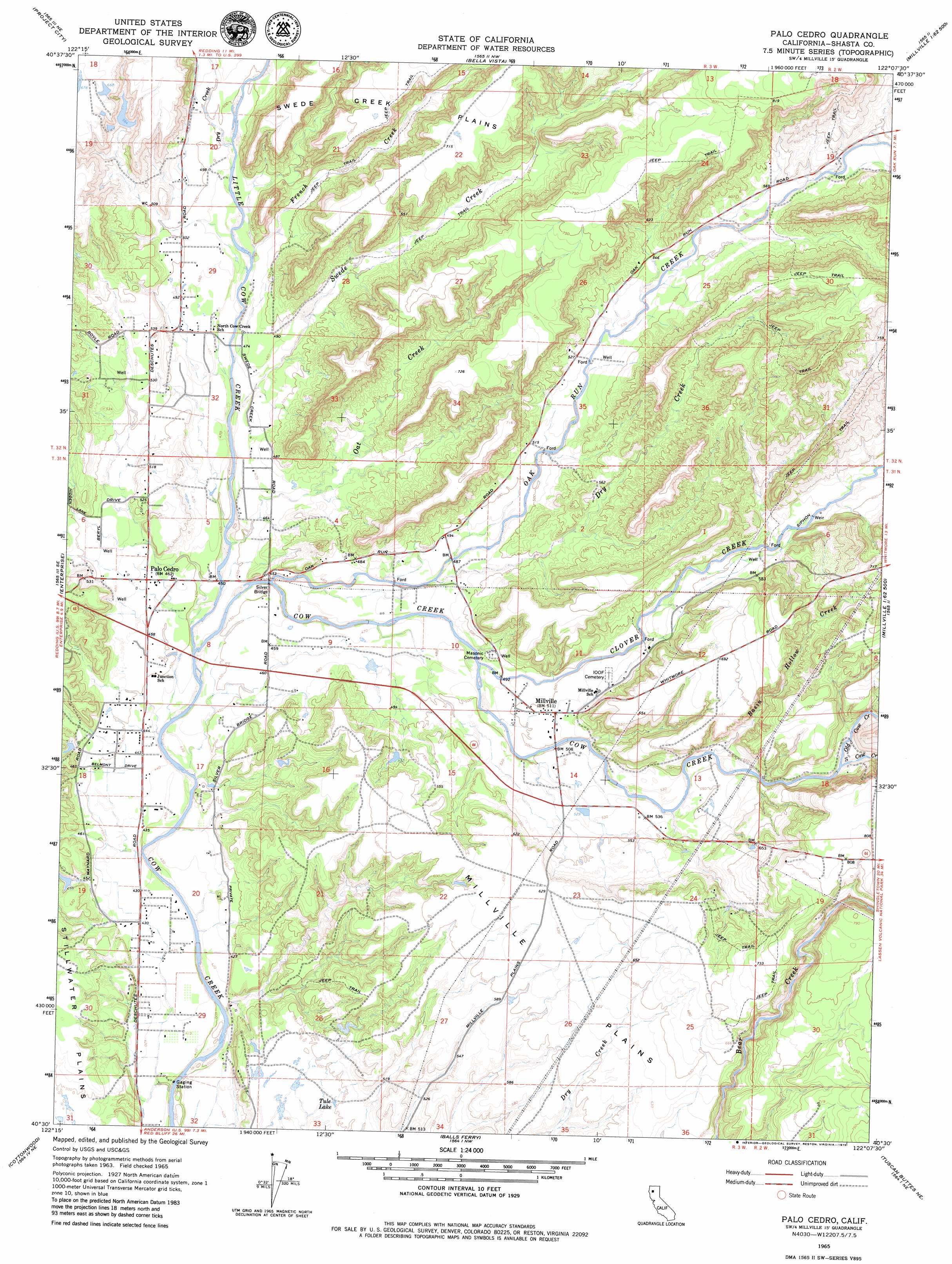
USGS Topo Quad 40122e2 - 1:24,000 scale
| Topo Map Name: | Palo Cedro |
| USGS Topo Quad ID: | 40122e2 |
| Print Size: | ca. 21 1/4" wide x 27" high |
| Southeast Coordinates: | 40.5° N latitude / 122.125° W longitude |
| Map Center Coordinates: | 40.5625° N latitude / 122.1875° W longitude |
| U.S. State: | CA |
| Filename: | o40122e2.jpg |
| Download Map JPG Image: | Palo Cedro topo map 1:24,000 scale |
| Map Type: | Topographic |
| Topo Series: | 7.5´ |
| Map Scale: | 1:24,000 |
| Source of Map Images: | United States Geological Survey (USGS) |
| Alternate Map Versions: |
Palo Cedro CA 1965, updated 1966 Download PDF Buy paper map Palo Cedro CA 1965, updated 1979 Download PDF Buy paper map Palo Cedro CA 2012 Download PDF Buy paper map Palo Cedro CA 2015 Download PDF Buy paper map |
1:24,000 Topo Quads surrounding Palo Cedro
Bohemotash Mountain |
O'Brien |
Minnesota Mountain |
Devils Rock |
Montgomery Creek |
Shasta Dam |
Project City |
Bella Vista |
Oak Run |
Whitmore |
Redding |
Enterprise |
Palo Cedro |
Clough Gulch |
Inwood |
Olinda |
Cottonwood |
Balls Ferry |
Tuscan Buttes Ne |
Shingletown |
Mitchell Gulch |
Hooker |
Bend |
Dales |
Inskip Hill |
> Back to 40122e1 at 1:100,000 scale
> Back to 40122a1 at 1:250,000 scale
> Back to U.S. Topo Maps home
Palo Cedro topo map: Gazetteer
Palo Cedro: Bridges
Silver Bridge elevation 133m 436′Palo Cedro: Lakes
Tule Lake elevation 153m 501′Palo Cedro: Plains
Millville Plains elevation 190m 623′Palo Cedro: Populated Places
Henryford (historical) elevation 177m 580′Millville elevation 157m 515′
Palo Cedro elevation 143m 469′
Palo Cedro: Streams
Basin Hollow Creek elevation 160m 524′Clover Creek elevation 144m 472′
Dry Creek elevation 144m 472′
Dry Creek elevation 150m 492′
French Creek elevation 143m 469′
Little Cow Creek elevation 129m 423′
Oak Run Creek elevation 132m 433′
Oat Creek elevation 133m 436′
Old Cow Creek elevation 170m 557′
South Cow Creek elevation 170m 557′
Swede Creek elevation 135m 442′
Palo Cedro: Valleys
Tabournel Gulch elevation 166m 544′Palo Cedro digital topo map on disk
Buy this Palo Cedro topo map showing relief, roads, GPS coordinates and other geographical features, as a high-resolution digital map file on DVD: