Crater Island Nw Topo Map Utah
To zoom in, hover over the map of Crater Island Nw
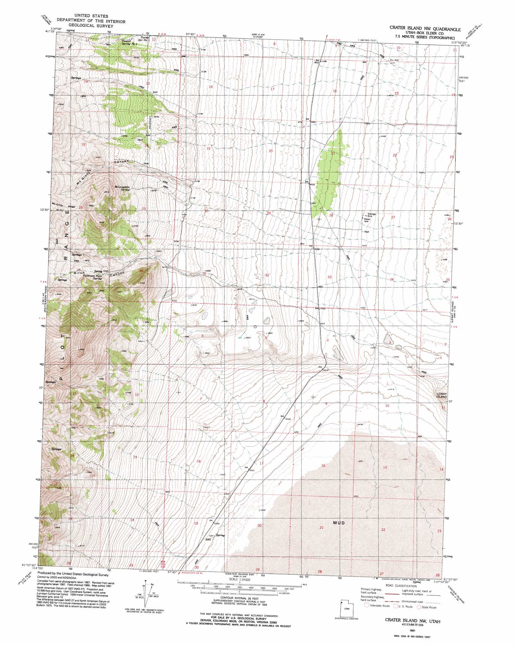
USGS Topo Quad 41113b8 - 1:24,000 scale
| Topo Map Name: | Crater Island Nw |
| USGS Topo Quad ID: | 41113b8 |
| Print Size: | ca. 21 1/4" wide x 27" high |
| Southeast Coordinates: | 41.125° N latitude / 113.875° W longitude |
| Map Center Coordinates: | 41.1875° N latitude / 113.9375° W longitude |
| U.S. State: | UT |
| Filename: | o41113b8.jpg |
| Download Map JPG Image: | Crater Island Nw topo map 1:24,000 scale |
| Map Type: | Topographic |
| Topo Series: | 7.5´ |
| Map Scale: | 1:24,000 |
| Source of Map Images: | United States Geological Survey (USGS) |
| Alternate Map Versions: |
Crater Island NW UT 1967, updated 1972 Download PDF Buy paper map Crater Island NW UT 1991, updated 1992 Download PDF Buy paper map Crater Island NW UT 2011 Download PDF Buy paper map Crater Island NW UT 2014 Download PDF Buy paper map |
1:24,000 Topo Quads surrounding Crater Island Nw
Twelvemile Ranch |
Jackson Spring |
Lucin Nw |
Lucin Ne |
Bovine |
Montello |
Tecoma |
Lucin |
Pigeon Mountain |
Jackson |
Pilot Peak Nw |
Patterson Pass |
Crater Island Nw |
Lemay Island |
Lucin 4 Nw |
Pilot Peak Sw |
Pilot Peak |
Crater Island Sw |
Crater Island |
Lucin 4 Sw |
Leppy Peak Nw |
Miners Canyon |
Silver Island Pass |
Graham Peak |
Floating Island |
> Back to 41113a1 at 1:100,000 scale
> Back to 41112a1 at 1:250,000 scale
> Back to U.S. Topo Maps home
Crater Island Nw topo map: Gazetteer
Crater Island Nw: Springs
McLaughlin Spring elevation 1726m 5662′Patterson Pass Spring elevation 1720m 5643′
Tunnel Spring Number 1 elevation 1668m 5472′
Tunnel Spring Number 2 elevation 1728m 5669′
Crater Island Nw: Valleys
Birch Canyon elevation 1464m 4803′McGinty Canyon elevation 1552m 5091′
Crater Island Nw digital topo map on disk
Buy this Crater Island Nw topo map showing relief, roads, GPS coordinates and other geographical features, as a high-resolution digital map file on DVD: