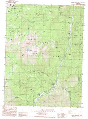
Tangle Blue Lake Topo Map California
To zoom in, hover over the map of Tangle Blue Lake
USGS Topo Quad 41122b6 - 1:24,000 scale
| Topo Map Name: | Tangle Blue Lake |
| USGS Topo Quad ID: | 41122b6 |
| Print Size: | ca. 21 1/4" wide x 27" high |
| Southeast Coordinates: | 41.125° N latitude / 122.625° W longitude |
| Map Center Coordinates: | 41.1875° N latitude / 122.6875° W longitude |
| U.S. State: | CA |
| Filename: | o41122b6.jpg |
| Download Map JPG Image: | Tangle Blue Lake topo map 1:24,000 scale |
| Map Type: | Topographic |
| Topo Series: | 7.5´ |
| Map Scale: | 1:24,000 |
| Source of Map Images: | United States Geological Survey (USGS) |
| Alternate Map Versions: |
Tangle Blue Lake CA 1986, updated 1986 Download PDF Buy paper map Tangle Blue Lake CA 1998, updated 2003 Download PDF Buy paper map Tangle Blue Lake CA 1998, updated 2003 Download PDF Buy paper map Tangle Blue Lake CA 2012 Download PDF Buy paper map Tangle Blue Lake CA 2015 Download PDF Buy paper map |
| FStopo: | US Forest Service topo Tangle Blue Lake is available: Download FStopo PDF Download FStopo TIF |
1:24,000 Topo Quads surrounding Tangle Blue Lake
> Back to 41122a1 at 1:100,000 scale
> Back to 41122a1 at 1:250,000 scale
> Back to U.S. Topo Maps home
Tangle Blue Lake topo map: Gazetteer
Tangle Blue Lake: Flats
Meter Meadow elevation 1048m 3438′Meter Meadow elevation 1045m 3428′
Sunflower Flat elevation 967m 3172′
Sunny Flat elevation 812m 2664′
Tangle Blue Lake: Lakes
Big Bear Lake elevation 1782m 5846′Little Bear Lake elevation 1897m 6223′
Log Lake elevation 1861m 6105′
Tangle Blue Lake elevation 1752m 5748′
Wee Bear Lake elevation 1889m 6197′
Tangle Blue Lake: Mines
Grand National Mine elevation 1848m 6062′Tangle Blue Lake: Pillars
Black Rock elevation 2225m 7299′Tangle Blue Lake: Streams
Bear Creek elevation 917m 3008′Davis Creek elevation 822m 2696′
Davis Creek elevation 822m 2696′
Eagle Creek elevation 842m 2762′
Graves Creek elevation 930m 3051′
Horse Creek elevation 1375m 4511′
North Fork Ramshorn Creek elevation 909m 2982′
Ramshorn Creek elevation 847m 2778′
Ripple Creek elevation 817m 2680′
Scott Mountain Creek elevation 1060m 3477′
South Fork Ramshorn Creek elevation 922m 3024′
Sunflower Creek elevation 943m 3093′
Tangle Blue Creek elevation 971m 3185′
Tangle Blue Lake: Valleys
Cold Valley elevation 877m 2877′Tangle Blue Lake digital topo map on disk
Buy this Tangle Blue Lake topo map showing relief, roads, GPS coordinates and other geographical features, as a high-resolution digital map file on DVD:


