Savona Topo Map New York
To zoom in, hover over the map of Savona
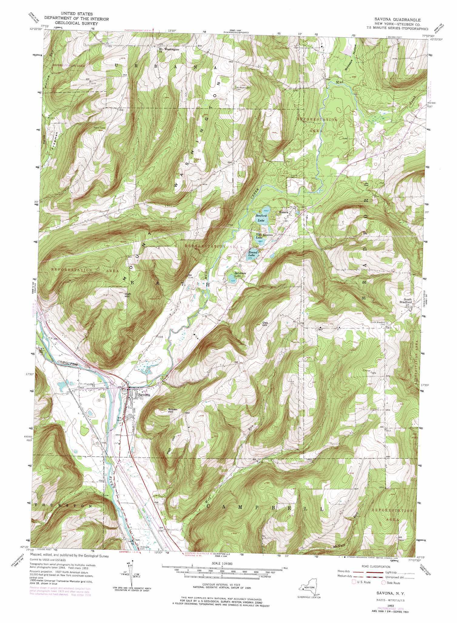
USGS Topo Quad 42077c2 - 1:24,000 scale
| Topo Map Name: | Savona |
| USGS Topo Quad ID: | 42077c2 |
| Print Size: | ca. 21 1/4" wide x 27" high |
| Southeast Coordinates: | 42.25° N latitude / 77.125° W longitude |
| Map Center Coordinates: | 42.3125° N latitude / 77.1875° W longitude |
| U.S. State: | NY |
| Filename: | o42077c2.jpg |
| Download Map JPG Image: | Savona topo map 1:24,000 scale |
| Map Type: | Topographic |
| Topo Series: | 7.5´ |
| Map Scale: | 1:24,000 |
| Source of Map Images: | United States Geological Survey (USGS) |
| Alternate Map Versions: |
Savona NY 1953, updated 1955 Download PDF Buy paper map Savona NY 1953, updated 1969 Download PDF Buy paper map Savona NY 1953, updated 1978 Download PDF Buy paper map Savona NY 1953, updated 1978 Download PDF Buy paper map Savona NY 2010 Download PDF Buy paper map Savona NY 2013 Download PDF Buy paper map Savona NY 2016 Download PDF Buy paper map |
1:24,000 Topo Quads surrounding Savona
Naples |
Prattsburg |
Pulteney |
Keuka Park |
Dundee |
Avoca |
Rheims |
Hammondsport |
Wayne |
Reading Center |
Towlesville |
Bath |
Savona |
Bradford |
Beaver Dams |
Cameron |
Rathbone |
Campbell |
Corning |
Big Flats |
Woodhull |
Borden |
Addison |
Caton |
Seeley Creek |
> Back to 42077a1 at 1:100,000 scale
> Back to 42076a1 at 1:250,000 scale
> Back to U.S. Topo Maps home
Savona topo map: Gazetteer
Savona: Lakes
Peterson Lake elevation 326m 1069′Round Lake elevation 327m 1072′
Sanford Lake elevation 324m 1062′
Van Keuren Lake elevation 325m 1066′
Savona: Populated Places
Savona elevation 321m 1053′Sonora elevation 338m 1108′
South Bradford elevation 561m 1840′
Savona: Streams
Mud Creek elevation 317m 1040′Savona: Summits
Brown Hill elevation 504m 1653′Irish Hill elevation 574m 1883′
Oak Hill elevation 570m 1870′
Platt Hill elevation 509m 1669′
Savona: Valleys
Birdseye Hollow elevation 328m 1076′Savona digital topo map on disk
Buy this Savona topo map showing relief, roads, GPS coordinates and other geographical features, as a high-resolution digital map file on DVD:
New York, Vermont, Connecticut & Western Massachusetts
Buy digital topo maps: New York, Vermont, Connecticut & Western Massachusetts